A Museum In the Morning

suncity

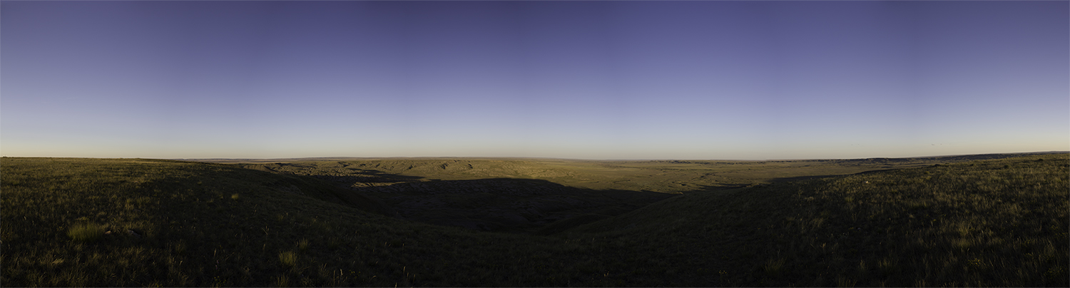
We are packed and to the car with a quickness. I always feel bad leaving the dogs in the car – it’s not the tight space, but the change of scenery and a different place to sleep that I feel they miss out on. Though I’m sure they could care less. Regardless, it’s back to the field for exercise and breakfast before we spend the morning waiting for the Manitoba Museum to open at 10:00 am. I drive us downtown and park in the Exchange District.

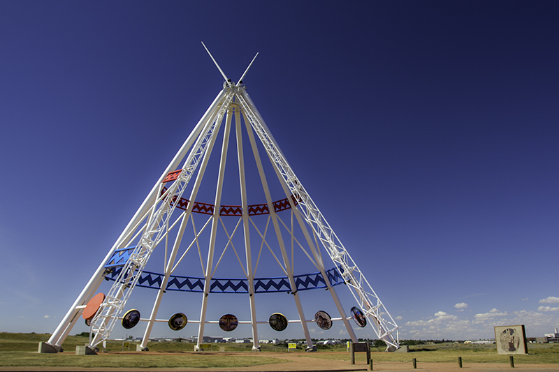
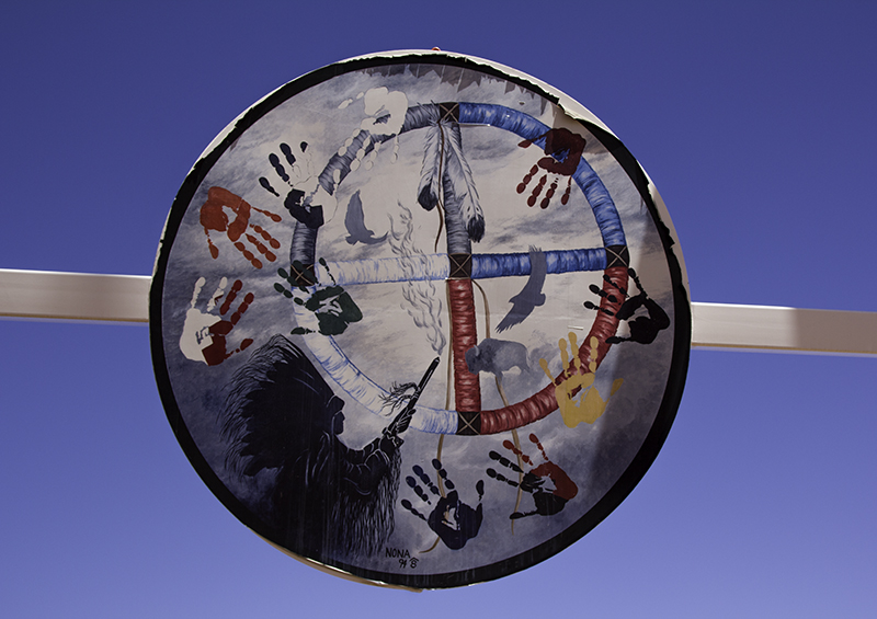
There are tall terra-cotta clad buildings with lots of windows; bronze statues with water, flowers, and glass on and around them; brick walls housing institutions and museums; empty streets loudened with the shuffle of our feet, the Red River curving lazily by parks and under bridges; architecture that is square, round, and many-sided; colorful signs and meaningful murals; flyers taped and pinned in layers; and a silver stage, The Cube, that cost 1.5 million dollars to make – of 20,000 aluminum links that hasn’t operated properly since it was opened in 2010.

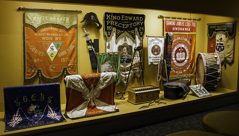
As soon as the museum opens we are inside trying our luck at discount tickets. They offer youth, student, senior, and family rates. We ask about military and lucky for us the lady behind the counter gets us in half-off for the museum galleries, one of the three exhibit areas – saying the guidelines don’t specify that government workers have to be Canadian, but the students do. We’ve been to a few museums in our day and I suspect there to be one section that catches my eye and the other five will be glanced, parts read, and photographed. I was not expecting nine galleries among other rooms housing over two million artifacts and two hundred thousand specimens.

amautik - traditional Inuit woman's parka

amautik – traditional Inuit woman’s parka

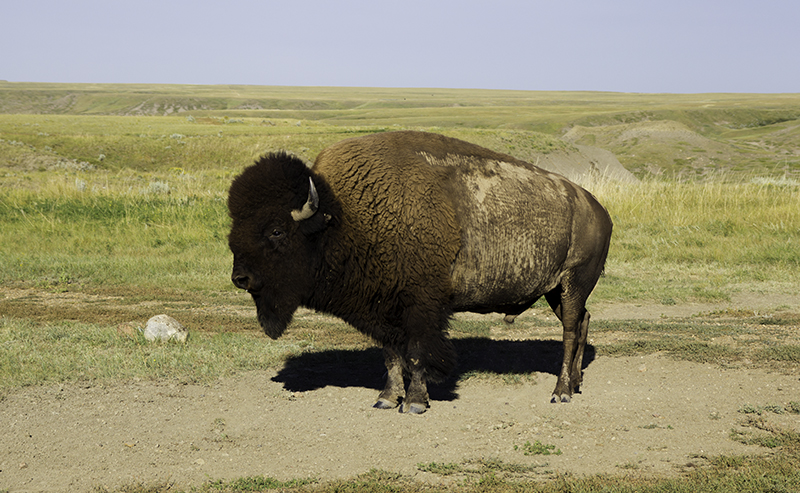
We are in for a surprise. This museum has levels and turns the size of a large labyrinth. It teaches us about the grasslands, the dinosaurs, local mountain formations, about the animals and rocks of different biomes, life in the arctic, the way of the Eskimos, the history of Hudson Bay, and lets us on a ship, the Nonsuch, for a feel of the sea life and trading it made possible. It doesn’t stop there. We get introduced to animals high and low that live in the boreal forest, the effects of coal mines, the popularity of fishing, the usefulness of arrowheads, the beauty of beadwork, the education for children in the past, a glimpse into the home life of settlers, and by the time we reach the apothecary our heads are spinning.

All the shapes and colors of the displays keep the eyes moving, but what draws us further in is treasures like the Giant Trilobite – the largest complete one of its kind as of 2006 that was found along the Hudson Bay. I am enthralled that as difficult as it was for immigrants to settle in the States it was even more of a challenge in the weather that sustains Canada’s harsh environments. I am awed at the determination and perseverance that it took the aboriginal people to call this place home. And Caleb can’t forget the lady that approached us in the Urban Gallery. We weren’t sure if she worked there, but she was willing to point things out and suggest we go inside each building – if only we had more time.

I had debated waiting around for some museum to open, but this place is phenomenal and very large. We spent three hours and needed at least three more just to see this one section. So when I get the chance to go back I can plan on spending three days there if the other two sections prove just as big and educational. Even their washroom had something new to show me – a toilet paper dispenser that keeps portions appropriate, like a triple-sized Kleenex box, and the roll from ending up soaked on the floor. Had we packed a lunch we would’ve stayed longer, but a trip to the store for a bag of greens, a can of corn, and some veggies with dip will be on our menu and our last stop in this friendly, fingerless-mitten-shaped province.

flags

We pass the longitudinal center of Canada, near the town of Lorette, that measures the extreme points of Canada from east to west, including islands. Then to keep our minds busy while driving I created a new in-the-car game. My family is used to the traditional license plate game (whether it’s math, personal plates, or states) and Caleb and I have long played finding the alphabet in order using billboards and signs. Today’s new idea was to list things – presidents, tree types, dog breeds – anything that there is a lot of. And then we were in Ontario, our fifth Canadian province, and the one with the most roads planned to cover its sloping south.

Highway 17 must have issues with speeding if the second sign on the road is how high the fine will be per 10 km/h over the posted limit. It doesn’t seem to be slowing anyone down, but we aren’t in a hurry either – no worries. The next thing we notice is the abundance of cairns, called inuksuk by the Inuit, by the road and up on cliffs where the rocks were blasted to make room for pavement below. They come in different colors, sizes, and some in groups and are a historical reminder of the Inuit’s use of them for travel and hunting.

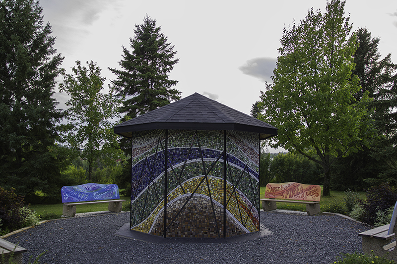
Our first long stop in Ontario would be the city of Dryden. We drive around some, missing the turn for the information center. Inside is an elderly woman who loves the area and flowers so much that she painted them and wants to sell those paintings to us. We thank her for the other advice, things to do and a place to eat, and are on our way sans art. She turns out to be a savvy travel guide as she directed us to Johnston Park, another turn easily missed and the location of “The Pieces of Dryden”, a hexagon with four benches surrounding it covered in tile mosaic representing the seasons and the locals who helped bring the idea to life.

mosaic

Also from Johnston Park is a trail leading to the Roy Wilson Suspension Bridge that crosses the Wabigoon River. There are wooden steps and a gravel path leading to the 34 meter long bridge that spans the rushing water below. Piggy is terrified of the sound, but is able to crawl across the swaying wood in three minutes with the help of a chain-link fence to keep her from falling off the sides. At the end is information on the history of a paper mill that was destroyed in fire and pictures of some of the local birds, fishes, mammals, and trees. I carry Piggy back across. She has faced her fears enough for one day.

Onto our edible recommendation for dinner at the B&B Roadhouse Bar and Grill located inside the Best Western Plus. Seating is quick and by a window, but from there the service declines. The place wasn’t that busy, but our waitress was hard to find. We ordered French fries and sweet potato fries that came with honey dill, honey garlic, and pink anju sauce for dipping – we’ve had better. We did get a laugh out of their monetary cheese on the menu. We waited for our receipt, that didn’t come, and went to the register where we weren’t the only ones in line. It’s there that our waitress appeared, receipt in hand, and was kind enough to take off the $8 martini that tasted like frog fart water. We will not be going back and we will no longer be taking fries advice from older women in information centers.

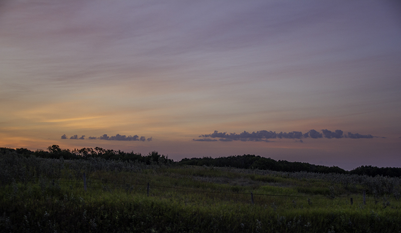
There is an annual county fair going on. I could see the Ferris wheel from my bench in the window, but Caleb gets sick on the rides, I don’t want to watch a steer auction, and we have over an hour drive to Sandbar Lake Provincial Park. It will be dark when we get there. We get gas in Ignace and find a spot near the entrance which makes me feel better about keeping our headlights off people already sleeping. Caleb notices clouds and says the weather report warned of a 20% chance of rain. Won’t be our first time waking up to sprinkling or mud and we hope it will keep the mosquitoes away.

Posted in Animals, Art, Camping, Education, Food, History, Things, Travel, Water | Tagged , , , , | 1 Comment

Frog Legs and Wheat Arms

pursun

I love camping. I enjoy waking up to the skies at first light and being able to watch the sunrise. At home, we have dark curtains to help block out the artificial light that would otherwise come through; though we have stayed at a campsite that was so bright the birds thought it was still daytime. That is not the case this morning as we stir from our sleeping bags and watch the sky turn from black to purple.

Breakfast is had at a gas station in Melville, the smallest official city in Saskatchewan, about an hour’s drive from camp. From there, we head north to Yorkton to drive east and then south on Riding Mountain National Park’s main road. We could’ve stayed on route and taken the small roads east along the south side, but this way we get to see the crosswalk art of Yorkton: silverware, piano keys, and neck ties in place of regular stripes to draw attention to pedestrians and drivers to make downtown a more safe place to visit.

The most discreet province yet. We almost miss the sign for Manitoba, and a time zone change, because we are focused on the body of water at the curve in the road. All provinces and territories of Canada, but Saskatchewan have rivers, lakes, and coordinate lines as boundaries. Sometimes the landscape change is gradual and other times more subtle as we cross these physical and imaginary lines. We could travel between fields of snow and desert plains or simply from stretches of grass to tall forests – it’s all new.

trees

We lose our second hour of this trip. It’s a good thing we aren’t trying to keep track of time as we immerse ourselves in the moment, but we think about how DST leaves us with dinner in the dark or the sun up at 4:00 am like we slept in until 9:00 am. We think about how Canadians must feel with almost endless daytime, though I’m sure this weather makes up for snowed-in days. I’m happy to have more daylight as I know there are not enough hours in the day – especially while on vacation.

There are remnants of a Ukrainian Village near Dauphin, and though the buildings are closed, we are able to see the Drifting River School erected in 1920; the General Store; Paul Sydor’s, the cordwainer, shop; Rhodes (Musicians Hall of Fame) Hall built in 1933; and their church with onion domes, amongst the other buildings and the fairgrounds where people are given a chance to show off their achievements and build relationships. But not today, so we will drive on to Riding Mountain National Park, just 15 minutes away.

Our first stop is Beach Ridges. It’s supposed to be an easy hour covering 3.5km of gravel and boulders that used to be covered by the world’s largest freshwater lake, Lake Agassiz, that left Lake Winnipeg among others in its place when it was drained into the Hudson Bay, Lake Superior, and the Mississippi River. It has left the ground fertile and a recent rain must have left it muddy. The area is covered in baby frogs and hungry mosquitoes. Lucky for us, Sparky can see his way around the messy path and Piggy stays in the parking area to lick something off the car tire.

haroun

So we decide to walk Kippan’s Mill Heritage Trail instead. It’s 1.5km is also supposed to take an hour to explore the grassy path that represents the logging era. The new sawmill was built in 1937 and all that remains today are some cement pads and a few firebricks. The layout was efficient. The main saw was above ground so that the sawdust could be collected to be used as fuel.  I know the mill owners chose this spot for its location and lumber, but it’s also great for its white flowers (a mix of popcorn and morel mushrooms) and the Northern Leopard Frogs that call this place home – now safe to do so.

Moon Lake is our next stop. We walk past two guys with their motorcycles in the parking area and a couple playing cards in the grass on our way to the water. Perhaps the lake got its name from being somewhat of a crescent, reflective, and having a beautiful surface. I only wish the Moon had a floating dock that I could walk on to admire its spacious qualities. But unlike the Moon, we are able to see rocks below the water, where there may only be patches of ice in the lunar craters due to space’s composition.

This park is part of the boreal, northern region, forest that comprises most land north of the 50th parallel, the largest ecological zone on earth. Over one hundred thousand species rely on this cold wetlands area, consisting of fens and bogs. The trees that dominate the landscape are spruce, fir, aspen, and pine – ones that can withstand temperatures, on average, ranging from 23 – 41 degrees Fahrenheit and rainfall between 8 – 79 inches, mostly snow.

clearsas

Our visit to the forest is part path and part boardwalk where we feel it will be safe to let Sparky get some free time off his leash as there are no plants or animals for him to harm or scare on the wooden walkway. That is until he decides to jump off the trail for some exploring. We see Sparky decide he has made a mistake, but the fall was farther than he expected and he can’t make it back up by himself. Caleb leans over the edge to grab him by his toes and get him on his leash again.

We stop at Clear Lake, in the heat of the day, to enjoy the view and let the dogs play. Sparky plays fetch with a stick in the water and desperately wants to play with a rock, but can’t get it out of the constant waves hitting shore. Piggy is scared that she is going to get wet, but I ensure her that she will be fine as long as she stays near us on the rocks and doesn’t go through the bushes to the parking lot. There is a couple selling jewelry and a family returning from a boat ride.

They may think the dogs are cute from a distance, but now we have a wet one. Even when washed with soap at home they don’t smell clean until they’re dried. Caleb grabs a towel out of the back to get the excess water off and then a blanket so Sparky can relax in the front seat and get warmed in the sun. This is where he would stay for the majority of the ride to a wheat field north of Minnedosa. I stopped to have a mango for lunch and Caleb found out that we happened upon a farm of future bread. Maybe next time I can ask the grower for a quart full of wheat berries – about enough flour for two loaves.

setpark

On the other side of Portage La Prairie is the Fort Le Reine Museum and the information center where we will be picking up our map and visitor guide to Winnipeg to get a start on our hotel search for the evening. What we think is across town, to the Airport Motor Inn, is actually only a third of the distance into the metropolis where we will be sleeping. Up the steps, through the back door, past the beer window, to the counter across from the door that leads to the strippers, karaoke, and video lottery terminals.

There is a $100 refundable deposit required. (This place holds it on your credit card. We stopped at one place that wanted cash – hell no!) The room is $88. We have access to a restaurant with nothing on the menu we want, coin-operated washer and dryer that we will use, and a hot tub with children being loud in the pool. Oh ya, and no dogs. We find a park less than two blocks from the Inn to let them run around in a fenced in area and Pad Thai restaurant under four miles away for us to order food.

I get a lychee martini while we wait on our spicy noodles and veggie rolls and we stop at the beer vendor at the Inn to try a Rockstar mango with vodka. Before the booze and food could make us sleepy we finished the laundry and headed to the hot tub. I don’t know if a working water slide would have given us more time to ourselves or if the bubbles got the kids’ attention, but now that our muscles are warmed up we can go back to the park to let the dogs stretch theirs before a night in the car.

Posted in Animals, Camping, Education, Food, Hiking, History, Places, Plants, Travel, Water | Tagged , , , , , , | 1 Comment

Moose Poo Sold Here

sunrise

I am grateful in the morning to have had Caleb emanating DEET through his sweat during the night. It was enough to keep the mosquitoes at bay so we could all get some sleep. Last night we saw the large letters, CAMPING, written on the back of a brick wall that happens to be the restrooms and self-registration area. This campground charges by the tent or RV, not by the site, and for $3.00 a non-camper can use the shower with soap provided. We choose to skip the white walls, yellow curtain, and pink suds and see the sunrise instead.

There is an Ecotour Road that takes visitors through the West Block of Grasslands National Park. The signs to get there are easy enough, but once we are lost in the view, we get lost on the route too. There is a mix of public and private property – roads and buildings. No intentional trespassing for us. We stick to birds in water, horses on hills, a rusted car in a field, and a ferruginous hawk in the distance. Also along this route are plenty of prairie dog colonies. I tame my excitement in photographing their masses so that Sparky won’t scare them into their holes.

We drive by a lone bison bull. I’ve seen them shed before, but this guy looks shaved to the standards of a giant poodle in the American Kennel Club. His horns are white at the base, but shiny and black on the top from him rubbing them on signs and other sturdy supports throughout the park. Sparky is oblivious and we are able to stop and enjoy this buffalo’s company for a while and admire the thickness of his afro, the length of his beard, the snot on his lip (he doesn’t sweat), and the grass in his fur.

buffalo

Even though we detoured we were able to find our way back to town, to the visitor center by 9:00 am, after the 80 km loop drive. We made some sandwiches as we prepared to wait fifty minutes for the office to open so I could get a stamp, my fifth in Canada. Caleb thought it didn’t open until 10:00 am, but when the ranger, Rachelle, came out to update the weather report she invited us in and gave me the only red-inked stamp so far in my Canadian collection. From there the conversation covered black-footed ferrets, the herd of bison we didn’t see, other parks we’ve been to, and other things in-between concerning travel, animals, and education.

As we go to leave, over an hour later, Rachelle asks if we have gas in the tank as the nearest station is thirty minutes away. We are sure that we have enough to make it to Swift Current about an hour and a half drive past construction, yellow fields, and algae-covered water. In town, we stop for drinks and the sales lady lets us know, because we asked, that we wrongfully adjusted our clocks as Saskatchewan doesn’t participate in Daylight Savings Time. We also learn that ‘off sale’ means the selling of sealed alcoholic beverages for consumption off premises.

We stop at a small local market to look around. The every day things for people living here may seem boring, but they are a tourist attraction to us. While inside with nothing catching our eye we happen to interest the clerk at the counter. She asks to join us, but was probably thinking that we wouldn’t say yes. I love to help people who want to help themselves and see more of the world they live in. Sadly she didn’t come with us, but perhaps she has pets or children or an unwilling husband at home.

sparky

photo by Caleb

We drive a few blocks before finding a park bench in the shade to stop for a lunch of chips and pretzels with cheese. Eating outside for us is so enjoyable that we will do it in the city or country, at a bench or on a median, in the dirt or in the car with the windows down. It feels more natural, historical, romantic, and memorable – what life should be about, but also about experiencing new things and learning the unknown or more about popular stereotypes such as the use of ‘eh?’ and ‘oh ya, fer sure’ that puts a smile on my face.

Another thing that makes me happy is the use of oversized things (a tepee, a moose, etc.) to give credit to the town’s namesake and bring in more tourists – the majority being from the U.S., Canada, Europe, China, Japan, New Zealand, and Eastern Australia that have visited Moose Jaw. We got to add a pin to the map in the visitor center and got extensive help from the woman working there and a large man who frequents the local eateries. We grab some brochures and head downtown.

The thing is, the restaurant recommendations were for people who enjoy meals centered on chicken fried steak and fried fish. In our search for a less meaty lunch, a man stops us at a burger/hot dog stand so that Caleb can put on the apron of the cook and pose for a photo. It’s just too bad I only took a picture of Caleb behind the grill and signs and not one beside all that to see the apron. We decide on a place that we think will give us more choices on toppings – Houston Pizza.

Cruising Main Street by Grant McLaughlin

Cruising Main Street by Grant McLaughlin

It seems like we are eating a lot of pizza on this trip – and we are. I would love to try other delicacies, but Caleb fears they won’t have something I can eat or that the leftovers will be too messy or the meal too spicy – not sure. The place seems empty and we watch a few people come in, look at the menu, and leave. We could’ve done likewise, but ordered the chicken pizza with the meat on the side – more ingredients for the same price as the two-topping alternative. Caleb and the dogs would appreciate the treat.

We paid for two hours of parking and still had half our time left so we took the Murals of Moose Jaw Walking Tour. There are options available on the brochure, but we just went with what was close by. Of the 14 we saw they mostly pertained to the pioneers of the 1880s, theatre and nightlife of the 1920s, the history of the fire department, and local veterans that fought in WWII and other wars. It was a great introduction to the past of the city, a beautiful way to decorate the buildings, and a thoughtful way to commemorate the people the murals represent and the ones involved in making it.

On the north side of the city is the Burrowing Owl Interpretive Centre. We leave the car in the shade across the parking lot. These birds are endangered in Canada and of special concern in the States. They use old nests that other animals (gophers, badgers, etc.) have made and abandoned. Most of the owls are released back into the wild once the young are fed and their habitat better preserved, but for those that can’t they can become ambassadors for the ‘Save the Owls’ movement.

Hopes and Dreams by Grant McLaughlin

Hopes and Dreams by Grant McLaughlin

All this driving had the car looking dirty – and parts of it felt that way too, so in Regina we drove around searching for a car wash. We came upon one that wanted special tokens from the attendant inside – we skipped it. We passed a TCBY (The Country’s Best Yogurt) – a franchise Caleb had never been to. I got a chocolate-dipped waffle cone with frozen honey-vanilla Greek yogurt and suggested that we walk around while eating our treats so they wouldn’t melt in the car. Nothing caused us to detour from the sidewalk and soon we were on our next hunt.

Piggy gets car sick, no vomiting, but she shakes and pants vigorously. We needed some more Dramamine or Benadryl to help calm her – if given an hour before getting on the road. After visiting a few stores we learn that medicine must be bought at a drug store, not a convenient or grocery store. The Shoppers Drug Mart reminds us of any pharmacy store in the States where people have the freedom to go into almost any store (retail and fast food too) and buy drugs. Canada may be one step ahead of us when they deny kids access to one store instead of cutting stock or demanding ID for certain purchases at all of them.

With pills in hand it will be us against the sunset as we head toward Echo Valley Provincial Park. I want to get there before dark, but the pinks and oranges of the horizon and the purple wispy clouds demand my eyes attention from the road. We pass trees, ponds, and small roads that add to the magic of the moment as nature puts on her evening light show in honor of this Thursday – a day that may look the same as the rest, be considered a weekend in some countries, but that stands out and can never be repeated.

owlet

The park entrance has a light at the information station, but is surrounded in darkness until we get deeper into the park full of RVs – TVs, campfires, Christmas lights, and flashlights. We are looking for a dimly lit spot to call our own for the evening and we find it on a hill overlooking the valley next to a group with a camper enjoying their dinner at a picnic table. They seem friendly enough and point us in the direction of the toilet, but I’m more interested in smelling my pillow and dog breath for the next few hours.

Posted in Animals, Art, Camping, Food, History, People, Photography, Places, Travel | Tagged , , , , , , | Leave a comment

Lethbridge to Val Marie

Indian Battle Park

Indian Battle Park

Though I may have given Caleb crap about the cost of the room, a plate of breakfast with a choice of drink was included. We eat potatoes, toast, and egg, drink some coffee, and save the sausage for the dogs. Our waitress had knuckle tattoos, something about her dogs, and it felt weird to leave her a tip in change – Canadian dollars. We got to see a man in military dress and listen to the local news and weather – forecast: travel and sunshine ahead. And though the world is full of bad stories Canada is sure to share the good too.

I wanted some more fruit for the road and we needed other groceries to help keep our budget low. We find a local Safeway and inside I find hot buttered rum mix on the shelf next to the hot cocoa and hobnobs. Now I know where the band got their namesake. We want to get closer to the Lethbridge Viaduct – the longest and highest trestle bridge of its kind in the world. Part of it passes through Indian Battle Park.

weather rock at Fort Whoop-Up

weather rock at Fort Whoop-Up

We decide to drive there to get a closer look – if we can find the exit! We have to circle back around as it seems the exit is only on one side of the highway. On our way into the park we notice Fort Whoop-Up National Historic Site – Alberta’s largest and most notorious whisky fort, that doesn’t open until 10:00 am. That will give us time to walk the dogs around. With another stamp to add to the pages we skip getting closer to the bridge, but it seems the park doesn’t unlock the doors exactly at opening time and after ten minutes we give up on waiting as we had other plans anyways.

Also available to see at this hour is the Japanese garden – Nikka Yuko. Inside the office is pottery, lights, woodturnings, dishes, and cookbooks. We were hesitant at first, but another couple came in excited and we quickly bought our tickets at $8 each. It’s a short walk to the entrance where we are greeted at the gate by a girl in a traditional kimono dress. We are given a map of the place, directions are quite easy, but the brochure also gives explanations of the types of plants and their placements.

Japanese Garden

Japanese Garden – by Caleb

We walk to the left, past a well on rocks covered in shade, to the machiya – traditional wooden townhouse, where we are asked to remove our shoes. Inside are woodblock prints and empty rooms. In the courtyard is a rock garden. We are allowed to stand on a ledge provided to get a better feel of the calm brought on by the relaxing sights and sounds. The rocks here stand for islands and the pebbles are the sea. I wonder what a rock-fall (perhaps similar to a rain stick) would sound like.

Back outside are trees of varying height to give dimension and depth to the fields, rocks that are round and smooth to give rhythm to the water, and still ponds to reflect the growth and never-ending sky. There are shadows and thought-out lines and curves to bring feng shui to the garden and the mind. On the far side of the walking path is a large bell that represents the friendship between Japan and Canada that is over five feet high. We are nervous at first, but decide to hear the ring. We pull back on the log attached to chains and with the release the yard is filled with sound.

Nikka Yoku

Nikka Yoku

We cross over another bridge and then follow a big stone path behind the house to the edge of the large pond. From that point the brochure tells us to turn around and enjoy the garden from another angle. This would be a great place to meditate, read, do yoga, or bird watch. We see others taking pictures, ringing the bell, and enjoying the view of the lake and trees that sit behind the hedge bordering the park. Then we have the option to go back through the machiya, which I do, or simply exit through the gate.

We stay in Lethbridge longer than I had planned. On trying to find our way to the next road we pass a farmer’s market, mostly local Hutterites, and others selling wine, frozen yogurt, and jewelry. We put a quarter in the parking meter that buys us 20 minutes. We share a mango-raspberry yogurt while we finish shopping for blackberries, raspberries, and two types of cheese – cracked pepper and dill Gouda.

Saamis Tepee

Saamis Tepee

Thirty minutes out of town, near Taber, and Caleb remembers that he left his Nalgene bottle in the fridge of the hotel and we agree that it’s not worth going back for, even if it was a gift from a friend on deployment. There are plenty more just like it. Our next stop is Medicine Hat to see the world’s tallest tepee made of steel. The Saamis Tepee was made for the 1988 Winter Olympics in Calgary and moved to its current location in 1991 where it stands over 20 stories high.

Underneath are signs describing the art-filled circles above. We make our way around the tepee learning about the Blackfoot’s story of how the area was named, the sacredness of the buffalo to provide food and shelter, and how the buffaloes and tepees may be gone from today, but that the Aboriginal continue to influence business, education, and unity.  We appreciate the chance to learn something about the land we are passing through as the dogs enjoy the sunshine and grass in the area provided for them.

Circle of Unity - painting by Nona Foster

Circle of Unity – painting by Nona Foster

In another hour we enter Saskatchewan with Caleb driving for the first time this trip. It seems too soon, but we have traveled the skinny bottom half of Alberta, there are few roads in the middle and none on the top of this providence. Sparky drank lots of water after playing and we had pulled over, after getting gas in Gull Lake, to feed them, but before we could get him out of the backseat he was peeing all over himself and one of the blankets. Nothing to do but shake it out and ride with the windows down.

We arrive in Val Marie after 6:00 pm to a town that looks dusty and deserted. We go to the information center that will give us what we need to stay entertained for the next fifteen hours. South of town is an access road to the trailhead of Eagle Butte, a 2km trail that figure-eights, and 70 Mile Butte, a 5km trail hidden behind the former; in the time it took us to drive down the road we will have forgotten that in our excitement. I park the car at an angle to keep the dogs in the shade, crack the windows, and get out to a crowd of people returning from their hike and getting back on a tour bus.

hiking up 70 Mile Butte

hiking up 70 Mile Butte

The brochure says the views from the top are spectacular at sunset. We ask two hikers how long it took them so we know what pace to keep. They assure us the up will be easy enough but to watch out as part of the trail got washed out after the last rain. We thank them and skip off to the left. We were enjoying ourselves and came across a steamroller that Caleb thought would be fun to ride, but I wouldn’t let him. It was shortly after this, when the bus was just dirt in the distance and the signs all had eagles on them, that I felt lost.

We backtracked to the car. Caleb grabbed the map. We had been on the eagle trail. This time we went right, over a yellow bridge, and were on our way to the top. There are flowers we haven’t seen before, dried dirt chunks that remind me of a picture I’ve got at home, and a skinny path with bright yellow plastic markers – everything one might expect on a trail in mid-Saskatchewan. The temperature is nice, the climb not too steep, a balance of light and shade, but not enough clouds in the sky to be contrasted in my photos.

shadows on 70 Mile Butte

shadows on 70 Mile Butte

I take some panoramic shots, first of the trip, and then one of us. I may have missed other opportunities to include more of the landscape in one photo, but I’m making the most of this moment on the highest point, this side of the park, with Caleb. And then… the mosquitoes come. And the trail is a mess like the lady said it would be and there are trees on sandy hills and lichen on rocks to look at while enjoying the sunset and trying to get back to the car without looking like a kid with chicken pox from all the thirsty bugs.

We decide to take a tour of the town and figure out where we are sleeping for the night. The up-side: seeing the beautiful moon over the field on the backside of town. The down-side: walking into the only open place in town and feeling awkward. The hotel café stays open to feed the street workers buffet style. There is an old convent that got renovated into a nine bedroom inn with restaurant. We pass it on the way to the park. We’ve decided to use one of the many backcountry campsites available.

panorama of 70 Mile Butte

panorama of 70 Mile Butte

The pamphlet says to pull off-road and set up out of sight. It’s starting to get dark, or so we think. It’s actually the sky filling up with clouds of mosquitoes. We drive 5.5 miles out of town. I know this because we had to turn around. Caleb said stop. He got out with tent in hand and within two minutes was racing to get back in the car with tent parts flying. He said we could camp in town where we passed a cozy tent and I agreed. Turns out there is a large campsite in town and we were one of many to make the decision to sleep there.

Caleb composes himself from the blood-thirsty attack of earlier by coating himself in a layer of deet. Once he feels safe he grabs the tent bag and begins to set up, but soon realizes he forgot the tent stakes where he was so quick to leave them behind and save himself. We choose to leave the dogs in the tent – either they will hold it down and claim our spot or they will be suffocated to death upon our return. We must’ve picked a recognizable place because it was a quick trip and soon we are back in Val Marie.

sunset on 70 Mile Butte

sunset on 70 Mile Butte

Posted in Camping, Education, Food, Forts, Hiking, History, People, Photography, Places, Plants, Travel | Tagged , , , , | Leave a comment

Cruising In Alberta

steele

We get a late start this morning and head down the 93 south. We drive past the Columbia River – the one that flows into the Pacific Ocean via Astoria, Oregon over a 1,200 mile  journey, and turn into Canal Flats to visit the headwaters. The road to the parking lot seems to be at the back of town, but is located near some nice houses. We wander around on the gravel among the trees and mosquitoes for a bit.

We see a sign that offers a compelling reason to pull over, Fort Steele ahead. Pets aren’t allowed inside to visit the admissions desk, but have their own door to enter the historic side of the fence. It’s a good thing they get in free, but we decide to skip the attraction and just visit the main building – a reconstruction of the brewing company that was built here in 1898, though the main office was moved to nearby Fernie in 1901. Now they sell tea, spices, cake, sandwiches, and soda in the café; and clothes, jewelry, books, and trinkets on the other side.

We learned that, as of February 2013, the Royal Canadian Mint stopped distributing pennies. They were phased out as costing more to make than they were worth and can now be used as decorated lotto scratchers, donated to charity, or returned to the bank to be melted down. Cash transactions will be rounded up or down to account for the change. It may seem that the States are behind in their financial decisions, but more so than we thought. Australia phased out their pennies in 1964 and, along with other countries, are starting to phase out nickels and introduce the use of polymer bills that can withstand more handling while in circulation.

titan

We order a Johnny Cake from the café; the recipe was discovered in Sam Steele’s journal, the namesake of the town for the Superintendent that solved land ownership issues in 1887. It’s a piece of cornbread served with butter and syrup – not the best I’ve ever had. I prefer mine with milk or peppers, but it’s another experience nonetheless. Outside they have compressed air locomotives that were used in coal mines until the 60’s when they were replaced with diesel. Also outside is the origin of horsepower – a few Clydesdales maneuvering in the field to avoid the sprinkler system during their brunch.

The road takes us south and north, but we are heading west, soon to leave the southern province of few roads. On the way into Sparwood we pass a yellow Cat truck with wheels as tall as the SUV in front of us, but that’s nothing compared to what awaits us in town – the Titan 33-19, the biggest truck in the world! From draft to completion in six years, the truck was sold to Kaiser Steel who used it in southern California for four years before moving it to a mine near its current location in 1978.

We were busy reading about the history of the truck when we hear this old guy calling out to someone. We didn’t realize it was us and I totally ignored him when I did. He was saying, “hey, you” and “are you deaf!?” I very well might be and that’s no way to treat visitors. I don’t want to hear you brag about how you drove the truck or your pappy did or whatnot after the attitude you gave me you can take your little wheeled cart and carry your ass back inside and wait for the non-deaf to approach you.

noodle

On the other side of the truck I get Caleb to pose near the wheel. He stands on his tippy toes with his hand stretched high totaling a reach of 7.5 feet. It would take the third Caleb’s head to reach the top of the truck while not in the dumping position. This would be our last stop in British Columbia. We would be in Alberta before 1:00 pm where they ask that we not bring intact deer carcasses or wood with bark into the province as both spread disease.

The municipality of Crowsnest Pass is a collective of cities and towns that lost their population levels when the mines closed down. One of these old towns, Frank, saw a boom after a 90 million ton landslide in 1903. It joined the other communities in 1979 and the Frank Slide draws over 100 thousand visitors a year – us being two of them unknowingly to the Leitch Collieries Provincial Historic Site after stopping at a shop that sells tea and homemade Asian noodles with carrots, peppers, and onions – good food for the price.

Caleb’s goal today was to make it to Waterton Lakes National Park – the Canadian side of Glacier NP in Montana, and we had a park pass that allowed us to visit until 4:00 pm. This is the only place to also be a UNESCO World Heritage Site, International Peace Park, and a Biosphere Reserve. We parked in the shade at the visitor center and walked up the drive to the Prince of Wales Hotel built in 1927. It took 14 years to get the land leased from the government and the supplies had to be carried the last 25 miles by mule team.

itch

The hotel is nice to look at, but pricey to stay at, or have tea for that matter which will cost an adult $30 for a teabag in one of the hotels porcelain cups. There are seven floors and six of them contain the 86 rooms that with high winds can sway slightly. It’s beautiful and historic and was built to attract people north across the border during prohibition, but it’s the view outside that brought me and it’s the wind that will almost blow me away. I enjoy the view from the ground and from the sixth floor balcony.

At the end of the main road is a townsite and Upper Waterton Lake that welcomes puppy paws and hands alike. The water is cool and some kids are playing in it. Sparky is more interested in playing with the rocks. There’s a parking lot in-between lakes Middle Waterton and Linnet. We almost walked the perimeter of the former, but caught ourselves after a while and hiked along the edge of the latter. We see running quail, tall yellow flowers, flying red bugs, big brown mushrooms, purple dying thistle, a garter snake, and paddle boats. We’d have gone for a ride had there been someone to rent them out.

This short hike took us past our ticketed time. Part of me felt guilty and the other half wanted to stay longer. Within the park boundary is a short drive that takes visitors through Buffalo Paddock – a small fenced in area with a loop road that shows less than 20 bison in their natural setting – just not allowed to go far so they don’t interrupt the rest of the park traffic, and probably so they don’t get hit by them either.

view from the Prince of Wales Hotel - by Caleb

view from the Prince of Wales Hotel – by Caleb

Caleb’s dad recommended we stop at the NW MP (North-West Mounted Police) site in Fort Macleod, but we got there after hours and could only see buildings behind a fence and from the roadside. This force would join with the Dominion Police in 1920 to become the current Royal Canadian Mounted Police – that we saw none of either. We were also late to Head-Smashed-In Buffalo Jump World Heritage Site – a very descriptively named place for the cliff that the Plains People chased the bison over to kill them.

And for the third closed place today – the Lethbridge Visitor Center that luckily has some brochures outside. Inside one is a small map with 11 accommodations listed. We’ll skip the ones we already know to be expensive and go door-to-door with the rest. The first place wanted $200 for a basic room. The map seemed to only show things below Hwy 3 and between the north and south clump of squares and circles on the map we stopped at the Superlodge. Caleb said they were the cheapest in town – and they would’ve been had he not paid $15 for a non-smoking room and the $10 pet fee for a total of $100.43.

We’re pizza addicts so we find a place nearby, Two Guys & A Pizza Place. We are quickly seated at a large wooden table with an extensive drink menu (description for every beer) and a dinner menu. We order a perogy pizza (mashed potatoes, burnt green onions, fakin’ bits, and ranch) and a California veg (tomatoes, onions, spinach, with jalapenos added).  We try two IPAs and a Rosmarinus Aromatic Ale – surprisingly delicious. There are pictures near the restroom of the place being rebuilt from the inside out.

photo by Caleb

photo by Caleb

The meal is great and the atmosphere enjoyable until it’s time to get our check and a table of three flirty guys walk in to distract our waitress. We waited for the to-go box and the bill, but I grew inpatient watching her at their table attempting to seduce a large tip out of them. As we walked to the register to pay she quickly joined us. She rang us up, but the percentage of her tip dropped drastically for her change in service. No big deal though. We got fed, will have tasty leftovers, and have a room with a shower waiting on us.

Posted in Animals, Food, Forts, History, People, Places, Plants, Travel, Water | Tagged , , , , , | Leave a comment