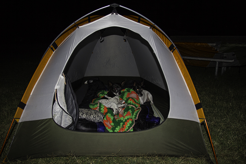
six in the morning
This isn’t our first time waking in a national park and I hope the experience won’t be our last. There was a lady in Seattle that wanted to live off sunshine and water, but she wasn’t in the right location for it – to die from starvation, so she quit after some weeks of trying to be a breatharian – when Seattle is full of smog. I think this lady had a death wish, but as for me – I want to move to Canada! I could easily get used to the variety of my morning routine while on the road versus doing dishes and laundry at the same house each time.
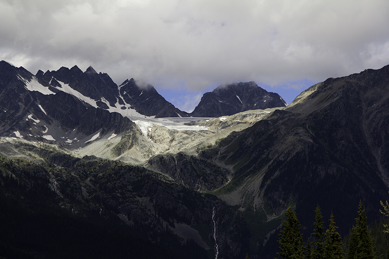
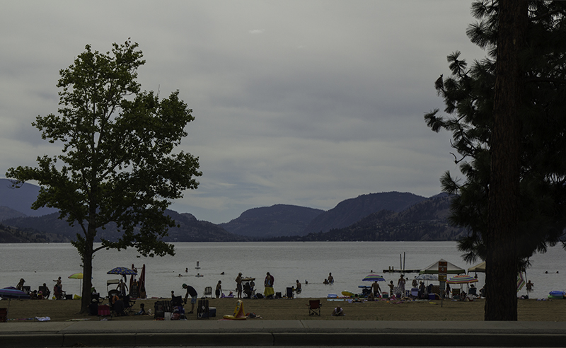
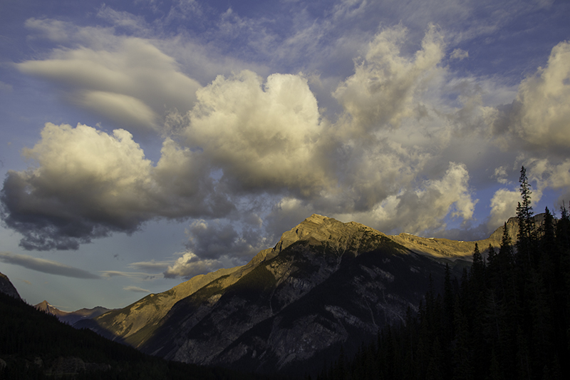
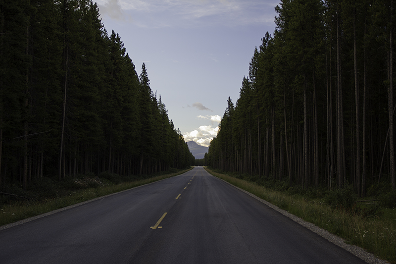
The sun and clouds have done so much by 6:00 am to inspire me with a spectacular view of colors and shapes over the mountains and trees. It seems like the blink of an eye and we are in Banff National Park on Bow Valley Parkway driving south in Alberta. Adjacent to the road we are on is Hwy 1 that has arch-shaped bridges built as animal overpasses with remote video cameras to keep an eye on which mammals are crossing and the ones setting up a colony, hoary marmot, in the area designed to be a natural extension of the park.

The crossings have reduced collisions between vehicle and wildlife by 80% and Transport Canada is working on netting for ducks and an electromat equivalent to the Texas Gate (Canadian name for cattle guard) to deter animals from walking on unfenced highway. We passed a lot of construction and now I know why. Canada cares about its drivers and the other creatures of the road and keeping them all safe. I hope more places with lots of roadkill will adopt these safety measures and keep what species we have left alive.
A safety precaution taken on the parkway is to close the road from 6:00 pm to 9:00 am between the months of March and June to allow animals to find food and raise their young – that’s dedication. I know there are wealthy people who wish it was easier to tell animals to go against their thousands of years of instincts and just relocate and stay put, but that only works for people when we stick them behind fences with guns pointed at them.
Or perhaps one day we can have CanadaWorld and watch as bears attack like Shamu does when held against his will and away from family – enough to inspire a change in the ending of a Pixar film, Finding Dory, to not support animals in captivity after watching the film, Blackfish, about the harm brought to people and orcas with them being contained in tight spaces for human entertainment and profit. Though the truth may be saddening, it needs to be known to bring about change for whales in kiddy pools and moose in windshields.
Further down the parkway and onto another sad story. The road we are on was built by prisoners of Castle Mountain Internment Camp between 1915-17. When the winters were too harsh and supplies delayed by the demands of war they were moved to the town of Banff to build sidewalks and tennis courts. They were forced to work eight hours daily, but had to march to the labor site making it a thirteen-hour day. This was the largest facility in Canada housing over 600 people, though a total of 8,500 captives, mostly Ukrainian, were held between 1914-20 amongst 24 camps.

Camp life was hard and escape attempts frequent. Detainees were released to meet the growing shortage in the labor force and some were able to return to their old jobs. Parks Canada has finally built educational monuments to bring light to the significance of these events and to uncover the history buried in fear and guilt over the decades. Hitler is the most infamous ruler of labor camps. He’s not the only one to cause suffering, but he took it a step further with scientific experiments and gas chambers. As much as I wish these events could just be a nightmare among fairy tales I hope these memorials do their job to ensure this type of insanity never happens again.
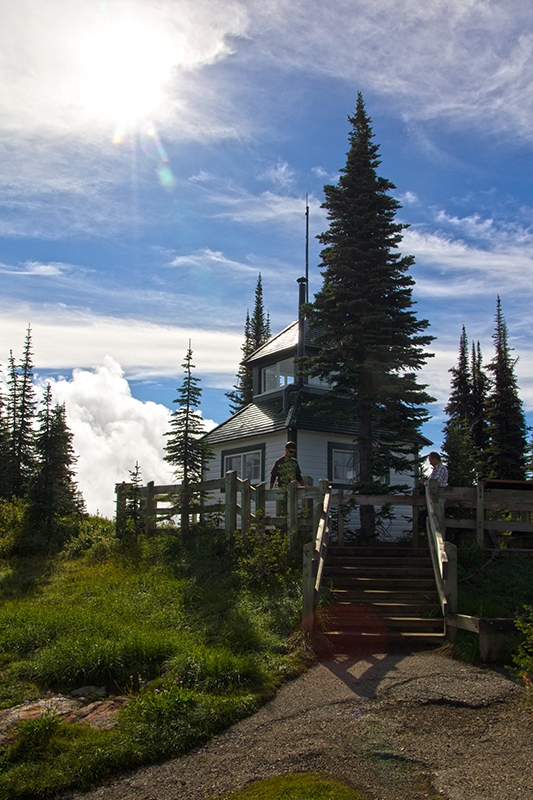
Onto happier things. We stop at the trailhead for Castle Mountain and there are two other vehicles with people loading their overnight packs and putting on sunscreen. It’s about a four-hour round-trip hike to the viewing area which sits well below the peak that would take a good twelve hours to return from starting point. Or we can take a shortcut on an unmarked trail with an ice axe required in summer. We agree to find something easier.

photo by Caleb
At Castle Mountain Junction we pull over to get a better picture of the bull elk eating with the cabin customers as his audience. I near the crowd as Caleb walks towards the road trying to keep our distance, but it seems our 13 yards were only half the space we were supposed to allow between us and it should be 100 yards with bears and wolves. I could see the predicament of remaining in your car – not too close, but not too fast to escape them and risk hitting one in the process. The elk crosses the road safely and is soon entering the thick of the woods.
We enter the town of Banff before the museum or the visitor center opens. We learn that Banff is Canada’s first national park and the world’s third, established in 1885. And that Canada was the first to establish a park service to protect all the natural wonders while increasing the tourism industry’s wallet size. We window shop between the two businesses waiting for them to open at 9:00 am and realize we haven’t had breakfast yet. We stop at Tooloulou’s and Caleb orders the Classic Canadian – skillet potatoes with mushrooms, onions, peppers, and tomatoes, and 2 slices of toast with 2 pancakes.
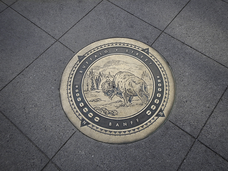
street marker – by Caleb
A very carb heavy meal. I eat the pancakes and we get to drink water out of mason jars sitting at a red and white checkered cloth-covered wooden table with a brick wall beside us. The restaurant advertises its mix of Louisianan, Acadian, and Canadian influences, but there will be no crab, calamari, or crawfish on our plates – just flour and starch in our bellies and smiles on our faces.
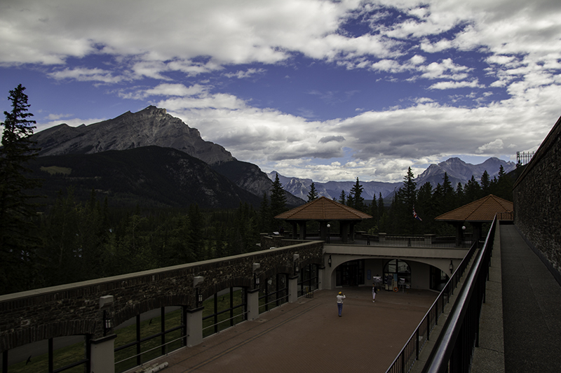
We step outside and I feel like we have entered Switzerland. The buildings have pointy wooden roofs and there is Tunnel Mountain staring down at us. Most seem so far away until you are on one of their paths, but this one has a trail that starts in town and it’s not the only one standing tall – we are surrounded by large masses of the Earth’s surface that have the power to touch clouds and amaze us in their power and beauty.

Banff Avenue
A trip inside the visitor center after waiting in the wrong line will get us quick service with an older woman who unknowingly gives me my third Canadian park stamp sideways. Caleb is amazed that this has even taken place as I have been the only one in the five years that we have collected stamps to enter them into the book. I smile and consider it part of the experience – just as I accept the format of my passport when they select a page and space at random.
I would love to fill my passport with countries from around the world, but they are becoming less common. Perhaps there is a Save the Ink foundation that I have yet to hear about. I do appreciate the woman stamping my book with the same space-saving savvy that I use to get the most usable area out of each page. I already had to upgrade to the larger book that can have pages added as the tiny one was starting to fill the additional spots in the back.
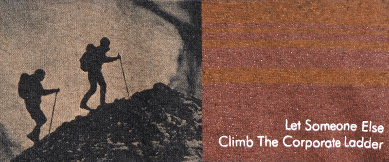
a t-shirt I agree with
It was the large PEZ collection that drew us in, but the older candy that is harder to find these days that kept us looking at each shelf in Welch’s: The Banff Candy Store until we left with some honey-lemon hard candies, made in America, for Caleb who was upset that they weren’t made locally. Next time he says he will read the label better. I got chocolates, made in Canada, with ice wine and maple fillings.
Town time is over. We are ready to get back to nature as we make our way west to Cave and Basin National Historic Site – the park that started it all… for Canada in the fall of 1883 when three railway workers found the cave and petitioned the government to make money on it when the Prime Minister saw an opportunity to preserve the springs and retain ownership of the land for, ‘the public’s great sanitary advantage’. The pool wasn’t closed until 1976 and that only lasted nine years until it was permanently sealed in 1994.
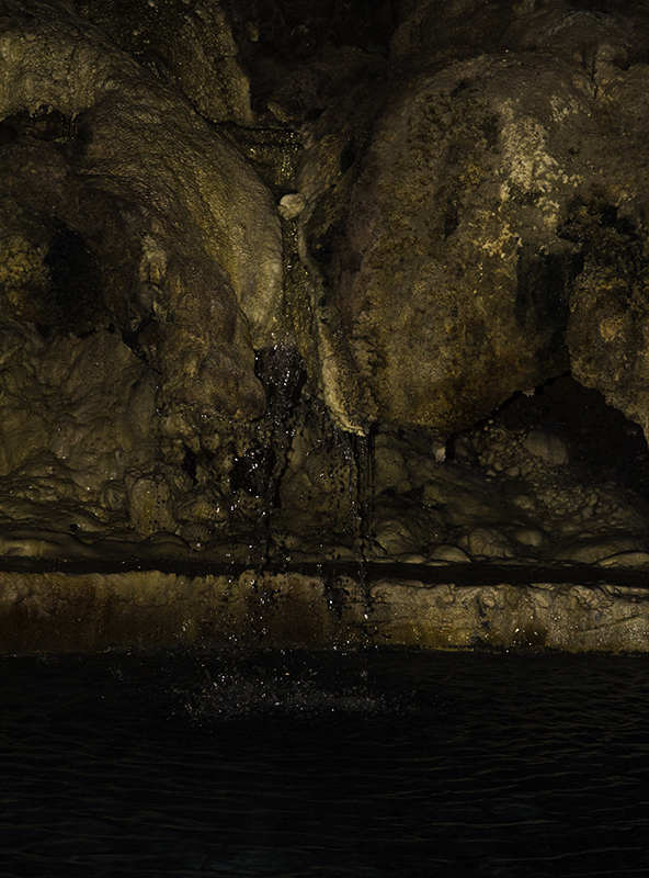
inside the cave
Closed or not, we are excited to be here. We are surrounded by mountains and fresh air and in the grass we spot a Columbia ground squirrel – a mix between a pregnant red squirrel and an anorexic marmot. We see a lot of people walking up a ramp next to the entrance and seemingly into the park for free. Once we pay our $3.90 each we learn that they are excluded from the cave and museum inside, but that the upper view of the basin and the lower boardwalks are theirs to ogle at.
Through the first set of doors and this boy is drinking from a contraption that I’ve never laid eyes on before – behold the water fountain for your face and bottle! He gave me a weird look as I patiently waited and then snapped a photo of this genius idea and healthy alternative. There’s some introductory information before we head down the hallway to the cave – a hot tuber’s wet dream – if that is to lay in warm water and stare at the walls and ceiling for hours and ponder the ever-moving path of the liquid that envelops you.
view from above the pool that closed in 1994
But that’s no longer a reality. There is an artificial wall and a railing built so that visitors may see the pool from another angle, even while sitting in chairs provided, but there will be no swimming in these soothing waters. Inside the story hall are big screens and story boards and a photo booth at the end. We walk outside to see the once busy pool, full of 157,000 people in 1961, covered in bricks. It might seem a bit saddening, but that’s a lot of bodies swimming in water that can’t be sanitized, but they could’ve made it viewable.
At the basin and it looks like it might have been a waterfall at one point. I want to touch the blue-green-clear water to feel how hot it is, but I’ve been warned to stay out of the home of the Banff Springs Snail. I think everyone else that was staring intently at the pool was also looking for a larger snail, but this one is the size of a popcorn kernel and easily blends in with the different growth and rocks at the bottom. Then it’s up the stairs to get another perspective of the springs, but my attention strays to the mountainous surroundings and imagining all the people in their heritage swimsuits prior to 1985.
hot pools
The lower boardwalks take us by pools that look like paintings. There’s a lot more to see here than initially meets the eye, like the grass-top roof on the visitor center that we notice as we walk back to the parking lot. We will backtrack some before heading south again and make a pit stop before that at Moose Meadows. We were obviously hoping to see its namesake, but there are supposed to be some ink pots in a valley northeast of where we parked. We might’ve stopped at Johnston Canyon, another way to get there, but cars already filled the shoulder so we joined the other lonely vehicle further up the road.
The map makes the trail look long enough to bring the dogs. The trail starts out nice enough and we are anxiously awaiting a moose sighting. Soon we are climbing over fallen trees. One or two wouldn’t have been an issue, but it was getting to be a hassle. I had to pick up Piggy for the bigger ones that she couldn’t jump over. Then we followed a sign that said, ‘Go that way’ when we should have done the opposite. We passed an elderly couple, that happened to be parked beside us.
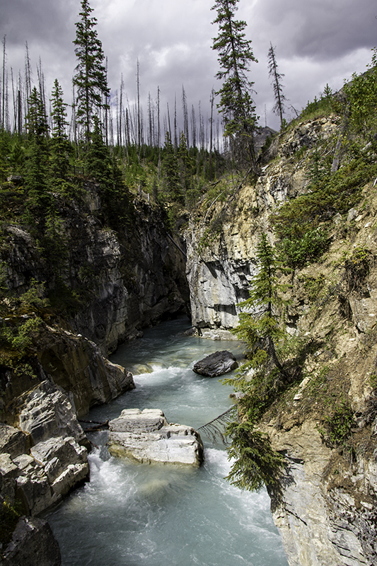
Marble Canyon
Caleb wanted to be upset that they didn’t give us a heads up, but maybe they got lost too, though that doesn’t seem likely. We would end up coming down a hill from a group of cabins and walking on the trail that leads past the lower and upper falls and eventually to the ink pots with another 2-3 hours of our time one way. Defeated, we head back to the car via the road and there’s that couple putting their hiking sticks away and changing out of their sweaty boots. Lesson learned: it’s not always about the destination, but the fun you have overcoming the obstacles along the way.
I also learned that it’s important to stay calm, even when Caleb thought we were lost. He wanted to attempt to just walk to the road, but as messed up as the trail was I knew another route would be even more difficult and could leave us stranded doing circles in the woods for a day or two. Or perhaps not as we were still close enough to hear cars on the road and could’ve followed the sound, but we still would’ve gone off the trail and that’s no bueno when plant and animal life are at risk – unless it’s life or death.

trail to Paint Pots
We didn’t remember that when we got advised to take Hwy 93, the couple meant the portion in Alberta, Icefield Parkway, that winds through glaciers and has been known as one of the most scenic drives in the world, not the southern end, Banff-Windermere Hwy, that will take us through Kootenay National Park after taking us by the Continental Divide. We get out so that I can sit between two parks and two provinces. It’s here at 5,382 ft. above sea level that water makes its decision to flow to the Atlantic or Pacific Ocean. We watch as a mother and son run around enjoying the divide and border to the fullest.
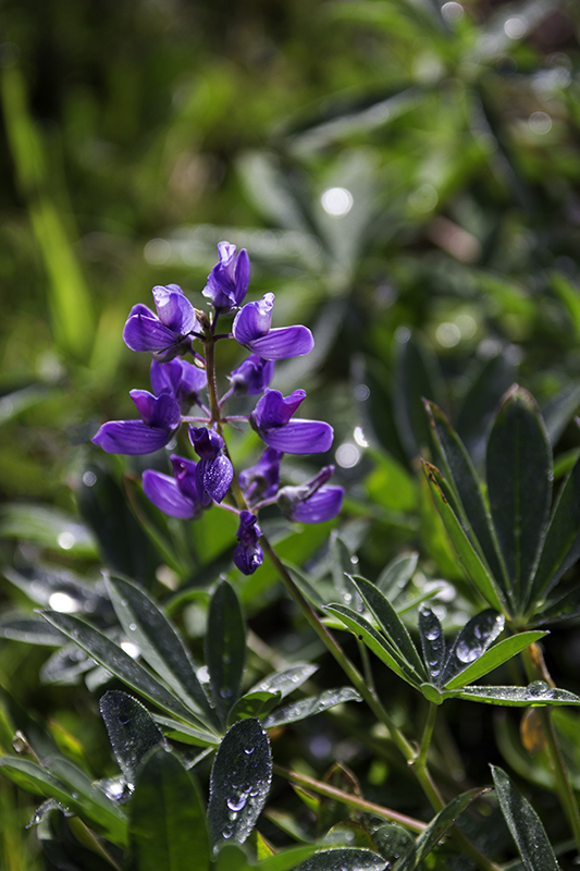
We stopped at Marble Canyon to see a waterfall, but on the other side of a gate we see a sign that says the other entrance to the Paint Pots is closed and this is the only way to access them – so we go. The other way may be shorter, but we are glad we didn’t miss out on turquoise-blue melted glacier, emaciated green trees and their burnt brothers, brown butterflies with a splash of white, and purple flowers amongst new undergrowth.

field of paint
Halfway down the trail and we see a sign for attacking trees – well, that’s what it looked like to us. It told us that fires made the trees unstable and that we should wait until it wasn’t slightly sprinkling (I was beginning to worry it would downpour and ruin my camera), avoid steep slopes (like the ones located near the rocks and rapids), don’t step on the roots (that happen to be all over a particular section), and to stop when one tree length away from all standing trees (that we happen to be in-between to read the sign). It also said to spread your group out and travel quickly to reduce exposure time, but I’m here to enjoy the scenery – not be scared of the many ways it could kill me.
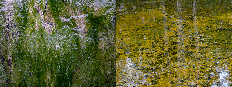
Color, ink, paint – they all may seem the same when describing colorful earth that I have yet to see, so I really didn’t know what to expect. There is natural ochre here that was mixed with fish oil or animal fat and used by the First Nations people to paint their clothes, bodies, tipis, and rocks. We find a field of iron with patches of olives growing out of pools of gold. There are still some old tools that have been left in the grass next to the river of red pigment.

river of ochre
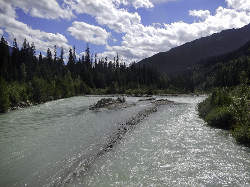
Two hours later and we return to the stairs that will take us to Marble Canyon – not named for the multiple types of marble rock that the river could’ve carved or for little glass balls, but for its resemblance to marble as gray and white dolomite. It’s a warm day and Caleb and I both want to go swimming. We could jump in, cool off, break a bone, and there are witnesses that may help or be too busy taking pictures of themselves in front of the falls.
Parts of the stone are smooth and others jagged, some are bright and others burnt. The grass is green, yellow, and brown in its varying stages of life. The water is pure blue, quick and inviting. As we get closer to the finale there are signs letting us know where the main attraction used to be and how it has continued to creep back over thousands of years. If that wasn’t cool enough we get to see a golden-mantled ground squirrel as it finishes lunch and then stands there with his paws pressed to his chest. He hibernates during the winter, which can be quite long in Canada, in ‘shallow’ burrows up to 98 feet in length.

golden-mantled ground squirrel
Another two hours have passed and we are at the circled number 4 on the map, the triangle is a camping spot. Kootenay River Valley Viewpoint is dedicated to James Sinclair, a man who guided people over the Rockies many times between 1841 and 1854. It’s also a stop to dump trash and walk dogs. I think it’s great that Canada put the investment into roadway garbage cans that seem to eliminate highway litter – or it’s their country pride.
Traveling in Canada is like having an invisible tour guide along to help. Everyone is so nice and all the information centers, in every town, are so easy to find though the parking may not always be – or so it is the case in Radium Hot Springs. We park above it near a park and walk down the stairs to a boardwalk that leads us to smiling faces and a sheet of paper with campgrounds listed on it with websites, addresses, phone numbers, prices, and amenities included – and all for free as Canada believes in the return when done or pass to someone else in need or recycle program.
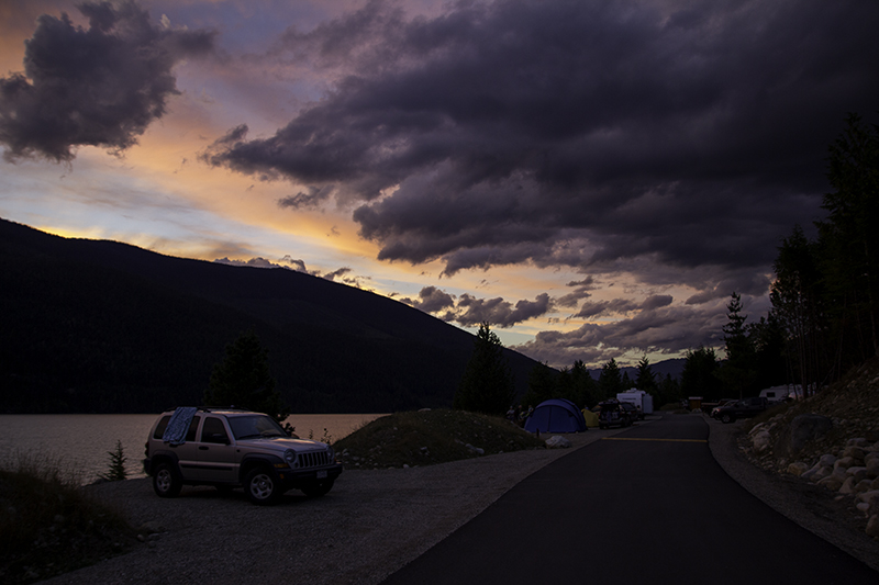
We go with the second choice on the list – Dry Gulch Provincial Campground. It’s twice the distance from us as Redstreak, located in the park, but saving six dollars or more is worth the five kilometer drive. The ranger arrives promptly and Caleb has decided on a campfire tonight. I will cut up tomatoes to go with mac-n-cheese while he struggles to keep the flames high enough to cook marshmallows. Beaten by the lack of blaze and tired from a long day we decide to retire early and skip dessert.