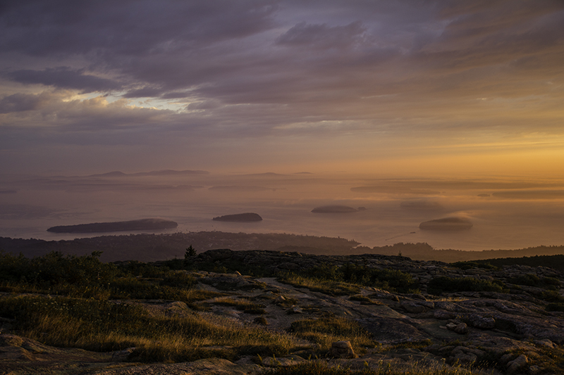
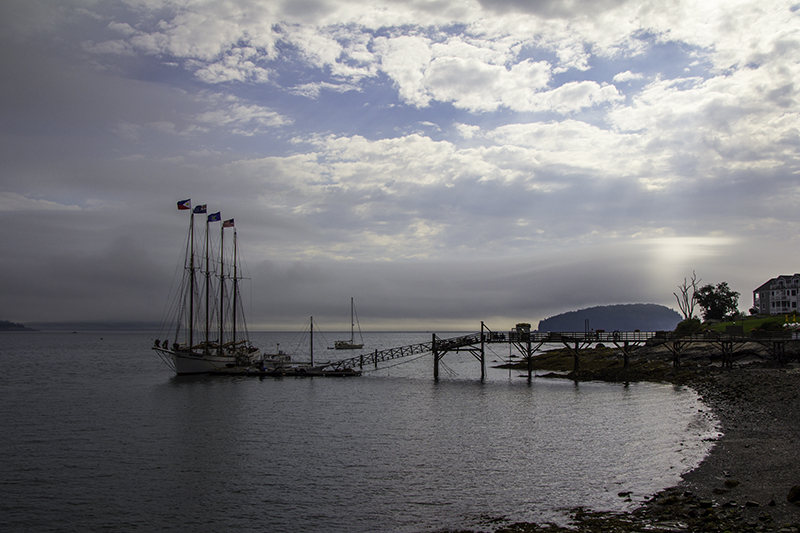
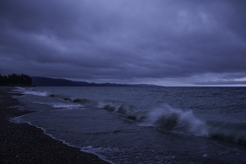
In New York, The State That Today’s History is Made Of

Hudson River

Hudson River

Last night and early this morning didn’t involve much sleep. I woke at 11:00 pm to pee, at 1:00 am to rain and calf cramps, at 3:00 am just because, and finally at 5:30 am after an interesting dream with me involved with a sci-fi group of sex and murder. Then I had the choice to drive the wrong way on a one-way road and quickly exit the park or drive past the other campsites and along Laurel Lake – of course I chose the latter. All the other campers were parked in the close vicinity of the shower, amphitheater, and nature trail.

Through the morning fog with a crumb donut in hand I drive past a layered cemetery and a personal greenhouse before reaching the Empire State sign. While waiting at a stop light in Troy a man pulls up beside us and lets us know that we are far from home – farther than he thinks – as he sees the Montana plate on the back of the car, but are living in San Diego. He used to drive semi-trucks to the woods of the Big Sky Country. He wishes us a good visit and the light turns green.
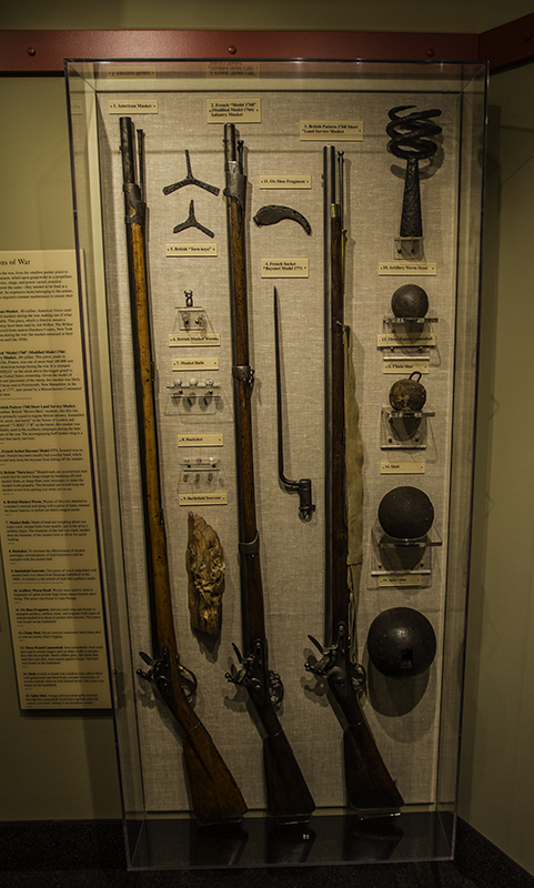
weapons of war

weapons of war

I love the old architecture, and closed-in porches of wood and brick, of the cities of the Northeast – there is much history – and probably just as much lead, asbestos, and rusted pipes that make up the homes and businesses of the area. Then there’s the countryside and a barn with the year 1892 on the roof seen on our way to Mechanicville along the Hudson River that offers a beautiful reflection of the sky above it, the plants growing beside it, and the railroad track that crosses it on the north side of town.

Still north is the town of Stillwater where a blockhouse was built in 1927, for the 150th anniversary of the Battles of Saratoga, according to the detailed drawing by Thomas Anbury. It was the original visitor center for the Saratoga National Historic Park for over 40 years and we are headed to the newer one on a hill in the trees past the water fountain with the Notice: Water contains sodium in excess of 20 mg/L and should not be consumed by people on severely restricted sodium diets. The FDA considers anything sodium free if it contains less than 5 mg per serving.


the Freeman Farm

the Freeman Farm

Inside the museum are cannons, battlefield models, long musket rifles, and cufflinks from the American and British soldiers. Also on display is a leather pouch made of porcupine quills and other animal hair carried by the Oneida warriors that helped fight against the British. There is a driving tour that travels nine miles and has ten major stops by farms, forts, houses, trails, plenty of monuments, and a burial site.

A volunteer ranger, after putting away his liquid lunch, lets us in the Neilson House. Inside are two writing desks with papers, a candle, scissors, and inkpot with feather-ended pens; foldable beds made of wood and rope; shoe boxes and a chest; a fireplace with wooden stools; and up the ladder – more room for sleeping. It’s a beautiful place and I don’t want to imagine it covered in bloody bodies, but people have yet to figure out a peaceful way to share when religion, politics, money, land, and power are involved.

desk inside the Neilson House

desk inside the Neilson House

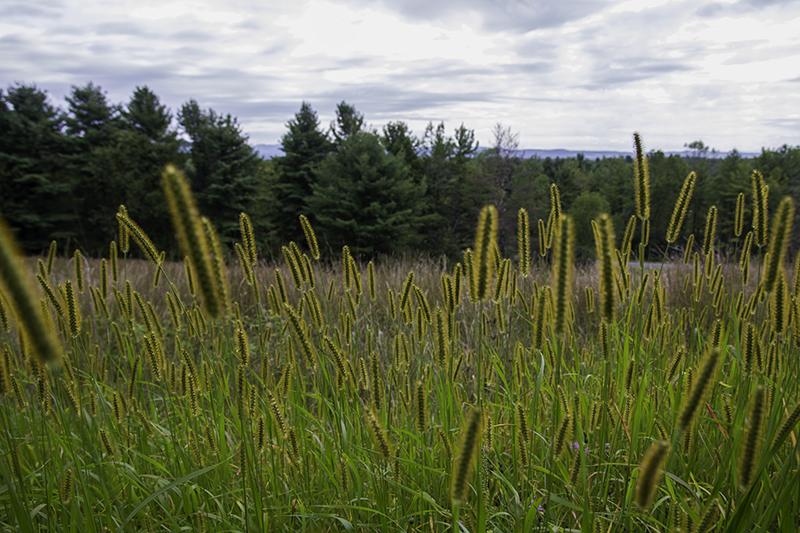
In the field is a little green spiny thing growing and either covered in dead leaves or dying itself. Its brown seeds are attached to a mass of thin strands – like a hair sample in the dyeing section in the beauty store – that will help carry them in the wind. Greatly contrasted is an orange caterpillar on gray pavement. We enjoy the grandeur of the park and its war memories – and being one of the most decisive battles in American and world history – but also the little things that make this place more unique to us.

Eight miles north is the Saratoga Monument in Schuylerville overlooking the National Cemetery and though we don’t know anyone in there personally we still find it worth looking at the extravagance of some of the tombstones and memorials left to remember someone who made a difference – or had a lot of money. Others have been buried with less decoration and had their effect on the world too. We are here to appreciate that – and to get to the top of the 155-foot monument which just happens to be closed today.

Saratoga Monument - by Caleb

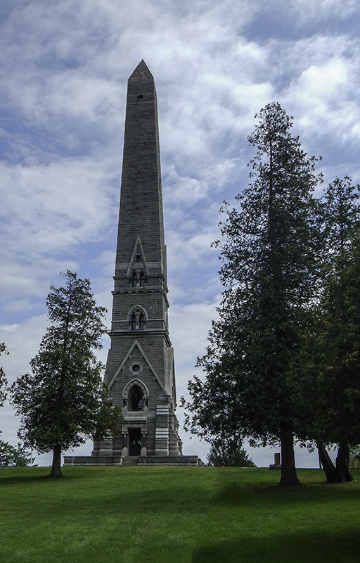
Saratoga Monument – by Caleb

Maybe a bit upsetting, but I can’t expect every building I visit to open just for my arrival. I’m grateful that with fewer visitors the site is better preserved, then again, bones and flowers can’t do much damage above ground. We drive west to see the giant ballet slippers, brick and stone churches, and painted horses of Saratoga Springs. We stop to pick up dinner in Fonda at Sorrenti’s Pizzeria before getting on Hwy 90 and driving past Utica, Syracuse, and Rochester to find a campsite for the night.

We watched two boys keep on eye on SpongeBob SquarePants on the TV and their feet on the booth and tables while waiting for our pizza, mac-n-cheese bites, and garlic knots that we would eat on the road. The sunset is seen through fields of future groceries and we arrive at Darien Lakes State Park. California camping may cost a lot for tents, but at least the sites aren’t as strict.
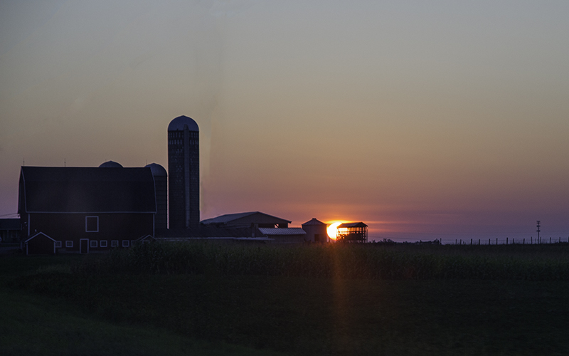
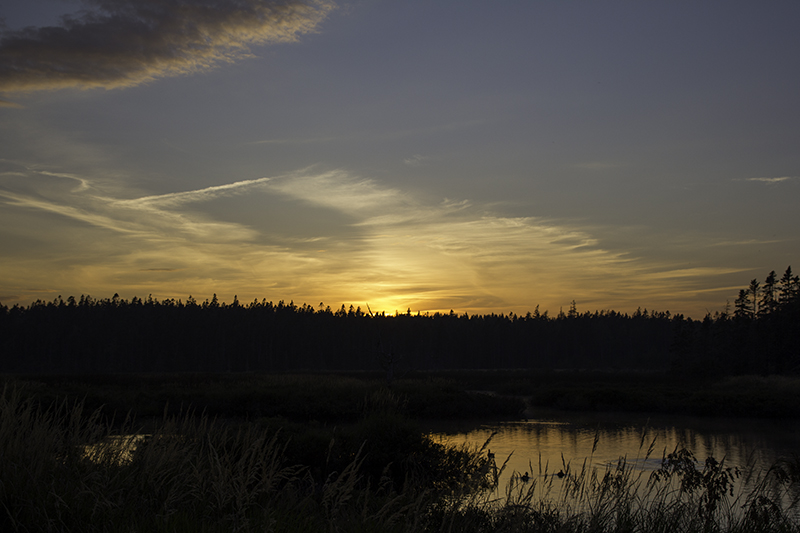
sunset on a farm

sunset on a farm

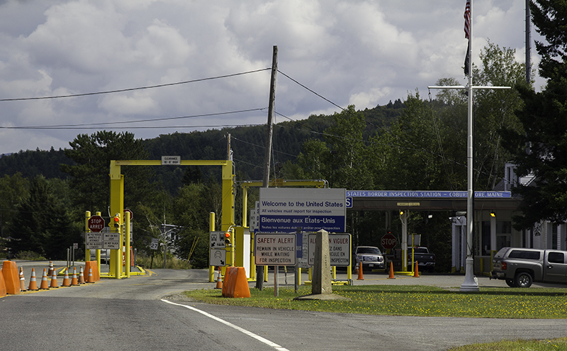
Once in the little wooden booth the ranger informs us that we have a long list of questions to answer about our home, family, car, pets, and plans. Then she requests a proof of the dogs’ rabies vaccinations – are you fucking kidding me?! Ok, calm down. Luckily I needed them for entry into Canada and happen to have them with me. There needs to be more informative websites and brochures for these kinds of things. It was already after 8:00 pm, we wanted to get up early, and didn’t feel like sleeping at a KOA or hotel.

Seven dollars in randomly assessed taxes and a list of rules longer than my arm – and we have a primitive site for $19 – complete with basketball court and BBQ with boombox. I stayed in the car to talk with my dad for 25 minutes while Caleb got approached by two camp host ladies, that made Sparky bark, and then set up the tent. Pets aren’t allowed anywhere, not even the parking lot, and we have to carry their bag of shit out of the park with us – I hope they can hold it. We are still going to sleep with smiles on our faces. We had an excellent day and have a birthday to celebrate tomorrow – mine.

Posted in Camping, Food, Forts, History, Military, Photography, Places, Travel | Tagged , , , , | Leave a comment

Mainly a Morning in Maine

cadmtn

By the lovely sunrise gods I am woken in the shadow of night. I stumble on the path through the trees to the fluorescently lit restroom. Once my mission there is accomplished I am suddenly more alert and feel like the rabbit in Alice in Wonderland. I hurry back to the tent and shake my husband awake. I ask him to tell me the celestial hour, but he is unable to because of a malfunctioning cell phone device. We rush to the car to my dead cell and I turn the key into the ignition. The little clock on the dash shows the time to be 4:30 am. No time to waste – I throw the car in reverse.

The other vehicles on the road seem innocent at first, but then I start to notice that they are all headed in the same direction – to the top of Cadillac Mountain. Panic sets in as we near the climb and I start to see dawn. I wanted to be there already and some slow person is taking their sweet time driving me absolutely berserk, for a split second, and then we are in the parking lot. Where did all these cars come from? Once we find a spot on the rocks a guy turns to us to join in our awe and let us know that some crazy couple decided to ride their bikes up here – and they still beat us to the top.

dilmnt

It is only 5:00 am when the sky begins to turn different shades of gray. The crowd begins to grow as the orange in the distance brightens the sky and highlights the fog covering the islands below. Forty minutes later and people are still filing in. It’s only now that we realize this peak is larger than we thought (and we will find out the parking lot is too). There is another side crowded with people and cameras. Behind us a couple brought foldable chairs and all the ingredients for a bowl of cereal.

In front of us, the only child present starts to play some cellphone game until her mother realizes the annoying sound is coming from beside her. Peace is restored and we go back to scanning the horizon looking for the bright ball of light that is due to bring life, energy, heat, and reflections to the plants, water, and faces of earthlings. 5:50 am the sun is spotted in the clouds and six minutes later it will begin to peek at the clouds, islands, eyeballs, and lens’ staring back.

photo by Caleb

photo by Caleb

It’s so pretty – and not just because I’m on a mountain in a state for the second day or because I’m partial to sunrises. It’s so mesmerizing that even though my pupils are starting to burn I find it hard to turn away – must aim face and camera at sun – enjoy moment as much as possible before going blind. But ten minutes later and the moment is gone for most people which is good; it gives us the freedom to move around and not block others’ views. There is fog and shadow, pink and yellow, and sun-kissed rocks.

It’s moments like this that I feel our love grow (though it may also grow when we see an unhappy couple – good comparison point) and am glad I have found someone to share this morning with – even if he only has one good eye to see it, he has given his whole heart to me and to nurturing the simple pleasures in life, which for this occasion is: a sunrise, holding my hand, giggling in conversation, kissing my sun-touched lips, and laying on the ground with me to get a flower photo from a different angle.

schooner

Margaret Todd in Bay Harbor

Now 6:30 am and the sun is moving up in the thick clouds. The view has changed dramatically in the last hour and a half and I enjoyed every second of it. We are now one of the few left gazing around longingly and reading the plaques about the location, one of which tells about the Frenchman Antoine Cadillac for who the mountain is named for his possession of it in the late 1600s. He would later go on to found Detroit in 1701 and inspire the name of the luxury car company that was founded 201 years later.

The drive down the summit road was much more relaxing. I made a memory with my husband and am now able to cross something off my Before Eternal Planking list. And I can’t forget to get a passport stamp for another national park visit. At Sieur de Monts Spring: The Heart of Acadia National Park we get to walk around the same area that Mr. Dorr fell in love with and purchased in 1909. I like that the garden is divided into different areas – wetlands, forest, and Caleb’s favorite – the bog ‘of eternal stench’ based on what plants are found in those regions.

ylowed

We haven’t forgotten about the dogs and go back south to pick them up. They were asleep in the tent when we got there. North of Bar Harbor is another visitor center – Hulls Cove. We stop in town first to see a guy repainting a building white; a giant lobster holding an ice cream cone; a schooner, the Margaret Todd, with four flags flying – American, Maine, New England, and Philippines; the rainbow of apartments above the shops below; and more offers for seafood and dessert. I can tell why fishermen love this place.

Somewhere near Saturday Cove we stop for sun, sand, shadows, splashing, seaweed, snapshots, and Sparky sprinting. We park by the road at the site of an apple tree, but the fallen ones and those within reach are rotten. We find a bakery, Borealis Breads, in Waldoboro where we get a garlic-hummus sandwich on rosemary bread, to split, a loaf of three-cheese focaccia and a cranberry-walnut log to go. Our next jaunt out of the car is at the Androscoggin Swinging Bridge connecting the towns of Brunswick and Topsham.

androbrdg

I saw a landmark sign and a parking lot big enough for five and turned around to get a look. The bridge was erected in 1892 of wire rope. It’s a good thing we didn’t get the dogs out of the car because Caleb wanted to test the bridge’s swinging ability. One side is a busy street with businesses and the other leads into a neighborhood with a walking path. Only six more rivers to cross, three other bodies of water, and we find ourselves accidentally on the toll road in New Hampshire.

We pay $4.00 for that mistake and take the Greenland Rd exit and follow that south to Historic Exeter where there are some nice two-story buildings: an old theatre, a curtain shop, a Szechuan restaurant, and an antique store. We don’t notice much more before entering Massachusetts where the border town has their Soles of Haverhill Shoe-labration on display. We see the ones in front of the firehouse and church. We admire the architecture of Lawrence before making our way to Lowell – our destination for today.

Pawtucket Canal

Pawtucket Canal

We park in front of the visitor center – or as close as the street will allow to the entrance – knowing that Lowell National Historic Park should be closed. We are in luck though as we catch an employee leaving work at 5:30 pm. She has forgotten her keys, but waits for security to let us in for a map and a stamp. We can still do the walking tour of the canal system, peek in the windows, and meet some of the locals.

There is a work dinner or birthday party going on in Market Mills Park where the Homage to Women sculpture is dedicated to the nineteenth century mill girls. There is a sign posted on the fence designating the area as a Busk Stop: Public Performance Space with rules available at Lowell.org. All the people nearby are too busy eating cake to entertain us. As we turn to leave we notice a kid in the street sitting on the handlebars of his bike and peddling backwards, perhaps because there is no tire on his rear wheel.

Lower Locks

Lower Locks

We walk through the UMass Lowell Inn like we own the place and find that the back door leads directly to the Lower Locks. I like how the build of a space, and the materials used, can give a different feel to a place. I’m standing in a state that helped build the U.S. to what it is today and in a city that once prospered with six miles of canals powering ten mill complexes with ten thousand looms. Working conditions might not have been great, but business was booming for a hundred years until competition closed the mills.

For someone visiting today, with a strong imagination, I can still hear the water powering the turbine, that generates electricity into the looms, and employs the workers for 12-14 hour days. I can hear the women in the windows and the men’s shoes on the street. I can see the smoke rising from the power house smoke stacks and the end of a man’s pipe. And in front of us, no fantasized imagery is necessary. We get to watch ‘the boys’ feed the ducks while the father and older brothers, uncles, or friends fish – a heartwarming scene.

willow tree in Lowell, MA

willow tree in Lowell, MA

I don’t know the uses of the Boarding House Park 150 years ago, but today people can be seen stretching, climbing stairs, riding bikes, drawing with chalk on the sidewalk, and admiring the layout, colors, and history integrated into this area. I also enjoyed looking at the contrasted skies, gray sculptures, Lowell Five Cent Savings Bank, and all the signs telling me what not to do – don’t enter this street, don’t park in front of this gate, and don’t use wheeled, non-motorized, transportation on the sidewalk – though I think it’s implied that I don’t drive on it either.

We drive halfway across the state to Erving State Forest where we will camp near Laurel Lake at campsite 4. The park seems a little empty – no ranger or other visitors in sight. It’s dark and a little moist while we are setting up for dinner and sleep. Caleb airs up the beds and I heat up the broccoli soup that we have with focaccia bread. Only in the Northeast can you drive across three states, watch the sunrise, visit a garden, play at the beach, walk around a historic district, and camp in seclusion.

Posted in Camping, Events, Food, History, People, Photography, Places, Plants, Travel, Water | Tagged , , , , , | Leave a comment

Parlez-vous français?

U.S. Border Inspection Station - Coburn Gore, Maine

U.S. Border Inspection Station – Coburn Gore, Maine

Another early morning and with nothing left to do at camp we were gone before 5:30 am and facing another cloudy morning. Breakfast is at the border at this little known place called ‘the back of the car cooler with sandwich supplies in it’. Now we are feeling excited – a new province and a language we don’t speak; though we are having luck guessing the directions est and ouest and the common sign sortie that lead to off-ramps.

We were bienvenue’d through Ottawa and through most of Montreal. We would’ve missed it had it not been for the near empty gas tank. We stopped in Brossard on the east side of the St Lawrence River. Caleb recognized the shaped street lights from the YouTube show Epic Meal Time and was thrilled. Then we get our chance to share a conversation with someone – a gas station attendant. Luckily I knew the routine – pump then pay or come inside, show your card or leave it with the attendant, pump gas, then return inside for card – because the exchange was hilarious.

Flagstaff Lake

Flagstaff Lake

Caleb walks up, “I need gas.” And the lady replies, “French only, but perhaps I know English. Ha ha.” And I start laughing. I can’t contain myself. Caleb says something else just to check her response and she squeezes her hand together like pumping gas. I told Caleb to go. Then we watched him pump gas. She might’ve been able to read English because she wanted me to write something on receipt paper, but I wasn’t able to understand.

Caleb wanted to give the poor lady a hard time (not to her face) but for not knowing English when she lives less than an hour from the States. I told him it’s just like us living five minutes away from Mexico and not fully understanding the full Spanish language yet; though it is easier to read and write than to speak. We see a large store across the parking lot that reminds us of REI. This one is called SAIL. I’m anxious to get inside and meet more of the locals and Caleb says we need to shop – so over we go to wait for them to open.

acadiatent

While doing so I admire their store hours and think about how close the French words for the days of the week, ending in di, resemble the Spanish words for the same, ending in es. We look at a tiny basket that has been left outside and think of the fun and pain we could have standing in it, but I’m just as quickly distracted by the beautiful flowers they have growing near the building. The doors open and I am all smiles. The store is four times the size of the outdoor outfitters we have.

There are mostly sleeping mats, sleeping bags, hiking bags, coats and tights, kayaks, fishing poles, and shoes. There were plenty of people working there to help us bilingually – it just flows from their mouth so naturally – damn cheap public American schools. We have no problems checking out and are soon back to enjoying road signs – a car and a tractor colliding, a car sign and a deer sign colliding, a man strutting sign, and the most confusing of all but most honest – what looks to be a beaten child left for dead with the words ‘attention and infant’; it means if you don’t slow down you will kill a child.

suntree

Amongst all the signs we pass one worth stopping for – Parc national de la Yamaska, with a no sign for shooting and picking up turtles. Something else they should add to that sign is their no pet on park grounds, in vehicle or not, policy. We try another park and they turn us away too. And to cheer us up we buy pickled cheese noodles from a local farmer that sells random things in a roadside shack. Yum. And we are just in time for crossing back into the States at the Coburn Gore border inspection station.

We forgot the stamp coming in so I don’t want to forget it leaving. The inspection officer lady makes fun of us, in kindness, and I’m happy to have my second cancellation. Now to drive across the state, skip Bangor now so I can bang him later, and get to Acadia National Park to the Seawall Campground at the south end of Mt Desert Island. We see an American flag on every other power-line pole near Eustis, but that doesn’t help with the language barrier – though mine was a sign error. I walked into a bank thinking it was a visitor center with a toilette, but was able to find one at the grocery store down the road.

suncloud

We stopped in Kingfield for the simple Main St. and stayed to look at the Herbert Grand Hotel, the colorful buildings across the street, and the old church across town. We reach the island before 6:00 pm and are lucky enough to get a spot in the woods for $14 – Loop D, site 61 by 6:30 pm. We are glad to have made it this year as a walk in because next season will be reservation only. We head just out of the campgrounds looking at Cranberry Isles to the east and the sunset to the west.

Back at camp I heat up some soup while Caleb sets up the tent. The ranger told us earlier that due to our distance from Cadillac Mountain, the one lots of people visit annually to watch the sunrise at 1,531 feet (the highest point on the east coast), that we should leave camp at 4:30 am to get to the top in time with all the traffic expected. Even so, I wanted to enjoy the rest of the evening. We went to the parking lot, a better view, to watch the moon and stars – romantic and educational – Caleb had a telescope as a child with a sky map.

Posted in Camping, Entertainment, Photography, Places, Travel, Water | Tagged , , , , | Leave a comment

Above Average: Over 500 Miles

blue

For the two weeks that we’ve been on vacation we’ve had a hard time going over 400 miles daily and only achieved it twice until yesterday when we covered 556 miles. We knew we had to drive just as much today, if not more, because we had given ourselves two weeks to get to Maine and just as long to return. Today is the 16th day of our trip and we still have a province and a state to cross. And because of our time predicament we will take the early morning slow, enjoy it, and try our best to not get too sidetracked during today’s drive.

The ranger assured us last night that the beach was the perfect spot to watch the sunrise. I thought that odd because it’s exactly where the sunset was, but figured it would still be pretty to see the colors develop in the sky over the water. Well, that moment never came. We stood on the beach, swatted at the mosquitoes, danced in the water, and tried to keep our toes warm by digging them into the rocks. Once the sky got a lighter blue I decided it was time to take a shower.

I can always appreciate a good washing, as I’m sure the people who encounter me throughout the day can as well. I thought this would be a simple three-minute ordeal and we would be on our way. The nozzle was like a water hose in diameter, but a fire hose in strength which I hoped would keep the mosquitoes off. I ended up playing whack-a-mosquito with their bloody little bodies all over the walls and others attacking me while I dance and get soap in my eye – partially clean and mostly wet I put my clothes on.

We stop in Batchawana Bay at the Voyageurs’ Lodge for breakfast and gas. We look for something quick. Caleb gets an apple fritter. I get an oatmeal bar and a fig pastry. They weren’t impressive, but we were fed. After father and son filled the tank and wiped the windshield we were on our way to Sault St. Marie to get the oil changed at Jiffy Lube where the customer service was fantastic. Then we made our way to the Wal-Mart and Home Depot parking lot to purchase things and borrow tools.

road sign

road sign

I forgot about the ‘No shirt, No shoes, No service’ policy. I had no problem in Wal-Mart, but they didn’t have what we needed, so we went next door. One of the employees expressed concern about my toes being smashed without shoes on. Well, someone told the manager, so I went to the car, put my soggy shoes on again, went back in, and then we were done and ready to go. I suppose a little trouble was needed to keep the trip balanced. Everything has been so perfect – even being asked to leave a store for the first time.

Driving along the Trans-Canada Highway we see, what seems to us, an exorbitant amount of horse and buggies carrying Amish and Old Order Mennonites. It’s not that we haven’t seen them before, one or two at a time, in Pennsylvania or the other many states that they call home. It’s that Ontario is the only province with Amish and there is either a sale at Jacob’s farm or it’s… Monday? I revel in the thought of joining them in the simplicity of family and community. And then I get back to driving my gas guzzling SUV down the road with my exhaust in their horse’s face.

Somewhere between Sault St. Marie and Sudbury are some trails that take visitors past fenced in mine holes – totally not as interesting as we thought. We pulled over and put on our hiking boots because the trail was washed out. We let the dogs go ahead of us and when Piggy fell into one of the pits, after I could get the majority of my laughing over, I called her back so we could return to the car. No point in drowning the blind dog in muddy water over a mine we can’t get stuck in, but it might’ve been awesome.

We stop in Verner to buy some cheese noodles in a jar, then in Sturgeon Falls to stretch our legs. We drive through North Bay to Mattawa where we will stay along the border, following the Ottawa River, of Ontario and Quebec until Pembroke where the road splits. Dinner of mac-n-cheese with tomato is had in a parking lot in Cobden in front of their welcome billboard. And sleep will be had at the campgrounds of Fitzroy Provincial Park. We did it. We managed to drive 564 miles today and wear ourselves out. Sleep comes easy tonight in our moist and sandy tent.

Posted in Animals, Camping, Food, People, Travel, Water | Tagged , , , , | Leave a comment

A Thousand H and Five Hundred O

Kakabeka Falls - by Caleb

Kakabeka Falls – by Caleb

As we were setting up last night a car passed and, returning from the reservation booth, set up next to us. It seems the park is emptier than the list of available spots would have one believe. I was feeling sweaty which makes it harder to fall asleep. It was just the warm before the storm – our first in a tent. The rain came hard as did the lightning and thunder. I could feel the drops pelting my feet and waited until 3:00 am when I could pee in the drizzling precipitation without worry of being soaked from above and splashes below.

I couldn’t predict what happened next, but as I squat in the dark with my headlamp searching for wild animals in the trees I inadvertently was peeing on worms. I felt bad and attempted to move away from them midstream. Caleb was giggling in the tent as my confession had been heard by our neighbors, also laughing. All this commotion kept me from realizing the mosquitoes were still thirsty. I ran to the car to write this down and let Caleb sleep, but figured it could still be raining in an hour when the alarm went off, so I went to roll my things up.

Kakabeka Falls

Kakabeka Falls

Of course all my moving around woke the dogs that stepped all over Caleb in an attempt to escape. They like to pee first thing too. I put my bags away, saw a fox – happy to see it before dogs could chase it, and then let the dogs out while Caleb put his things away. While we were breaking down the tent I saw a bat and am realizing that the best time to see wildlife is while everyone else is asleep. We see a lot of frogs on the road on our way into Ignace – we are going to need some coffee this early in the morning and luckily truckers keep this gas station going throughout the night.

Did I just see a wolf? There is no questioning it. I know you are supposed to give them space and I can guarantee that I won’t get out of the car, but I might crack the window. I don’t have the time. This wolf knows all about reversing cars and that I’m about to shoot him with a canon. He’s gone and so is my morning momentum. Sleep was little to none and I’m ready for a nap before crossing over 90 degrees longitude west and into the Eastern Standard Time Zone where we will lose another hour. Good thing we got a head start this morning.

Feeling refreshed, an hour later, we are back on the road. Our first stop – Kakabeka Falls – like caca, the reference to poo. Ha ha, the ten-year old in me chuckled as I found a parking spot in the large, mostly empty, lot. We can hear the rush of water as we make our way down the wooden steps to the wide viewing platform. In front of us is a railroad track built over the Kaministiquia River flowing through a variety of green trees and over smoothed rocks showing its gold-brown-yellow-copper qualities before falling behind a wall of white tumultuous water before cascading quickly out of sight.

near Enterprise Bay

near Enterprise Bay

Somewhere near Enterprise Bay on Lake Superior we stop to get our first touch. We agree we should’ve stopped sooner – 40 minutes is too long, and yet, even here we are stopped by a man and his dog. I guess it’s his turn for community watch. He tells us to park on the side of the road, leave the dogs in the car, and make our way down this street (as he points). He has to keep track of visitors as most of this area is private property and the tiny stretch we’re allowed on only fits so many people at once.

No one heard me complain. The Great Lakes have for my entire life been something in fairy tales and history books and now I’m getting the chance to see one of the H.O.M.E.S. Lakes for myself – out of my way. At the cul-de-sac are two paths. We stay to the right, past some trees and flowers, and there it is – sand, a pool of water, a sandbar, and the lakes little waves lapping on the shore. In the distance are peninsulas and islands of Canada. I’m so grateful to be able to appreciate this place for what it is – not just some slut bath for fish, but a place of history, a suburban settlement, and a memory for Caleb and I versus nine years ago when Lake Michigan just meant freedom from work, watch, and training.

What’s next – more water! We are graciously provided with another hour or more of lake views before our next falls destination – Rainbow Falls – along the most scenic of the park’s trails. The trail is mostly wooden steps with some ‘holes’ in the railings to allow you a closer look at the river. This hot day and cool looking water have us in an extra upbeat mood and the few ‘old’ people (they acted that way) made it obvious they were getting out of our way as we skipped, joked, and photographed about the boardwalk. We came to a spot where I thought about getting in, but the fast water and sharp rocks had my mind made up for me.

Whitesand Lake

Whitesand Lake

This park, over two square miles, surrounded by water was sure to have another swimming opportunity – and we found it. I told Caleb not to worry about drying his undies later if we went skinny dipping now. Luckily I only had my shoes off when Caleb brought towels and a couple in conversation along. They gauged what was happening and wished us well. I was ready to go. The ‘pool’ was in the sun and there were big rocks and sticks easy to see at the bottom so I wouldn’t cut my feet. Caleb was enjoying the view and untying his shoes when he realized the kayak closing in on our location.

The other side of the park is for camping and fishing and kayak rentals. I didn’t wait to see their faces clearly before I was out of the water and putting my dry clothes on my wet body. I didn’t want to know if they had brought a zoom lens with them. It’s one thing to talk about swimming in the nude. It’s another to have pictures of said activity posted to the internet. And for a moment it felt like we had the park to ourselves. On the way back to the car another couple was making their way to the water. Maybe next time.

We are suckers for waterfalls and are easily tricked into thinking we will get a decent view at Neys Provincial Park of Aquasabon Falls. The other viewpoint is under construction so we get to enjoy the depth of the gorge formed by the gush of water obstructed by trees.  South along the shore are trails leading to other parts of the lake at Pukaskwa National Park. There is a tiny parking lot and the only person inside in uniform doesn’t know where the stamp is as she is supposed to be at the front booth charging entry fees. I don’t mind getting in for free. Thanks.

Horseshoe Beach

Horseshoe Beach

We take the trail from the lot, through the campgrounds, to the beach where piles of driftwood are washing up on shore. The park is pretty, but without a map we have no idea how long the trails are, so we enjoy the greens, browns, yellows, reds, and blues before a ravenous mother spider jumps out at us and threatens to feed us to her children. We don’t need to be told twice. It is lunch time and we should be finding something to eat too. We head back to the town of Marathon for a bag of lettuce and call it a salad.

We enter the town of White River and turn around to get a picture of the sign ‘Where It All Began, Winnie-The-Pooh’. It turns out a cub was brought to town in 1914 and went to London with its owner, that bought her for $20, that would be seen by a little boy in the zoo and become the namesake of his teddy bear at home and his father’s famous stories, and the only Latin version to be featured on the New York Times Best Seller list in 1960. Winnie died in 1934, but Pooh went on to inspire philosophers and the Soviet Union to make their own adaptation – different looking characters, but sticks more to the original story than Disney did.

Unbeknownst to us, Pooh is remembered on the third weekend of August annually in White River at a festival to commemorate the cub that gave life to a story that would be shared around the world. There are different themes each year with a parade, trade show and karaoke. The story also inspired a game, the World Poohsticks Championships since 1984, based on dropping sticks over a bridge on one side and seeing whose makes it to the other side first – the power of pop culture. And without knowing where to go – we leave.

Lake Superior

Lake Superior

We stop in Wawa to see the giant goose – it has done its job. It was unveiled in 1960 to attract tourists while traveling along the Trans-Canada Highway thanks to Al Turcott for the idea. He was worried at one point that the road wouldn’t be built through the city, but left plenty of reasons to visit including a small church made of glass bottles, and he is still there – buried next to his fort overlooking the Michipicoten River. Also at the visitor center is an information board with tiki posts, bright flowers, and a commanding view.

Deep, far down, through the depths of Lake Superior Provincial Park and out to the other side we approach a dangerous area with slippery rocks, high rogue waves, innocent looking chipmunks, and narrow gorges to see the Agawa rock of the Ojibwe people. Or so we thought. In order to do that one must be a good swimmer and not scared of a few sharp rocks, some cold waves and holding on to ropes and chains to support your weight while you venture further out in hopes to capture a picture that some one painted over 2,000 years ago and that was rediscovered by Selwyn Dewdney in 1958.

Caleb was brave enough to make it to the first rope (that you grab until you can reach the second and so forth) and stick his hand out, point his camera at the rock, and hope that it captured some of the ochre still persisting today through wind, water, and sun. We thought a man might venture out alone, dangerous and stupid, but the lady he was with wouldn’t give him the chance. She wouldn’t leave the parking lot after seeing the sign for an animal with crested back and horned head 400 meters in the direction her man had disappeared. She stood there shouting his name until his return.

Caleb photographing Agawa Rock

Caleb photographing Agawa Rock

Not far from where we are is a campground with safer access to the water and a nice pebble beach to sink our feet into. Of course to stay we have to make our way through their maze. We find an empty spot, but before we can claim it a park ranger says we need to check with the office as it could be taken, by phone, and not yet marked for reservation. Well it’s a good thing we didn’t take either of the two spots near the beach that we saw available because we ended up getting another that we hadn’t noticed. Note: don’t walk barefoot around a site that you haven’t checked for the previous camper’s tent stakes.

This evening’s lakeside accommodations will cost us $42, the price of traveling without reservations or prior knowledge of what our plans are going to be except drive east, watch sunrise in Maine, drive home. And at this hour we had the option to watch the sun set behind clouds or drive into the darkness and hope that the next park almost an hour away had camping available. We opted for site 229 and with shoes off and cameras in hand headed towards the beach, with mosquitoes, to enjoy the evening as it seemed another couple further down was also doing.

Posted in Animals, Art, Camping, Education, Hiking, History, Photography, Places, Travel, Water | Tagged , , , , , | 2 Comments