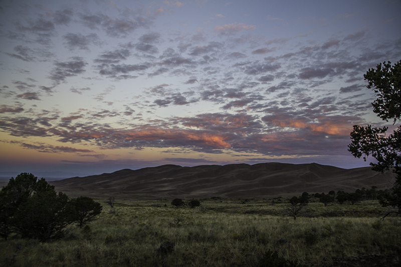
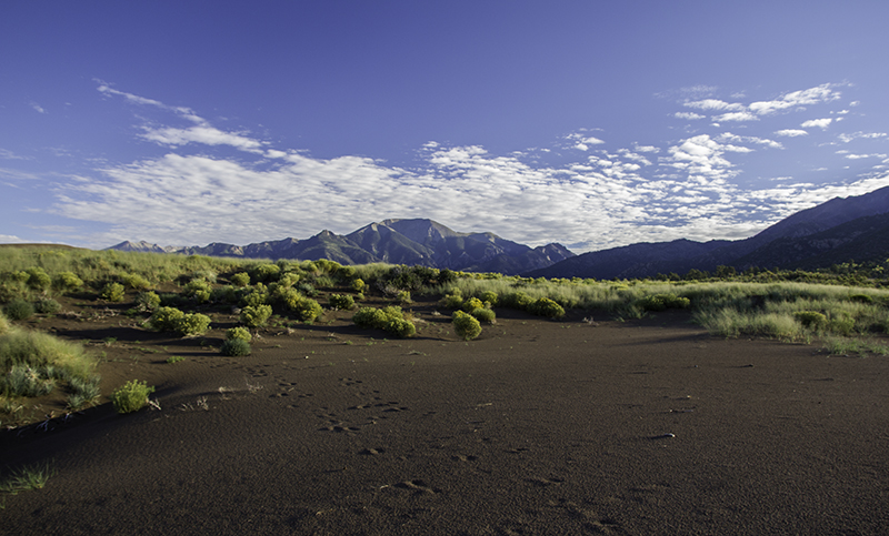
sunrise at Great Sand Dunes National Park
It seems we couldn’t have come across a better camping spot accidentally than we did last night. As the sun begins to rise the tent, with sleeping dogs inside, will remain in the shade. We know hot temperatures will change our ability to see and do for the last few days of our trip. We want to make the most of this cool morning and start it off with a hike on the Dunes Overlook trail. We get to see the blues and purples in the sky as we walk through the green path and see the shades of brown change on the dunes below.
The trail is two miles round trip and offers us a look at new-to-us desert plant life that is thin and spiny to withstand low water levels and high winds. We pass some backcountry camping – the only evidence being a tiny trail and a small fire ring, and from the overlook of the dunes we could’ve continued down the Sand Ramp trail around the dunes perimeter for another eleven miles, but we turn back to make our way to the Escape Dunes which includes Star Dune – the tallest in the U.S. at 750 feet.

Sangre de Cristo Mountains
Had we known that when we set out to put our toes in its sandy goodness we could’ve tried finding the top with three hours of zigzagging up and down the windblown crests – a feat to brag about later. This is why Caleb and I agree that brochures should be left in a case outside the visitor center so they are always accessible. The bigger we get, a perk of growing up, the harder it gets to fit on the toys at the playground. A sandbox that no longer resembles a kingdom but a shoebox just isn’t as much fun – that would not be the problem here.
Another trail that cuts through the campground and leads through some low grass brings us to sand that is hard and soft, cold and warm, smooth and rough, shaded and sunny, and crisscrossed with footprints of man and dog. We could race each other, build castles and moats, or make sand angels. Or we can admire the different shapes of the sand and how it changes in our hands and stare at one plant and imagine the power it has to shape this area as its ancestors have done for millennia or maybe just a decade.

the road to Del Norte, Colorado
Daydream time is over and its back to the campsite to feed the dogs and put away the wet tent since they spilt the water that we left them. We washed our dishes and refilled our water supply and then went to the visitor center to learn more about how dunes form and don’t just blow away, about the animals that call this place home, and how the dunes could’ve been reduced to a misplaced beach in a landlocked state had it not been preserved from a possible gold rush in the 1920s.
Down the road, after getting gas and eating sandwiches, we come to the Great Divide – the continental backbone of the Western Hemisphere. It follows the crest of the Rocky Mountains north from the Brook Range and south to the Strait of Magellan. The divide helps determine which way water will flow and offers the longest National Scenic Trail through five states, three national parks, and 25 national forests. So as I straddle the bronze line marker I think about history, geography, water, and adventure.

at Treasure Falls
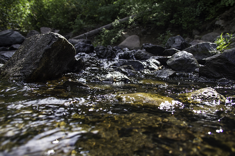
Into the San Juan National Forest and we stop at the interpretive trail of Treasure Falls – where legend has it there is gold cached here from an expedition in the late 1700s. We’re no miners, but we have a love for falling water, wet rocks, bright green moss, lens flares, rocky climbs, tiny snakes, friendly couples, sunny trees, misty decks, and forested blowout overlooks. A nice half hour stop before a forty minute drive to a pyramid with a chimney that entices us to pull over.
It’s Chimney Rock National Monument and there is more to this place than just two ancient stone pinnacles. There is architecture, pottery, history, wildlife, and hiking, but there won’t be any of that for us today. Their kennel offerings (to keep our dogs out of the sun in the car) is to put our dogs in the sun in a cage that one will climb and the other dig under. As much as it may be worth the $12 fee to help fund this park, not even a year old, to see what it has to offer, it’s not in the best interest of all involved – unless I think I could live without the dogs – which today’s answer is no.

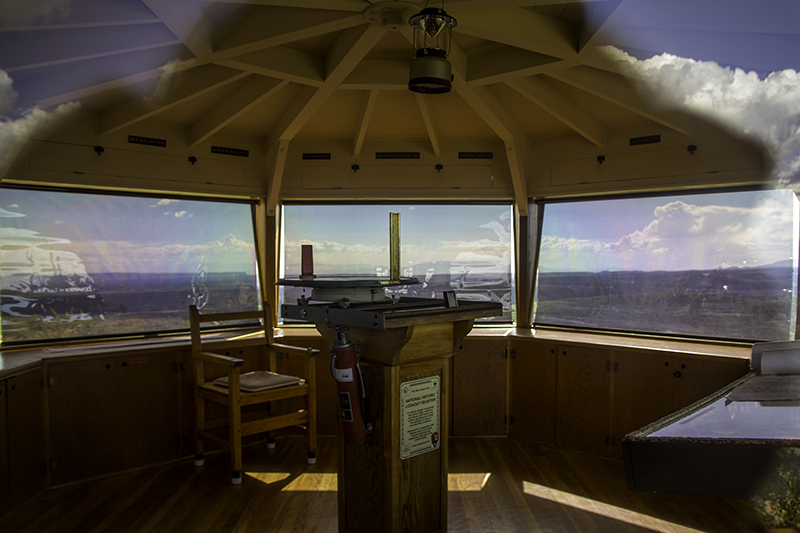
Fire Lookout at Mesa Verde National Park
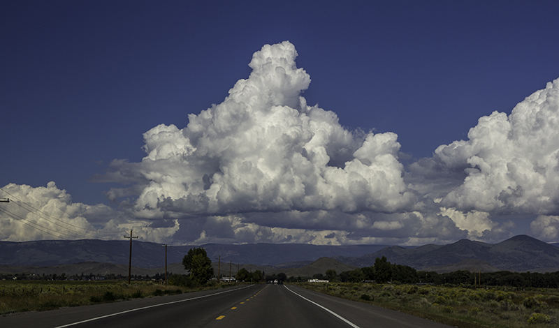
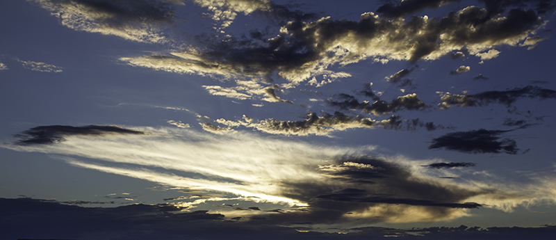
Following the 160 west it’s easy to fall in love with the clouds of Colorado. They make the roads, trees, and mountains all the more pleasant to look at and the sky more contrasting in photos. I’m lucky to have a husband that allows me to drive erratically, stop frequently, and give him the wheel so I can attempt a picture when I think the view is just right, but there is no place to pull over – on a bridge or a highway with no shoulder. And sometimes the view is just better from the car as we come over a hill than it is on foot after running back up the hill to attempt the same picture.
The next park is somewhere I’ve been before, but it was ten years ago and with a different man in my life – my dad. Mesa Verde National Park is one of the places he took me on his attempt to show me compassion, respect, and love for history, travel, people, and food. I may not have known it at the time, but his way of showing and not pushing or demanding worked, especially when I met the second man in my life – my husband.

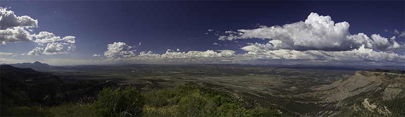
panorama at Park Point Overlook
We got to the only way in the park, the north entrance, at 3:15 pm. Inside the visitor center with a helpful ranger we learn that of course there is not enough time to see everything, but that we have plenty of options for both roads after the fork. There are many lookouts offering different views of the rolling hills in the valley covered in green shrubs, winding roads, yellow rocks, and shadows from the clouds – and that’s just one look at what’s right in front of me because I can see for miles.
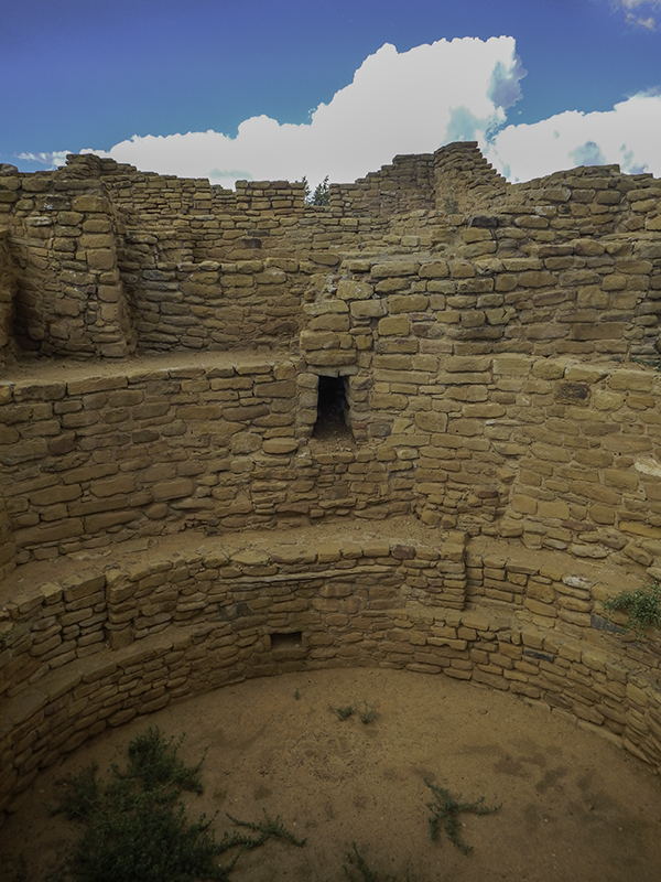
Our favorite stop on the North Rim was the Park Point Overlook and the Fire Lookout. There is a closed tower, viewing scopes, informational signs, purple and yellow flowers, eerie branches lining the trail, and enough smutty views of Mother Nature to start her own porn channel. I suppose some parks are already on the sexual highway with live cams available for viewing 24 hours a day – so many plants and animals, oh my! Maybe some parks could get in on the micro fetish and film the tiny building blocks of life.
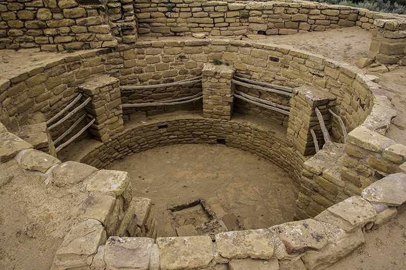
part of the Far View Sites – by Caleb
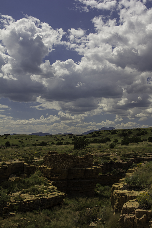
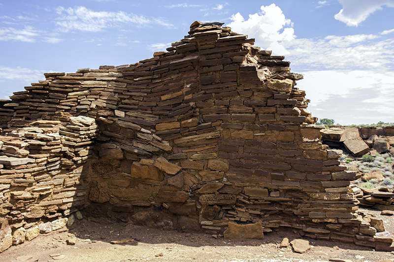
After Caleb is able to pull me away we choose to drive down Chapin Mesa Road. It’s not long before we are stopping at the Far View sites. These structures are still very well-preserved. It would be nice to hire the same constructors, or their descendants, to one day build me a home. I’m surprised, and grateful, that though I have the ability to carve my name in the ruins or run and jump on them that it seems no one else has chosen to either. Perhaps it’s the short drive or the even shorter hike that has discouraged delinquents from destroying this place. I am thankful and am sure to take plenty of pictures.
I can imagine the sight of smoke and children playing, the smell of food, and the sound of music and conversation, and the feel of dirt in my toes. I’m tempted to take my shoes off and join these people, but they are long gone by over 600 years. I wonder if there is a place that does reenactments so I may step back in time and stay a moment longer. All but one structure has been left to the elements. The Megalithic House (known for its few megalith walls) is covered in a metal room with sliding windows to let the light in for archaeologists.

looking in a kiva
We make the decision now to leave the rest of the park unseen as it’s overflowing with sights to keep us here until after dark. We hope to return one day, to spend the whole day, learning more about these Puebloan people and their tools, trade, basketry, pottery, and especially their dwellings. Our next stop is somewhere we have both been before, but it has since changed drastically. What once was a few booths of turquoise beads and frybread around some concrete and metal marking the intersection of four states is no longer so.
It was the simpleness that we loved. We were almost confused -thinking at first that we had driven to the wrong place. There is an entrance fee, parking lot, official booths and working hours, and the park is working on trails that show more of the area – which would be worth a look. We talk to a man as he is putting away his knives about getting something to eat (i.e. frybread) and he lets us know that business was slow today and we might have some luck in a town down a road somewhere. Thanks.

panorama at Four Corners
Though we may be originally sad to see the place change we can appreciate the smiles on all the other visiting faces that are seeing this spot for the first time. Then I wonder if this is what it was like for all the founders of other parks as they watched the untouched nature get paved to bring in more tourists but also to protect it from their trampling footsteps – Yellowstone, Carlsbad Caverns, and Muir Woods to name a few. As I drive into Arizona I feel too close to home. There is plenty to do in this state, but I could turn us around and we could just keep going, but we don’t because we need money to afford these excursions.
Instead we drive into Utah where it will be us versus sunset as we near Monument Valley on our way to the Swingin Steak in Mexican Hat – a favorite every time we’re in the area. This will be our first time coming into town from the east and arriving before total darkness. As our food shows the sun disappears and I get to watch my bearded husband enjoy his medium-well done steak (his second time eating meat on the trip) along with the same toast, pinto beans, and salad that accompany the veggie burger on my plate.

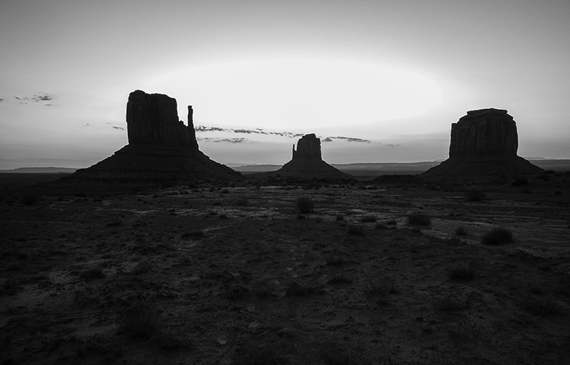
sunset in Monument Valley
Though I only left enough ‘food’ on my plate to tease a mouse I look around for the long-haired tan dog that used to be here. Perhaps the mutt settled down and made a family or went on to discover other mountains and meat-filled places, but he has been replaced with cats – quite a few of them that must leave so that I can let the dogs out. While distracted from the table, Caleb must have been busy flirting with the waitress because I return to some brownie bites – I didn’t even know this place had dessert.
As soon as dark comes, while on a road trip, we like to be done driving because we can no longer see the world around us. And then it gives us time to cook, eat, read, write, and relax. Tonight we drive 30 minutes after dinner to find a spot in the desert with covered picnic tables. I feel bad bringing my headlights into the starlit ukulele party, and as soon as we think we can see the sky another car comes screeching into the lot and stirring up dirt – that’ll be $10 please – and she is gone just as quick.
She told us she lives nearby and saw us arrive and hands Caleb a large purple sheet of paper (vehicle pass) that is good for three people on the 14th – oh well. Now we think we can settle down, but not before the last car of the evening sets up right beside us and brings the return of the hostess – making me feel like a caught animal as I wonder what my figure looks like in the tent being lit by her headlights. I get to fall asleep to the sound of singing, lite traffic, zippers, and whispering chatter from our neighbors.