
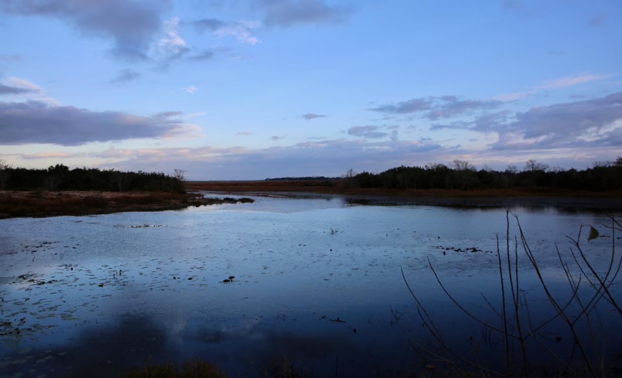
I didn’t recognize the park last night, Stephen F. Austin State Park, the same one we stayed at just eight nights ago on our way east. In my defense, we had set up in the dark spot amongst the RVs, which is rare, and I was tired both times. The bathroom and the deer look familiar as we leave under a thick blanket of grey sky so we can get to Attwater Prairie Chicken NWR, also a return trip but one I remember, as the horizon starts to pinken. About 80 birds take to the clouds as we turn down our destination road.

The sun is trapped behind puffy sheets that continue to reveal the white of stones and a large heron as it stirs in the cool morning air. We’ll spot a few deer on the rest of our one-way auto tour and part of me wants to circle back around, but we’ve also got a trip deadline, as usual, so I’m ok leaving this park in hopes of returning again. We’ll stop in Eagle Lake to get Caleb a coffee and I wrongly assumed that the Valero sign above the gas pump meant that the store behind it would offer decent crap coffee.


Caleb said it would’ve been better not to stop at all, so I reassure him I’m ok with tossing the wasted $1.40 of room temp poo water for something more drinkable from a new-to-us place, Buc-ees. This gas station looks like a fancy version of a Dollar Tree and definitely knows how to attract that crowd in their passing droves. We leave with caffeine and chocolate pieces the size of burgers to get us through the mess of roads that is still San Antonio. We miss our poorly marked exit and notice how much the trees have changed in a week.

I’m also keeping an eye on the threateningly thick rain clouds that seem to be playing peek-a-boo with the highway and I’m ok with that as we still have over 500 miles to El Paso tonight. In downtown Kerrville, we hear “Rudolph, the Red-Nosed Reindeer” via the churchbells and I’m grateful for the moment in traffic since I don’t know how long the music will last. We’re stopping to stretch our legs at the Riverside Nature Center. We walk past the makeshift dig site tent and talk with the gentleman behind the counter, who keeps reeling Caleb in for more conversation.


Once free from exchanging words, we can focus on the fossils, shells, and Paluxysaurus jonesi, Texas’ state dinosaur. Enough bones were found on a ranch to assemble 65% of a skeleton and put it on display at the Fort Worth Museum of Science & History. There are pressed flowers, dead bugs, and a resident corn snake named Shucks. We walk their small garden and are back on the road following a pilot truck through a one-lane construction zone.

Our next stop is Fort Lancaster which is 177 miles west out of our three route options; one adding 22 miles to detour south through Rocksprings and the other 37 miles to detour north through Menard. As we pass a rest stop in the process of becoming decrepit and roadways blasted into being with dynamite I’m ready to explore the historic valley that once saw the only attack on a US Army fort by Native Americans (the Kickapoo Indians, along with the help of Mexican traders and renegade whites).

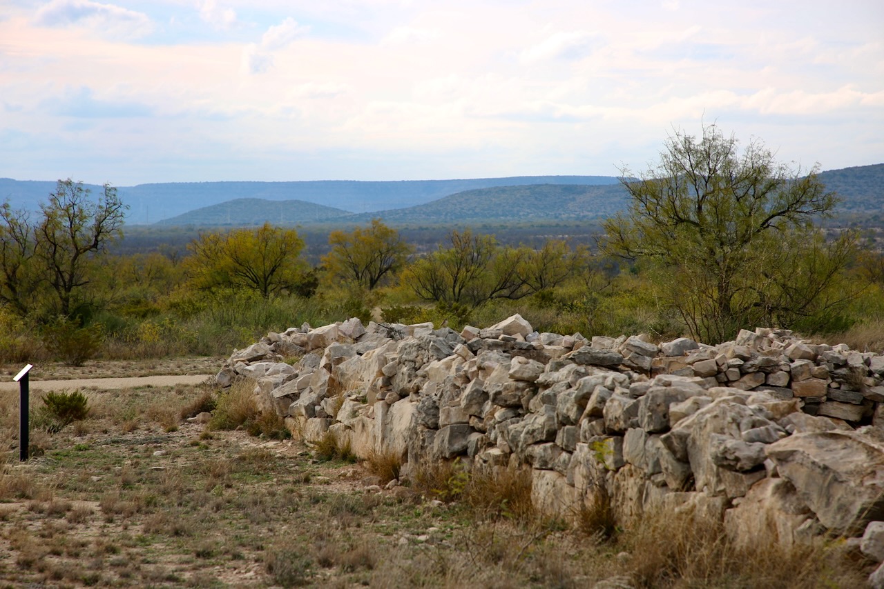
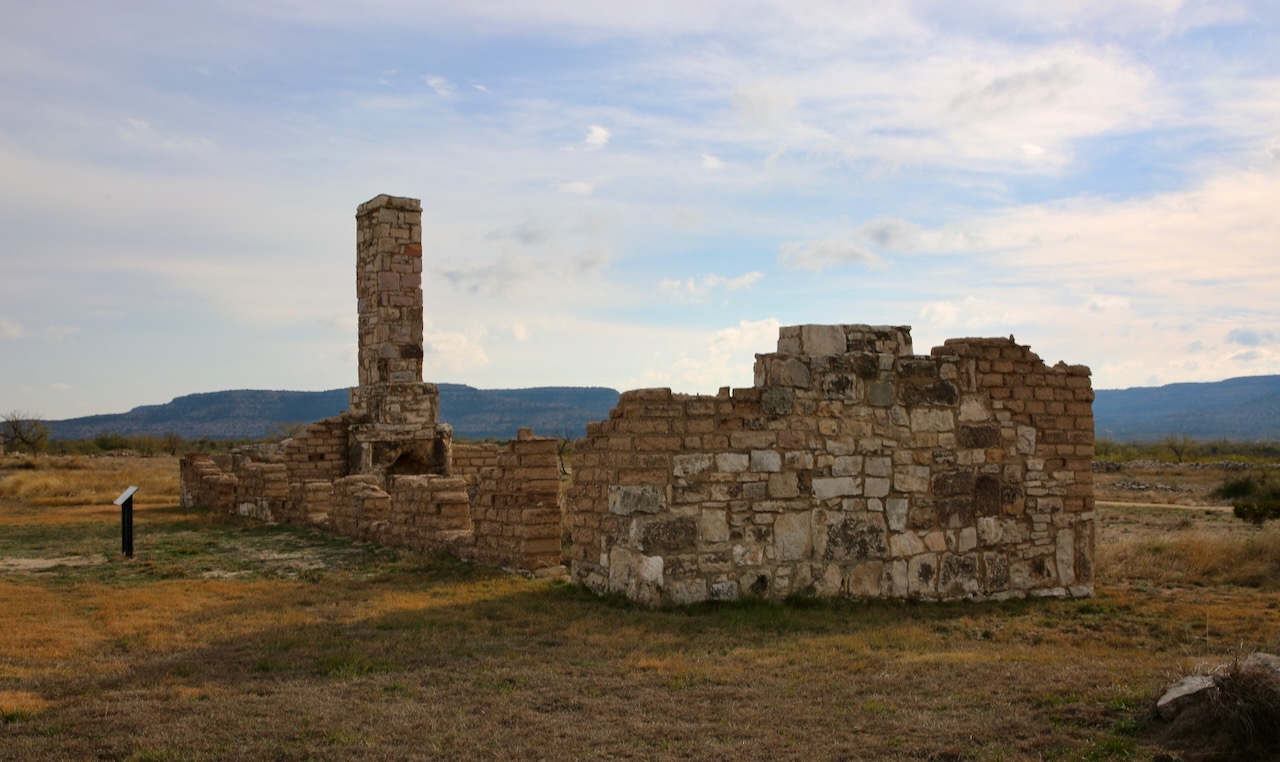
The fort was established in 1855 to protect migrants moving toward California and defended by Buffalo Soldiers (aka African Americans) in 1867, and though they proved their effectiveness, they weren’t yet deemed worthy of integration or equality. The enlisted slept in wedge tents, the officers in wall tents, and picket buildings were reserved for the bakery, carpenter shop, and hospital. The Army experimented with Turnley portable cottages until the more permanent adobe and limestone buildings could take their place and withstand the strong winds in the Pecos River Valley.
The Army was historically unprepared and put soldiers, from the cold northern climates, into the Texas heat in wool uniforms without enough hat to protect their faces. It would take a few years to address the issue, and in the meantime, the men went sans coat. The soldiers found other ways to get in trouble, mostly by being drunk and neglecting their duties which left officers to choose their punishments — solitary confinement with bread and water, forfeit of pay, carrying a knapsack full of rocks, or wearing a barrel coat.
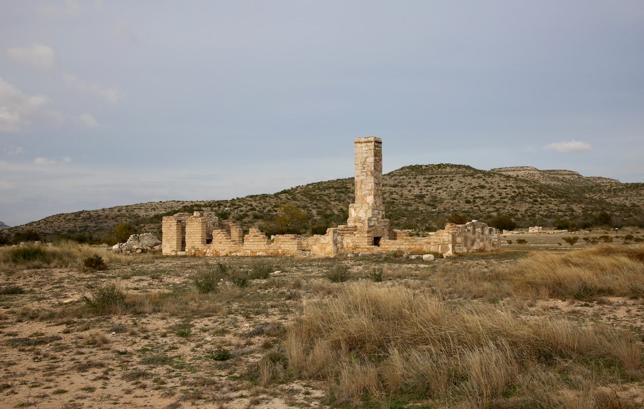
We are offered to rent a golf cart for the 2.5 miles of trail available outside, free to do so but need to sign a waiver. We let the ranger know we did enough sitting to get here and look forward to the lengthy challenge of visiting the 14 stops on the walking guide. Officers lived in the original duplex, the three-bed hospital had a dedicated cook, and the sutler’s store sold liquor, and tobacco, and served as a mail relay. The soldiers would hike six miles for wood to fuel the lime kiln and the kitchens. The barracks housed 30 men. The only women present would’ve been officers’ wives or hired laundresses.

There are other buildings left to ruins and plenty else that took place here, but what I see now are rolling sandy hills covered in wedges and spots of green and some beautiful stones reminiscent of the fireplace in my teenage home, some gathered from this broad region. I notice dancing hoof marks and scattered poos as deer migrate more safely when distanced from the murder pavements of our current transportation infrastructure, though West Virginia has the highest reported roadkill count with Montana in second place, especially between October and December.

We stop in Fort Stockton for flavored coffees – cinnamon roll and pecan peppermint (free from the cashier who doesn’t charge for caffeine) – so we can get to El Paso tonight with our bodies on Eastern Standard Time. It’s here that I notice my ankle is swollen; where my fibula bone is usually more pronounced has been subdued under a layer of red lumps. Time to carry on so that I can drive 85mph in the rain, whistling the car between semis as I pass (not like I did in my 20s, but also not safe and un-rushed) so that we can arrive at 730pm Mountain Time.

