

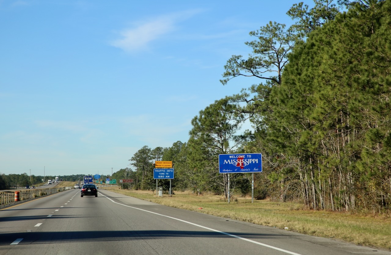
We wake up in Pensacola and I sit down with a mural of the city and the Blue Angels above within view while I chow down on a waffle with four different syrups – strawberry, chocolate, maple, and caramel – because they’re on offer and the waffle is divided into equal quarters. Caleb makes his breakfast into a sandwich, definitely a guy thing, and makes no fuss about ingesting the necessary calories for whatever the day brings. We’re starting later than usual, but it’s a good thing the road will still be there as we arrive. We pass through Alabama in an hour and arrive in Mississippi.

We stop at the Stennis Space Center; the big debate online being that this is a base, not a museum, and they (whoever the online people are) would be correct. The museum is on the other side of the highway and is distinctly called the Infinity Science Center, which is magically always closed when we’re driving by. With our military IDs we thought we’d try our luck visiting another part of NASA; having successfully enjoyed a tour of the Kennedy Space Center and experiencing a G-force of 3. Anywho, we are waved through the gate by security and I feel like I’m in an action movie.
The reason for this, Caleb thought we might have to think of an excuse as to why we were visiting (such that the outside world has since run out of drinks and we are just stopping to rehydrate), but I’m sure as with all bases there are too many employees and contractors for the rotating gate guards to keep track of. Some bases are more strict on their access policies and make it clear with larger guns that give you ample time to turn around (overseas) but America likes to watch you squirm when you realize you’ve made a wrong turn or followed the lights that you thought led to an exit.

If that wasn’t adventurous enough, we passed by some Rocketdyne buildings, learned that this largest rocket engine testing facility in the US is surrounded by a 125,000-acre buffer zone, and wandered to a random tan building with an MB-3 engine on display, plaque and all, with no signs stating not to have a micro-photoshoot, so I went wild. This type hasn’t been used since the 70s and was only made to build better engines. I’m nerding out on the amount of desiccants used on one side as the most I’ve seen in things I buy is two.

We’re on our way back to the car, in a mostly empty lot, so I parked close when a man comes out and invites us in for candy (don’t mind if I do), our names (even my middle one) on a sticky note (couldn’t be fancier), and confirmation (eyeballs wandering) that I deleted all the pictures of the engine because apparently it’s for their eyes only. There’s a process I’m told where I can get an official picture of one, probably all redacted, but I would share that here, especially if they’re going to be so stingy with their out-in-the-open top-secret toys.

We stop inside the gas station on base to have a look around and I’m on the phone talking about the rows of aluminum cans with brown syrup dried to their tops. The representative of those drinks overhears me and appreciates me pointing that out to him so he can correct the issue and offer his customers the best, not the healthiest or necessary by any means, but if you’re going to imbibe sugar then there shouldn’t be someone else’s sweetener sticking up your way. Good thing I wasn’t going to drink that anyway, but I do like seeing the different flavors that cities/states/countries offer their patrons.

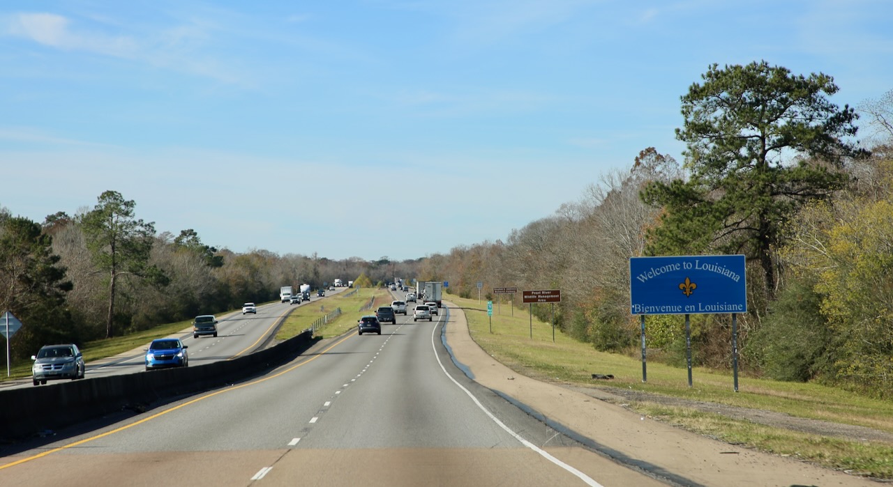
A few minutes later we’re in Louisiana and stopping at the Fontainebleau State Park; one of the many on the Explorin’ LA State Parks mobile pass that offers rewards after checking in to 3, 13, and 19 sites to learn more about the local history. I don’t need the app as an incentive but I do enjoy collecting stamps, stickers, and swag so I will keep this in mind for when I have more time to explore the Cajun culture in the L state. The visitor center is a mix of wood and metal objects on shelves and the floor, a pie safe (a one-sided screened box with shelves that fit in a window), some clay pipe and plate pieces, and some animal parts you can play with, like a turtle-less shell.

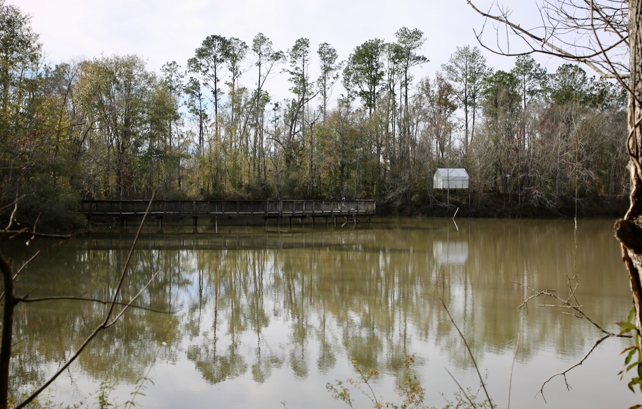
The woman at the fee station was more concerned about discussing her kid’s issues with her co-worker and the woman inside the visitor center was too busy researching a Christmas craft, but both found the time to tell us that the cabins were being rebuilt next year from the hurricane damage caused in 2021 and that the park would get around to repairing the boardwalk slowly after because it doesn’t generate income. Of course, I want to see just how closed the trail is, so after a short inspection of the sugar mill ruins, operated between 1828 and 1852, I approach a single barricade in front of a muted shrubbery background.

Just behind the overgrown path is a boardwalk that seems to have been pushed really hard on the playground and collected all the gravel on one side on its way inland, though I couldn’t help but wonder about the condition of what lay around the corner of the upturned wood attempting to sleep on its side. Caleb and I agreed that a few volunteers could easily clean up the busted boardwalk, possibly repurpose some of it, and clear the way for the professional wood layers to give the campers something else to look forward to as a park activity.
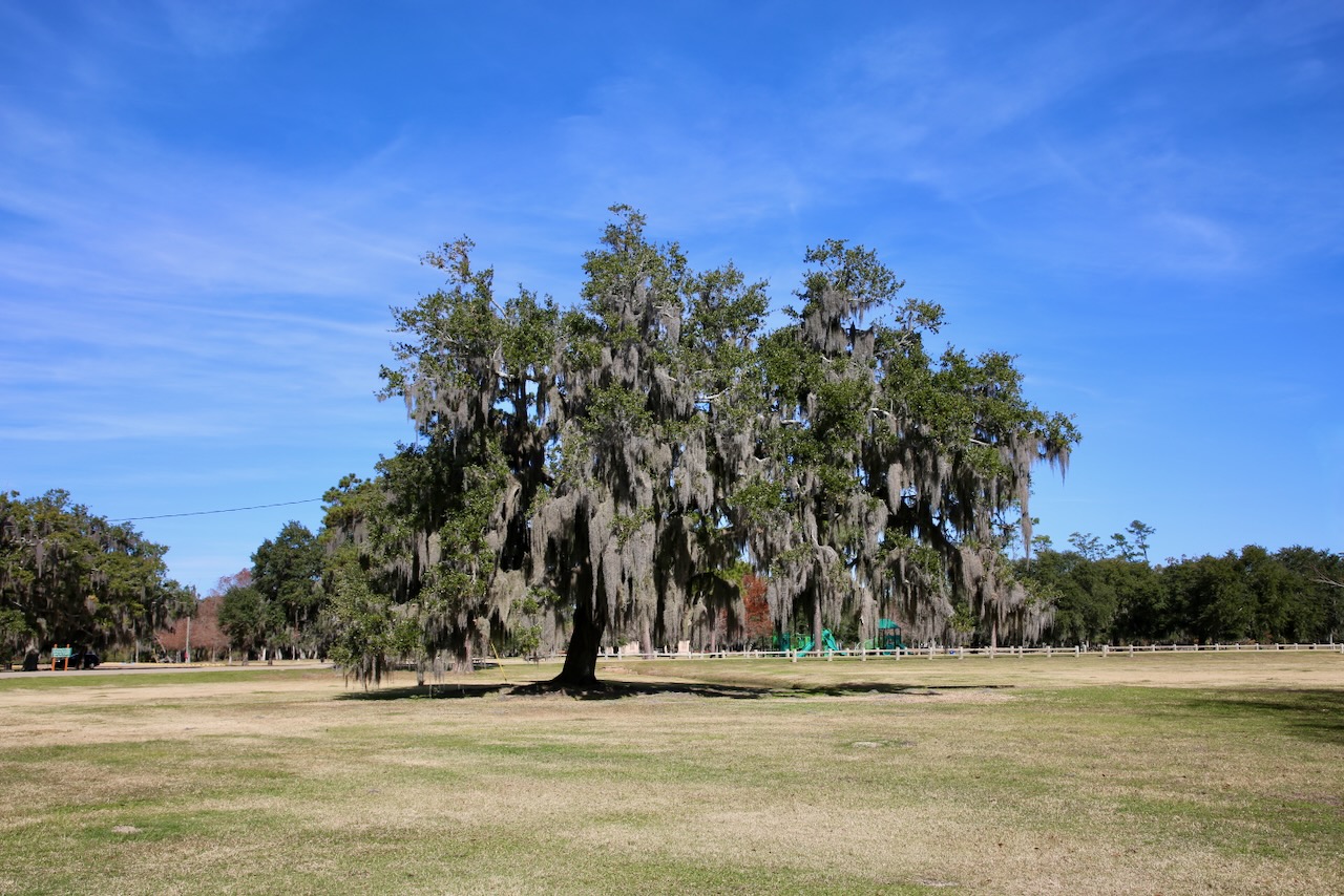
We enjoy a lovely walk under the Spanish moss-covered trees, along the beach, and out to the end of the pier before crossing the field of confetti (evidence of a prior celebration). The land here is beautiful, but the history is covered in blood and reduced to two plaques – one for Native People forced West and the other for The Enslaved forced into hazardous labor. I’m glad these reminders are here, as some statues and natural formations have been destroyed, and hope they help towards educating the future to not repeat the pains of the past; as there are many issues to deal with going forward.

Our drive west seems to be broken up into roughly hour increments. Our next stop will be Tickfaw State Park, which also has three closed boardwalks. This narrows our hiking options down to Cut Thru Trail (between the nature center and picnic shelter, through the playground) and the Pine/Hardwood Trail with a mix of gravel, wooden bridges, and dirt paths. We meet JC at the river’s edge as he waits for one of his many hunting dogs to return, one from a mile away. We encounter one, tired on the trail, and have to backtrack towards the water until the dog hears JC’s voice and stops following us.
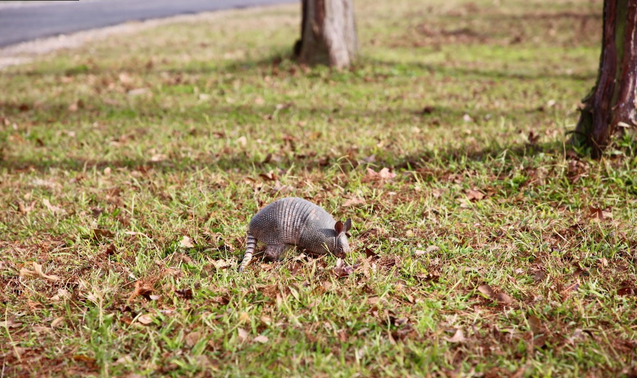
Also highlighted on the map of approved trails is the loop around the fishing pond located behind the RV campgrounds. Here we will see limpkins (a tropical wetland bird that specializes in eating apple snails – large freshwater parasite toters) in the trees, a gator attempting to hide under a one-inch thick branch in the water, and an armadillo rustling in the sun-coated grass of the afternoon. There’s a picture of me, as a preadolescent, after a visit to the local lake holding an armadillo that Mom caught just for that purpose before we let it go. I decided to leave this one in an unterrified state of being handled by a giant, even if just in the time it takes for a photo in the 90s.


We reach Texas just before 6pm and stop in Orange for an exchange of fluids and to make dinner so that I have something to eat while steering between the concrete and semi-trucks that are the Houston area construction zone and changing the radio station along with my driving speed, constantly. Traffic thins and the speed returns to 75mph from 60mph as we’re two miles from our exit for the night. Caleb gets us to the tent sites at Stephen F. Austin State Park, past the family of deer and the rabbit that we scare off from our site at a quarter to nine. We had stopped at 8pm each night on the way east, so I’m more than ready to be done driving for today.

