photo by Caleb
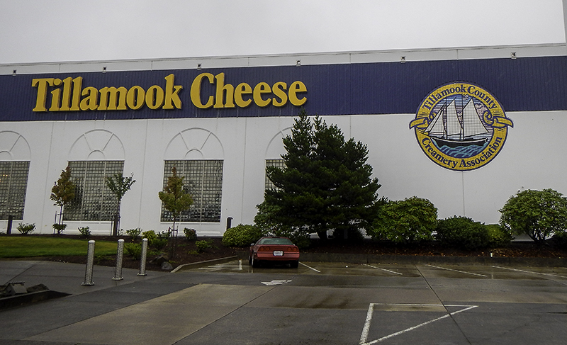
We wake to a morning still covered in rain. The tent may be wet, but we are dry and the day will go on. We pack our things and make our way into town. This time we are determined to wait until the cheese factories, Tillamook and Blue Heron, open at 8:00 am which comes too late for either of us to want to eat more than cheese samples. We are both impressed with the massive amounts of milk and plastic and delivery trucks it takes to deliver this cheese to the States.
We are happy to learn that the creamery has been owned by farmers for over one hundred years and during that time they’ve seen a growth in business, their fair share of court cases, a reduction in production waste, and the phasing out of growth hormones in their milk. Once inside we get to see the cheese and chocolate, and the ice cream and deli counters. I leave with Seattle Chocolates and a bar of Ritter Sport white chocolate with hazelnut – my favorite addiction from Lindt Chocolatier.

drunk on pollen – by Caleb
I recently found a website (roadtrippers.com) that can help me plan stops along a route to see things related to history, nature, scenic routes, and tourist attractions. One of these is the Witch’s Castle which would be our reason for stopping in Portland today. It’s in Forest Park along the Wildwood Trail which just happens to be where lots of things are. We will find the Hoyt Arboretum first and decide to take a walk.
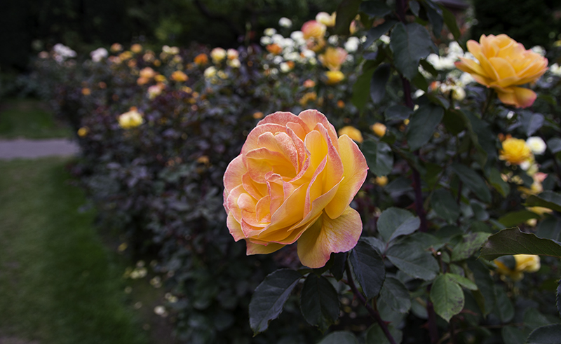
Inside the visitor center we are told to see the Japanese and Rose gardens first – if our time is limited. We go from trail to street and back. There are runners, park employees, and a construction team working on the road. We enjoy the layout of the path leading to the Japanese Gardens only to realize at the top that this one isn’t free. We walk in between the tennis courts and down the stairs to join the roses in looking over the city.

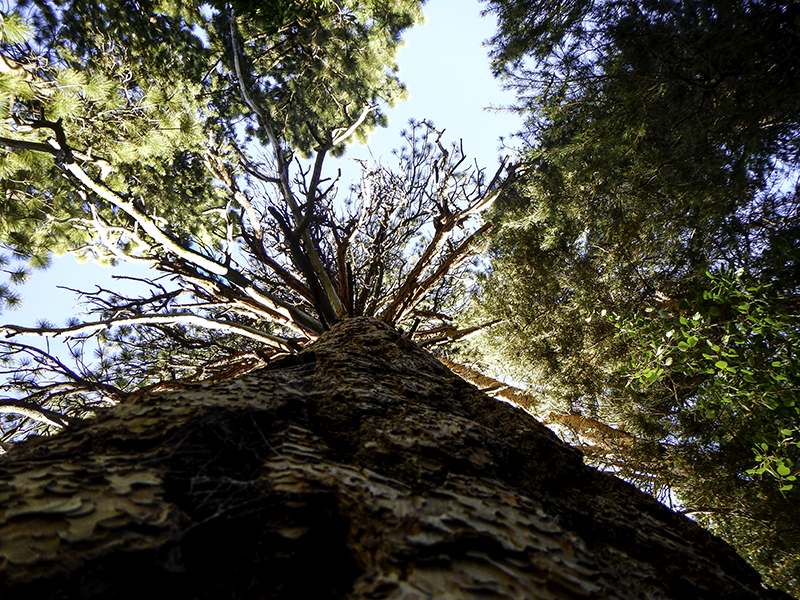
new growth in the Hoyt Arboretum – by Caleb
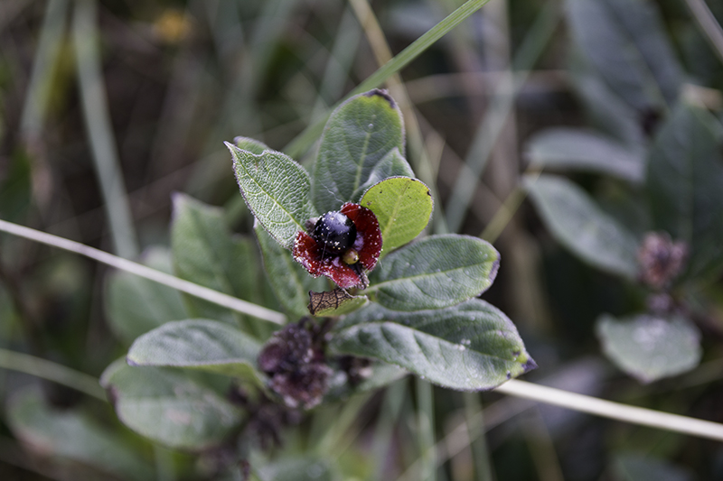
This is a large rose variety test garden where successes are released for commercial production and the others destroyed. The oldest rose was planted in 1943 by Grand Duchess Armstrong, one of thousands in a garden of 4.5 acres. We see every burst of sunset growing on these petals and shades of purple, blue, and bright pink. The only colors I don’t see are brown and green – perhaps too confusing with leaves and dirt. The red rose may be too popular for my liking, but this garden gains a certain reverence with me.
When we return to the parking lot we leash up the dogs and take them on a short loop to get them out of the car. We would like to take them with us more often, but Piggy can’t see and Sparky doesn’t know how to act right around other dogs. Luckily for us it hasn’t been proven yet that dogs can tell time so they have no way of knowing that we got to walk the longer, more beautiful, trail.

in the garden
We drive back into town and then a little further north find ourselves in the parking lot of the Pittock Mansion. The place looks like it cost lots of money and I’m sure the rambunctious kids going on the next tour will be able to appreciate that, but I’m interested in something else. We inquire inside and the man behind the desk tells us we are in for a long walk. I don’t want to walk the 5.5 miles to Witch’s Castle via Wildwood Trail which would take an estimated two hours; we will find the closer parking area.
Back into town and I’m getting hungry. We are driving along a road and soon it becomes an industrial area…or so it seems with all the big buildings and their large tools and storage facilities. I turn down a street that should lead us back into the forest, but it dead-ends into a parking lot. I eat what’s left of a burrito from earlier and when leaving my chosen spot for lunch realize that we were sitting in the corner of a strip club lot – that explains the funny looks.
strawberry-cheese rose
We finally find what we’ve been looking for. It’s down a road that goes through a neighborhood and ends in a cul-de-sac near restrooms and under a bridge. We get the dogs out and a guy carrying booze happily struts past us heading towards the castle. We’ve heard that it’s a party place, but we’re hoping that’s not the scene when we get there. Along the way are a few bridges to make Piggy want to turn back, but I’m glad they all have guidance boards placed at her height to keep her from jumping off mid-crossing.
The castle is as it should be – lonely, covered in moss and graffiti, and made of rock. There is no roof and it seems a railing has been added to keep people from falling off the second floor. A nice two-mile loop complete and on our way out we see the man with the booze standing by the river with his Discman (portable CD player) in hand – a good way to enjoy nature, a good band, and a relaxing bottle of 2:00 pm elixir.
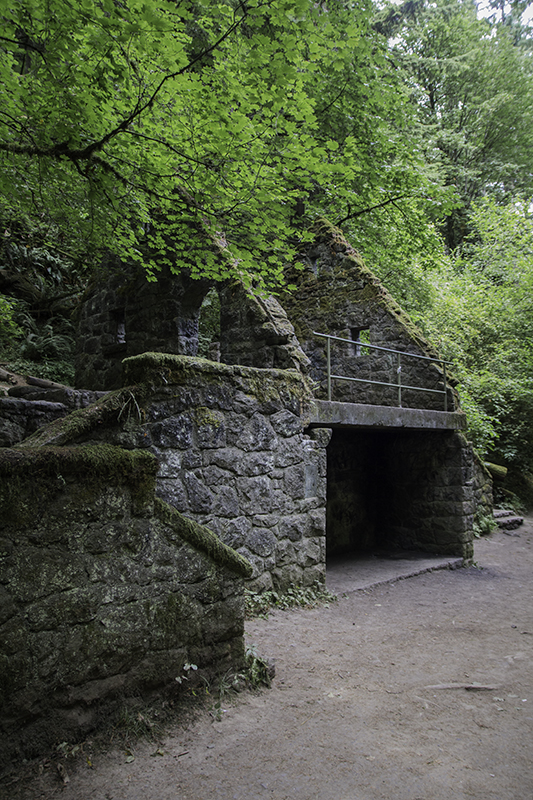
Witch’s Abandoned Castle
Now it’s time to move to the other side of the Columbia River and into another state to visit Fort Vancouver. We began our tour at the Marshall House built in 1886 for the Department Commander, the most famous one being Brigadier General Marshall who received the Nobel Peace Prize in 1953. It’s here that we will hear of the Grant House, the first structure built on Officers Row in 1850, and still open to the public today as a restaurant with live music.
There’s a lot of history in these houses and they served as happy homes for many officers and today they continue to serve as residences and businesses and office space. It’s good to remember the past and to include it in the present, but we have to continue to move into the future so that our great-grandchildren will have something more recent to look back on. The past is so comfortable because it’s what we know, but we have to think about our grandparents and parents who were uncomfortable with the use of cars and cellphones – and then thank them.
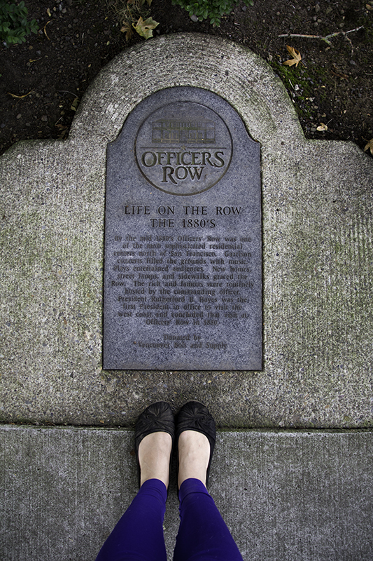
my feet on Officers Row
*President Hayes was the first President in office to visit the west coast and concluded that visit here.
I’ve learned that some elderly people get confused with all this new fancy technology and think that youngsters are trying to trick them, but this is a failure of their own doing. They’ve been trained to get set in their ways as 20 something’s and continue that tradition until their 40’s when their kids move out. Then they stay at a job they don’t like and wait for the grandkids to visit. They need to keep that love of life and learning strong so that they can aspire to enjoy every day with new-found flexibility.
And once a life lesson has been learned…I write it down for future reference…and then walk over to the fort to see what the fence hides inside. There is a large welcoming garden with flowers, herbs, artichokes, and pumpkins. One day Caleb and I would love to pick our dinner from such a fresh variety. On the other side of the wooden wall are a bunch of buildings and a couple remaining foundations. In the first home we learn that people had to sleep at an angle on their bed to fit most of themselves on it.
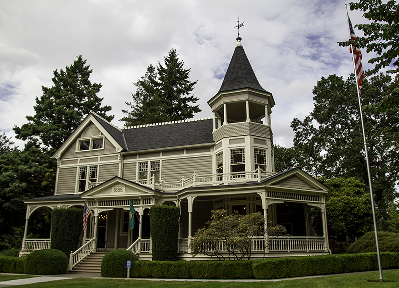
Marshall House
The kids’ beds folded against the wall to give them more play space and out of the nine kids the couple had (or most families of the time period) only four survived past the age of five years old. We learned about the China dishes and that the blue and white idea originated in the Middle East, but China perfected the art on porcelain – and that they still make for fine meeting dishes at the men’s table in the 1800’s.
We see other rooms with fiber, copper, pelts, cotton, porcelain, and rope. There is a display on patent medicines showing different bottles that were found on site and popular ads that would have helped sell these tonics consisting mostly of alcohol, opiates, and oils as ‘cure alls’ to the unsuspecting public. This also gives good reason why there were traveling doctors that made house calls. Once the patient realized their medicine was doing more harm than good, the doctor was already out-of-town. Or that’s just how the movies portray it and the physician was able to blame it on something else.
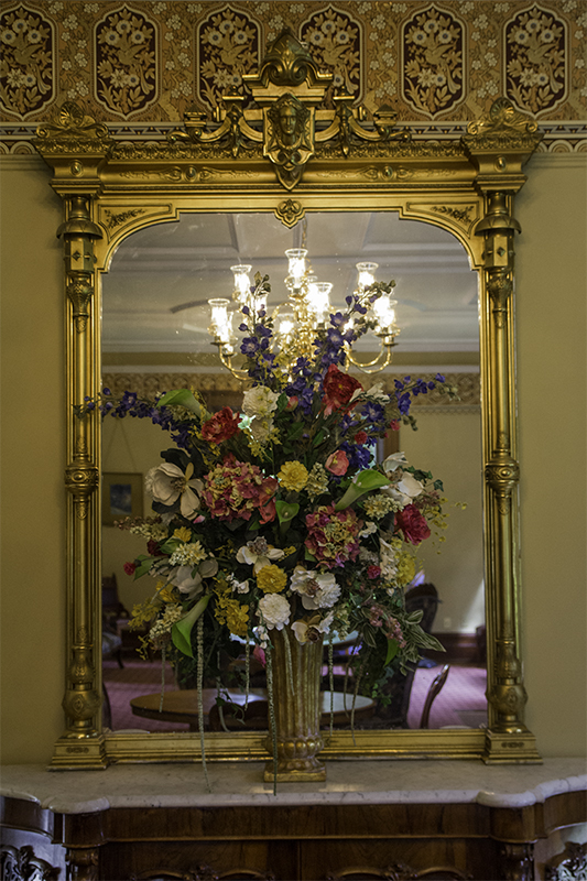
inside the Marshall House
These false claims of healing drinks and powders caused President Theodore Roosevelt to outlaw false claims and require an ingredient list. Thirty two years later and President Franklin Roosevelt will sign an act giving the Food and Drug Administration authority to regulate the safety of medicines. Bayer Aspirin, Vicks VapoRub, and Luden’s Cough Drops survived as over the counter drugs with new formulas, but Coca-Cola and tonic water can now be found in the drink aisle – which doesn’t make soda any healthier for you now.
This is a large park and we know we can’t see it all today. We will drive from the visitor center parking lot, where we walked to the Marshall House, down to the Fort Vancouver lot, and then over to the Pearson Air Museum lot. Inside we are greeted by two volunteers who welcome our questions. Through the canvas door the exhibits look temporary or perhaps still that new.
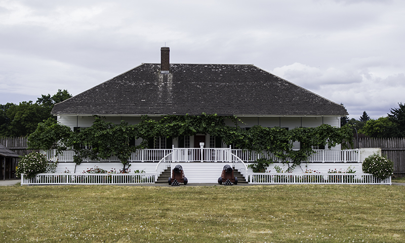
house inside Fort Vancouver
We begin to look around and the man from the front walks in just as I have a question. I was busy reading about the spruce mill that could produce one million board feet of lumber each day when I thought about the Spruce Goose. He sadly informed me that we would have to drive back south 45 miles to McMinnville where it’s located and then goes on to tell us about another model plane they are building to add to the ceiling.
I hadn’t realized till now how many wing variations were tried on airplanes to get the best flight and stopping capabilities. I also hadn’t thought about the importance of the wood and the strength of its grain. I get overwhelmed a lot by the vast amount of information that is available to be learned in this world, but the more I expose myself to the same ideas the easier it gets to comprehend and expand on them.

view from the lookout tower in Fort Vancouver
I may have never been into building planes or flying them, but the people who were changed the world and my ability to travel quickly. I appreciate that and am glad that I can understand more about the environment they lived in (during freedom and war) to inspire them to risk their lives trying out new technology with no websites to help them pick tools, supplies, craftsman, and pilots.
With dinner time approaching we drive over to the Grant House to check out their menu. We are parked close enough to hear Sparky bark at the dog playing in the park. There is a special event happening in the back so they are only serving the bar menu. That’s fine with us as we see plenty of options for me and we choose a spot on the patio. I still want to take a look inside and get to see the catering, the bar, the bathroom, and the other diners.
in the Pearson Air Museum
We order a mango IPA that’s not hoppy and their red beer which isn’t what we were expecting either. To eat, we get the hummus plate and flat bread with tomatoes and balsamic. We make friends with our neighboring table. The man gets up and asks his wife to watch his chips (from what, we don’t know), but as soon as he’s gone she offers one to us and the table beside them and watches as they get eaten.
Historic patio, friendly company, tour group going by on Segway, and live Folk music by Tom May makes for a perfect evening. The main attraction is singing with another man who happened to write a song that caught my attention about traveling and speed limit signs. I wait until the music stops and approach the man about purchasing a CD, not something I do often these days in the world of iTunes, and he tells me to ask their photographer that tells me it will be in 45 minutes when they can man the booth.

dinner at the Grant House – by Caleb
It saddens me to walk away from this knowing I’m missing an opportunity to hear more of this man’s songs, but he doesn’t know that I still have to find a camping spot for the evening at the Millersylvania Campground near Olympia about a hundred miles away. And what we don’t find out until we get there is that most of the spots are reserved as a lot of the locals still appreciate their weekend getaways.
We had driven by the lake in our exploration of the park and seen a woman being trained in the art of rolling her kayak, and face, out of the water. We settled into a spot and then I asked a lady for the walking short cut to the lake to watch the sunset. She is here visiting her daughter and we walk to their site to ask. She is willing to walk me there herself, but I assure her I can find it. I just happen to approach from the large picnic area.

sunset at Deep Lake
The sky is getting dark quick and the lady, though tiring, was still practicing. Here, I meet another traveler who also happens to be visiting his local son. He points to his truck with kayak on top as he explains the things he loves in life. The sunset was pretty though it was on the other side of the trees easily accessed on the other side of the park. Caleb approaches, to inquire about my photos and let me know my bed for the evening is ready, just as the mosquitoes are beginning to find out my blood type.
Caleb was able to find the actual short cut back to camp leaving me less to trip over in the dark as neither of us brought our headlamps. The bathrooms are well-lit, the kids have quieted down, and the camp a few sites down with a table full of booze is being respectful of these late hours too. Today will be our shortest mileage day yet. We are currently averaging 350 miles a day with 26 mpg and gas at about $3.82.