
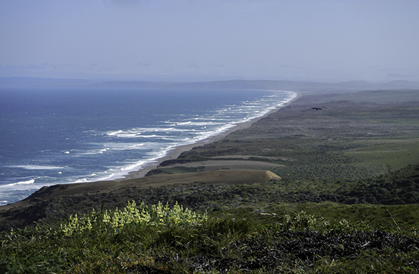
Point Reyes Beach – by Caleb
Fields of green, pools of blue, rocks of gray, cows of brown, clouds of white, and road stripes of yellow – these are the colors we see on our way to Point Reyes National Seashore. On our way to the lighthouse we see a red and black Chevy parked near a moss-covered tree; black and white cows munching on green and brown grass; a deer go limping by a sign warning of dangerous cliffs, waves, and shark infested water; pink and yellow flowers growing on the hills, and white surf washing up on a sandy shore from a bright blue ocean.
We arrive 30 minutes before they open – and we are fine with that. This gives us time to look around at the different colors, shapes, and species that make up the life of this land and sea. The breeze is strong this morning and I try to block some of it from hitting me by standing between the trees, that have grown over the road, and the hill on the other side. We are excited to be in the small information center with an albatross hanging from the ceiling and a section of blue whale teeth on a table.

me and my shadow photographing flowers – by Caleb
Where I almost break down and cry is when the ranger tells us that people, including rangers and scientists, aren’t allowed down the steep ridge when the winds are over 40 mph… “but I drove all the way here.” I was about ready to accept the fact that I was lucky enough to see it once when we were told that we could go down the 308 steps, more if you include the ramped sections, to visit the lighthouse again. We would be two of the lucky ten that day. I thanked the ranger for putting up with me and looking out for my safety.
I looked at the layers of rock, and the gray whale skull, then read the sign about the “strenuous effort… to climb… a 30-story building.” I grabbed the railing as I looked down at the white buildings with red roofs built on the edge of this beautiful, yet dangerous, cape. There is a striped bird looking for breakfast, rocks covered in orange algae basking in the sun, and a banana slug gliding around in the shade. The seas are rough and the wind gusty, but the views are worth it.

The Ken Patrick Visitor Center, on Drakes Beach, is closed when we get there. Dogs aren’t allowed on the beach and we are grateful to not have the distraction when someone points out a whale in the distance. We see some back, some fin, and some blowhole action. It seemed like such a large whale, at least 12 feet, to be so close to shore, within a football field or two. We watch the large cetacean swim north as we witness the tide carving the coastline of Drakes Bay.
On our way out of the park we stop at the Bear Valley Visitor Center. I was hoping to get different stamps in my passport, but they are the same, so I penciled in the name. On our way in I see a gopher and wonder what this place looks like from his point of view – when he’s not face deep in dirt. Inside is a little girl holding an elk antler on her head, with the help of her mom, doubling her height.
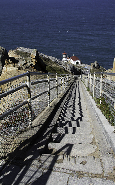
Point Reyes Lighthouse
Along Hwy 1 to Muir Woods National Monument we stop so that Sparky can chew on some oysters; we can see all the harbor seals and cormorants bathing on the sand bar; be worried that we are too close to the baby seal maybe 20 feet away; wonder what the rusted parts in the water used to be; look at the curvy road as it winds between the hills and the sea; and to see the plants, signs, poles, trees, and rocks that live in such a serene setting.
Parking at the 105 year old monument, that was almost named after Congressman Kent, with trees over 500 years old is farther from the entrance this time. Our last visit was us and a few buses. This trip would consist of us going through the two parking lots and leaving the car, with dogs inside, parked along the road in the shade. I suppose we should’ve noticed the sidewalk last time, but we made use of it today. The park is still beautiful, but where there were peaceful animals there are now noisy people.
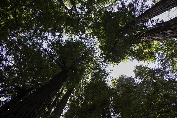
Muir Woods
The trees still loom largely over us and even more so on some parts of the boardwalk. The trail from Fern Creek to Eastwood is closed due to a slide, but where these trees fall they have no problem creating even more life from their branches and partly hollow trunks, and providing more protection in making nestable areas to smaller fauna on the ground. Some people are just fine with walking among these giants; others want to touch them, sit on them, climb in or on them, in an attempt to feel their age and power – if only we treated our elderly with such attention.
Along the boardwalk I see a lady telling her friend to smile so that she can take her picture. I tell the smiler, “more smiling,” and get all three of the friends to smile – now only if I would’ve taken a picture of that. We make it to Fort Baker on the northeast side of the Golden Gate Bridge around 4:00 pm to get some information about the rest of the Golden Gate National Recreation Area. We stop along the way to Fort Barry to see the different angles of the ninth longest single span bridge in the world also painted red-orange to stick out amongst the thick fog that is known to blanket the area.
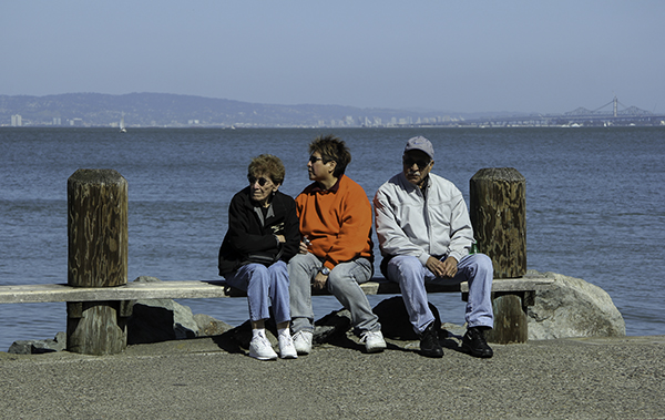
three people on a bench
Fort Barry, or what’s left of it, a battery with a view is where we see the Point Bonita Lighthouse. We try, but the tunnel to get there closes at 3:30 pm, so we enjoy the expansive view of rocks, city, and ocean; and the black sand beach with seals resting on its shore. We will take the other road, the one with the five-minute red light and one-way tunnel, back to Hwy 1. We drive 16 miles north to China Camp State Park where we will pay $35 for site 22.
The camp host is there when we check in and sociable. He lets us know that he closes the gate at night and that he can definitely open it early for us. He works here seasonally. Note to self: become a traveling camp host when Caleb gets out of the navy. There are one or two other tents in the park so we have our pick of the place. After we see the turkeys, rabbits, and other birds we let the dogs run around while we build a fire. I could get used to getting paid to live in a relaxing setting near such a busy city.

