Icy and Late

the road to Crater Lake

the road to Crater Lake

I woke at 6:00 am only to go back to sleep while Caleb broke down the tent, since it was rained on recently we set it up last night to dry out, and took a shower. It was a good decision to get a room for the night because this morning there is ice on the car and the temperature at 7:00 am is 30 degrees. I almost lost an earring this morning, gifted to me by Robert. I was in the shower, in a small bathroom, and it fell in the sink.

There is still snow as tall as us on the ground as we make our way to Crater Lake National Park, and we are surprised by the hood of a car we see sticking out amongst the pile of white flakes that have accumulated through the winter. The evergreen trees, small patches of grass, bright sunshine, and running water give us a false hope that we will see the deepest caldera lake, at 1,949 feet, in the U.S.
orcav

The road through the parking lot is walled with snow. They have done some serious cleaning so that rangers can man the station, but out of the 44 feet that fell there is still ten of it on the ground. Inside we are told we will have better luck at the end of the month. We will make the most of this visit by exploring the few items for sale, the educational displays, and getting pictures of the snow covering the windows – something new for someone raised in the south.

Outside, Caleb will attempt to either climb the wall or throw himself in it. Either way the expressions on his face are worth it – it’s cold. We will stop on Crater Lake Hwy, out of the park, to enjoy more of the snowless terrain. While on our walk we find a Cialis 10mg 3-pack empty, a Hamm’s beer can that has been depleted, and what’s left of a teal Trojan wrapper – all among the gravel and pine needles – romantic, trashy (in the sense that they didn’t pick up after themselves), and partially dangerous due to sharp sticks nearby.
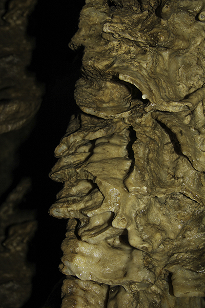
orecav

Time for my second muffin that will conclude my breakfast before we walk around the Mill Creek Falls Scenic Area. And though we may be worried about being washed away if the power dam floods our minds are skipping down memory lane as we realize we are seeing part of the Rogue River – the bypass reach (Avenue of the Boulders). This section is Class 5, expert only. We were guided by Jerry’s Rogue Jets on a 104-mile round-trip ride through six rapids one-way and a stop for lunch from Gold Beach – on the other side of the Rogue River-Siskiyou National Forest.

Cookie and coffee from the café for lunch and gas from the station pumped by Santa’s dad. At the western end of Hwy 46 there is the Illinois Valley Visitor Center that tells you more about the Oregon Caves National Monument with a few things to know before you go: must be at least 42 inches tall to go on a tour with over 500 steps, the temperature inside is 44 degrees, and the 19-mile road to get there should take about 45 minutes.

caveballs

At the information booth/ticket center/gift shop at the eastern end of the road we learn that the marble that is now 4,000 feet above sea level used to be a bacterial reef on the Pacific Ocean floor. We also read that the extra coldness of this cave has help preserve the bones from scavengers, weather, and acidic soil revealing the most northern found jaguar skull and oldest grizzly bear bones in North America, and the best record of a salamander in the West.

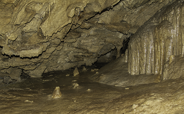
Some animals are only found here, though we won’t see any of them. They are a colorless millipede, a harvestman with extra-large front limbs, and an ice crawler that needs year-round cool temperatures to survive. We sign up for the 2:30 pm cave tour and are joined by our guide Steve and two sisters over 60, one is 72, with their husbands. With such a small group I’m able to get plenty of pictures of the cave that supports the animals and roots, with flowing and dripping water, that call this hole home.
worms

There is not a lack of color in here. And when we get to the signature wall we see one dated to 1897 – only 115 years ago. It would be neat if the caves with such old art, dating over 30,000 years ago and more, were able to sustain the constant damage that light and human presence cause so that I could gaze amongst those marks left so long ago by people living in what could be considered another world – no cars, lights, phones, or sliced bread. We come out the other side of the half-mile passage 90 minutes later.

On the 0.75 mile walk back to the visitor center I learn that the two couples live in Oregon. The younger sister got her hip replaced in Jan. ’09 before her 13-month-in-advance trip for May ’09 to hike the Grand Canyon rim-to-rim. She had broken it while skiing and doubled her rehab so that she may be slow when the trip came, but she would be able. Her sister had one knee replaced 3 months ago and the other one 7 years ago – the effect she says of backpacking for 35-40 years.
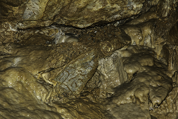
corley

Outside the cave we see green moss, blue birds, and marble rock. Then I spot some morel mushrooms. Had we been on public property we would’ve had those with dinner. Back down the Cliff Nature Trail and we part ways. It’s nice to meet fellow travelers with so much enthusiasm that they won’t let overly used parts, or the age excuse, stand in their way of fun. We linger in front of their waterfall-pond before walking back down to the car.

The campsites are still closed for the season, but the space in front of the gate is more than enough room to park the car and make mac-n-cheese. I fed the dogs, made sure they were full, walked them around some, and then gave them treats – dogs are like kids, and me, never too full for dessert. It will be another 19 miles back to Cave Junction and then 13 miles to the California border where we go through agricultural inspection.

popflo

Eighteen miles from the state line on Hwy 199 is the Darlingtonia Trail. It’s a short 0.2 mile loop, but it takes us to a bog full of the California Pitcher Plants, more like a praying cobra snake than a large beverage-serving dish. They are mostly green and mottled with purple and able to survive in this highly toxic environment along with flowers nearby made of pink, white, and yellow, and poison oak.

Not far from the bog, a mile and a half, is the Panther Flats Campground where we will claim spot 11 for the night. We got here just in time to walk to the river and back as the night got darker. We were able to make dinner and set up the tent in the dark. Two hours later and a car will park across from us. It’s cool to be so close to another group, but have trouble seeing them because the stars don’t drop enough light through the trees, giving the false impression of more distance and solitude.
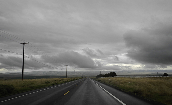
Posted in Animals, Camping, People, Places, Plants, Travel, Water | Tagged , , , , | Leave a comment

Rainy Oregon

the 11 South

the 11 South – by Caleb

We woke at 5:30 am and it had rained all night. It’s a good thing I suggested we put on the rainfly. We pack up, skip the fifty-cent showers since we’re already wet, and drive to a gas station with hot coffee and cold chocolate. The Whitman Mission National Historic Site in Walla Walla doesn’t open until 8:00 am and we are there at 6:45. It’s still raining too much for my camera and my absorbent yellow coat.

It seems like in only five minutes, but it must have been an hour and a half since we left the park, that we are crossing into Oregon via the 11 south. We are greeted with a rainbow, but the dark clouds continue to hang over the fields and mountains. I start to get a bit drowsy from the gray day so I pull over to a closed campsite at an Oregon state park and we walk around for 20 minutes or so before I resume driving on the 395 south that will take us closer to John Day Fossil Beds National Monument.

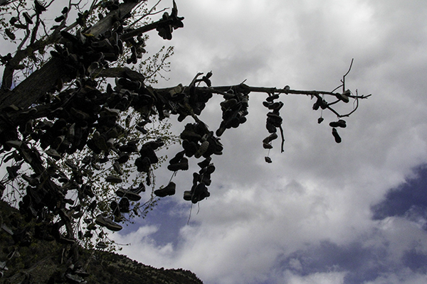
shoe tree on Ochoco Hwy 26

shoe tree on Ochoco Hwy 26

Two more turns and we are learning about basalt floods, clouds of death, ignimbrite layers, rings on a petrified tree, about the age of fruits found in the area, and the relationship of mammals to their ancestors and bacteria. The visitor center has ant pupal cases, a rodent brain cast, chewed up skulls of fanged mouse-deer, and the skeleton of a three-toed horse (Miohippus). We take a walk through the Blue Basin via the Island in Time Trail that follows a mostly dried up river bed with green water.

Along the trail we see beautiful multi-colored mountains with a replica of a tortoise-shell, some history about the nimravids (false saber-toothed cats), and get to watch Piggy cross the many expanded metal mesh bridges. I would carry her once or twice to keep her soft paws off the sharp edges. Also displayed is a letter received in 1995 from parents mailing back rocks that their children, ages 6 & 8, had stolen.

On the outside of the park we will see our third shoe tree. There is a chain of shoes so heavy that the lower branch is now on the ground, along with a pile of sneakers. We meet a couple that is on a trip celebrating their 10th anniversary (our 4th was in March) and they are trying a new route. They visited Tillamook with wine, cheese, salmon, and bread, and ate their lunch in a national forest – how romantic.

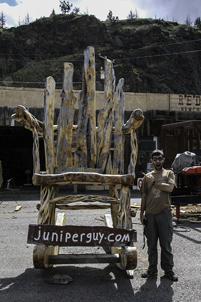
Caleb next to a giant chair

Caleb next to a giant chair

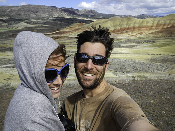
Our next stop will be in the town of Mitchell at the Redwood Bench & Table Co. where we get to see the tables, chairs, and votive candle holders made of juniper trees by Bruce and sold on his website too at juniperguydotcom. We were at the Sheep Rock Unit earlier and are now visiting the Painted Hills Overlook. There are red and golden striped hills with touches of white between and on top. There are layers of the Clarno formations and Picture Gorge Basalts where Thomas Condon, pioneer minister and amateur scientist, found fossilized leaves in 1865 that would entice him to make many return visits.

It’s more than breezy outside, but that doesn’t keep us from learning more about the forest that lived here 30 million years ago that has been replaced with near-desert today and the adaptations that plants and animals had to make to survive. We read about the oxidized iron, and a mix of oxidized magnesium, metamorphic claystone, and the black marks in the rock that are rich in manganese. Once in Prineville, I notice that we have 11,620 miles on the car. We bought it in mid-February with 49,280 yards on it and we are 1,593 kilometers from home.

us in the Painted Hills

us in the Painted Hills

A lot of the gas station attendants aren’t fond of getting their photo taken, so we get one guy to put the pump in our tank and another to take it out – or it’s just the way the rotation works. Either way I would like to get a good picture one day. I think it’s a great way to increase the workforce, especially when they wash your windshield too. From here we will drive to Redmond for dinner.

We choose the parking lot of Firemans Lake City Park as the place to set up our camp stove. We are joined by Mallard ducks, Canadian geese, Brewer’s blackbirds, yellow-headed blackbirds (the bravest), large gray geese, a manky (British term for impure) mallard, some brown finches, and a marmot in the distance that has a close relationship with the shade provided between a tree and a port-o-potty.

We will look for camping in the Willamette and Deschutes National Forests and when we can’t find one we drive on. We might have just set up somewhere but it began to rain, so we drove south of Chemult and get room 8 at the Budget Inn for $43. This will place us under 70 miles from the south entrance, since the north highway and Rim Road are closed during winter, to Crater Lake which is our destination in the morning.

Posted in Animals, History, People, Photography, Places, Plants, Things, Travel, Water | Tagged , , , , | Leave a comment

Leaving Missoula

Jake, Sammi, Caleb, Robert, Jessi, and Lyra in front of Stone of Accord

Jake, Sammi, Caleb, Robert, Jessi, and Lyra in front of Stone of Accord

We had planned on an early start, and when the dogs woke me at 7:00 am Caleb took them out, but we wouldn’t get out of bed until 8:30 when we hear Sammi say, “hello”. We will go to Robert’s to take our showers to help move the morning self-cleaning schedule along and this will give Caleb some father-son time that him and his dad need. We take him with us to meet the rest of the family at Stone of Accord for their brunch menu offered from 9a-2p.

We, adults, order coffee and Sammi takes it upon herself to help us with the creamer, so Jessi will order her a tiny cup of cream for herself (because that’s what Puss in Boots would drink). I ordered an omelet and Caleb something else veggie, but somehow   his omelet got dropped in the kitchen so when his plate arrived I got excited and started eating. I helped him with his potatoes, eggs, cheese, spinach, and artichoke hearts, and he got half of my omelet in return – I love sharing.

We drop Robert back off at home and he gives us a bag of homemade cherry-oatmeal cookies for the road. Back at Jessi’s, to pick up the dogs, and she will give us a goody bag with pineapple rings, spiced nuts, fig bars, etc. and refill our water bottles and jugs. We fill the car up with gas before making our way into Idaho. We will stop frequently in the Selway-Bitterroot Wilderness, the third largest in the lower 48, to see ferns, mosses, trillium flowers, a birdhouse, fields, tall trees, a ground nest, and a suspension bridge.

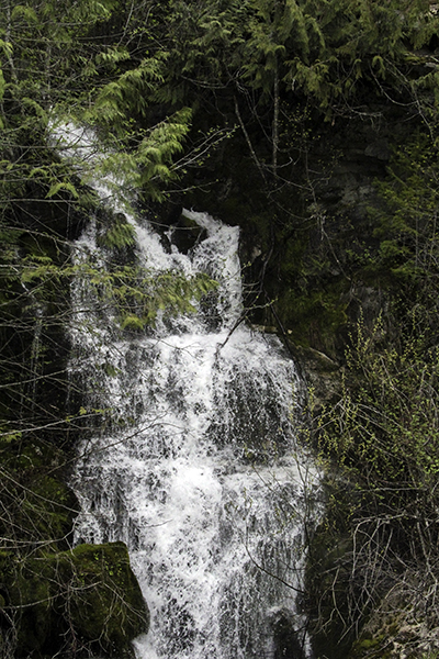
waterfall in Idaho

waterfall in Idaho

Also while on Hwy 12, that runs along the Lochsa River, Piggy gets muddy feet, Sparky runs as wild as the rapids, we see a vulture with a six-foot wingspan take off from lunch, a man traveling down stream on a catamaran raft, and some waterfalls – while I eat chocolate-covered raspberries. We get to the Nez Perce National Historical Park Visitor Center at 5:30 pm, when we think it will be last-minute, but they closed an hour ago.

We stop at a gas station or two looking for a coffee thermos and come across Stinker Stores which remind us of Jessi and Lyra. Jessi will ask, “Who’s a stinker?” and Lyra will slowly point at herself – so cute, but no luck, so we head to Clearwater Park in Lewiston to cook dinner. As we set up, nine-year old Robert in 4th grade that plays baseball and who is visiting his grandma because he lives in Moscow (Idaho not Russia) keeps us company.

I let him taste our alfredo sauce. He asks about the dogs and thinks that Sparky, with his spots, would be more fitting of the name Piggy. He tells us that he doesn’t understand taxes, about how much he likes baseball, and that he has a little brother. I wish we could eat meals with strangers more often; I enjoyed the conversation. As we pack up Robert will ride his scooter home.

We will stop at the Lewis and Clark Trail State Park in Washington for the night. We were going to use the primitive area, for hikers and bikers, but the ground was too lumpy. We picked the second site on the left after the bathroom. After we set up the tent, I climbed in and went to sleep at 9:00 pm – a little more tired than usual after a 300 mile driving day. Caleb will burn some wood to set the ambience and then join me.

Posted in Animals, Camping, Family, Food, Media, People, Photography, Places, Plants, Travel, Water | Tagged , , , , | Leave a comment

Welcome to Missoula

Jake and Lyra hiking to the "M"

Jake and Lyra hiking to the “M”

The girls had just gotten put to bed from the screaming fit they were having prior to our arrival. We are welcomed in, and our little dogs too. We talk until 12:30 am and when Lyra wakes, Jessi goes to put her back to sleep and we do the same. We get a mattress and blanket on the floor. Piggy starts on the couch with her own blanket and Sparky beside her using the couch arm and a pillow.

I get woken before 6:30 am to crying, prancing dogs. I go to the bathroom first, then go to let them out the back door, only to see a big kitty face staring through the locked animal door. I let the dogs out the front and then put them in the bathroom while I let Tibu in his house for a moment. Piggy is warm on the couch; Caleb is putting the bed away while I eat Hawaiian bread, and Sparky is keeping watch out the window.

view of University Hall to Blue Mountain from the "M"

view of University Hall to Blue Mountain from the “M”

The dogs are hungry and I feed them at 7:15 am. I’m hungry too, but breakfast won’t be until 8:30 am, so that we can let the girls sleep and Caleb can go pick up Robert to have waffles with us. Sammi wanted cereal so Jessi gave her an ounce or two and then Sammi changed her mind. She had to go to her room for screaming, even after I offered to eat the cereal for her, but we all enjoyed a noisy homemade breakfast.

We decided to hike to the “M” on Mount Sentinel and Robert chooses to stay behind. We don our coats and smiles and take frequent breaks to wait for the short-legged hikers to catch up – they are full of energy. Jessi has fun walking Piggy up and then we all make our way to the M where it becomes a bit steep – good thing I had on grippy shoes as I help Sammi down. Lyra will make it halfway down before she becomes hungry and tired.

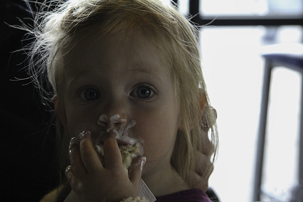
Lyra napping

Lyra napping

Jessi will carry her in a baby front bag and we all have a good laugh and take some pictures of Lyra sleeping with snack, appears to be puffed rice, hanging out of her mouth. Back at the cars Sammi asks if I can drive her parents new Nissan Murano – they agree, and I drive it back to the house to pick up the father-in-law, and then to lunch at the Staggering Ox – famous for their cylindrical bread loaves and bread guts.

We choose a table outside and quickly put our jackets back on – we had warmed up from the hike. Sammi entertains us by dipping her Doritos into her mason jar full of water. When our food arrives we decide to move inside so we can be warmer while we eat. Sammi will now take some of the turkey from her sandwich and dip that in the water too. Not to be outdone Lyra starts by dipping the same piece of bread gut in ranch sauce and eating the condiment from the carb and re-dipping.

Sammi eating lunch

Sammi eating lunch

She does manage to eat some of the bread in the process, but also paints her hand and face with the tasty dressing. Minutes go by before Lyra realizes she can just drink the ranch directly from the serving cup and we all laugh as she gets some on her forehead – and here I am simply enjoying some veggie sandwich the simple way. With the kids done eating the parents can finish too and we go back to the house so Sammi can take a nap.

While she sleeps, Jessi and I will go to Garden City to pick up a new reel mower so that Jake can cut the grass when we get home while Robert wears a plant bowl on his head – this is how we garden.   Then Jessi will take her brother and dad grocery shopping for dinner. We will have leek and potato pie with corn and beans, and kale chips. I have a soda to wash it down, and brownies and an Oreo for dessert.

Lyra eating ranch dressing

Lyra eating ranch dressing

Before the eating, and during the cooking we don’t have to do, Caleb and I will ride bikes to the Pattee Creek Market to buy more dog food and some treats for them being so good with the girls. Our dogs don’t do so well with the slap-petting of small children or being mostly blind and chased around – it scares them. I was on Jessi’s bike, and with Caleb having trouble keeping up with me, we realized I need a new ride of my own.

Caleb takes Robert home at 11:30 pm and it will be another late night. Sammi picks Caleb to be the reader of tonight’s bedtime stories. Sammi is allowed to choose three books – this explains why she talks so well. She jumps on her bed for the last one. I thought kids were supposed to wind down, but it’s good to see her listening and so involved in the story. Her parents also help identify things on the page – shape, color, animal, etc. and ask questions about the story – education and imagination – sweet dreams.

Posted in Books, Family, Food, Hiking, People, Photography | Tagged , , , | Leave a comment

Hot and Wet in Idaho

fossilization map

fossilization map

The alarm goes off at 5:30 am. Fifteen minutes later I’m standing in a burning hot-only shower waiting for Caleb to get back with the keys to room 7. I tried splashing water on me using the dog bowl as a coolant, but it soon felt like it was going to melt in my hand. I ran next door covered in two towels and was done in seconds. The room was a lot cleaner – except for the mold growing in the window.

Back at the office we learn that the place is being remodeled and we got put into an old room when there was vacancy in a newer one – thanks. Lampliter Motel in Burley, Idaho gets the worst review ever and the dirtiest crack motel award. I make a note to check our credit card statement when we get home to make sure we weren’t charged more than once for what we deemed the scroungiest room we’ve stayed in.

Hagerman Fossil Beds

Hagerman Fossil Beds – by Caleb

We are 40 minutes from our first internment camp – Minidoka National Historic Site – where Japanese Americans were sent during World War II because their loyalty was questioned. The 97% that answered yes to joining the armed forces and swearing allegiance to the U.S. were offered jobs in East Coast companies experiencing war-time labor shortages, or they joined the war in Hawaii, France, Italy, and Asia.

An ornamental garden was built by internees to express strength and patriotism versus the symbol of the gate that stood for confinement and injustice. The rocks in the garden were quarried from miles away and some plants were donated by local communities. The 3% that answered no to questions 27 and 28 on the questionnaire were branded disloyal and were moved to the Tule Lake Segregation Center in California.

A few of the structures are still standing today and it’s hard to imagine the suffrage of these people in a beautiful landscape, but it differed greatly from the Pacific Northwest that they called home. A soothing factor was the North Side Canal that offered flowing water to listen and watch, and a place to fish. The clouds seem darker over this park. As we drive a seventh of the way across the bottom of Idaho to Hagerman Fossil Beds National Monument the sky lightens up.

stone head in Idaho

stone head in Idaho

They claim inside to have found 4 amphibians, 9 reptiles, 18 fish, 27 birds, and 50 mammals, along with a variety of plant life. I like seeing the different bone structures between a snake and horse body and the size of a mastodon head. Outside is windy, but I endure it to learn more about the three ancient lakes and the Snake River that helped develop this area in land formation and fossilization 3-5 million years ago. Even now the river supplies life to birds in the winter with a constant flow of 58 degree water from the Thousand Springs area.

We get to drive over a one-lane bridge and stop to go in the caged-in walkway that takes visitors over the Snake River. It would’ve been nice had the fence had a larger viewing hole so that I could’ve taken more pictures without wire in the way. We were the only car in the parking lot upon our arrival to Craters of the Moon National Monument and Preserve. Many a wagon got broken trying this same route in the 1900s when emigrants were moving west.

Craters of the Moon - by Caleb

Craters of the Moon – by Caleb

In the visitor center the ozone monitoring system tells us it’s 35 degrees Fahrenheit outside with winds blowing at 13 mph. This is good news. We don’t have to worry about the dogs overheating in the car and this will give us plenty of time to explore some caves – the ones where helmets aren’t recommended. I like the first trail sign we see. It tells us the grade, cross slope, tread width, and trail surface material along with regulations and length as usual.

The park may seem rough and desolate from a distance, but the cracks, craters, and caves provide a place for plants to grow and animals to live. Lava flows rapidly, but forms in so many ways depending on the air, trees, rocks, or water that it encounters during the cooling process. This leaves us with mounds, spirals, and waves of igneous rock to explore. We see some chipmunks on Devil’s Orchard Nature Trail and then it begins to snow. This cold white stuff that drops from the sky might deter some people, but I find it romantic.

From the top of Inferno Cone, at 6,181 feet, we get a great panorama of the park and the feel of cinder underfoot and wind in our face – making happy memories. The Spatter Cones Trail, one of the shortest ever, leads us 274 feet up an 11% grade to look at magma that has exploded from a vent like taffy and folded back on itself. The snow is falling harder by the time we reach the Caves Trail – one that leads to four developed caves for recreational spelunking.

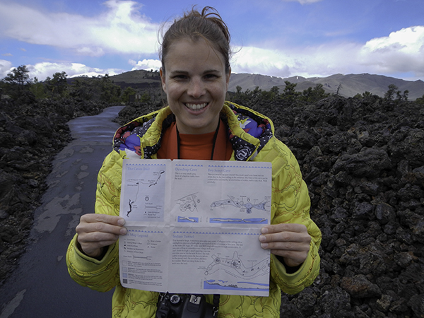
me holding map of caves

me holding map of caves – by Caleb

We are coming out of Dewdrop Cave when a couple walks by. The man says, “Look! Cave dwellers! That wasn’t on the program.” Caleb replied that we were a new exhibit. The man asked if we could see after such a long time in the dark depths of the cave. I told him that we were following his voice. Some persistence pays off and by the time we are doing caving, the snow is done falling.

Back at the visitor center as I’m waiting for Caleb a man asks if I’m airborne – referring to the t-shirt I’m wearing that I got from my mom. Then he notices my Merrill hiking boots. I tell him he can get them at REI or Dicks and warm them, in their comfy car attire, about the tight, wet caves. The wife is determined to change out of her flip-flops. They didn’t come too prepared, but thought it would be an interesting stop – they were right.

On the way to Arco Caleb plays me a voicemail from my dad letting me know that my parents are worried about my lack of updating them about our travels. I call my mom and let her know where I am. She tells me about her recent bicycle ride. I call my dad and he offers me a GoPro Hero, tells me to put an emergency contact number in my wallet, and lets me know Adobe CS6 will be out in May. He’s excited about our trip and mentions two places that we missed by under ten miles.

road sign in Montana

road sign in Montana

In Arco there are lots of years painted on the Lost River Range Mountains – a local school tradition that started in 1920. From here we will head to Big Hole National Battlefield. The 230 miles are strewn with curvy roads, fluffy animals, rushing water, and high mountains. We take our time traversing this beautiful scenery. We expect the park to be closed, arriving after 6:00 pm and two hours before dusk, but this spot is one of many included in the history of the people who this park preserves.

With no maps available until 10:00 am tomorrow we decide to drive to Missoula, Montana where we will visit with Caleb’s sister, Jessi, and her family. We were going to drive to his dad’s, but he’s not allowed to have dogs in his apartment. We starting hitting small towns 60 miles away and the speed limit is 65 at night. I notice the 45 sign, and then the 25. I’m doing 28 when I see police lights in front of me. I had missed the 35 mph zone.

The cop takes my license to write my information down for a speed warning and gives me a heads up that most small towns here make you slam on your brakes. Then he tells me that our license plate isn’t visible enough, but that it’s ok since we’re just visiting. Well, we will be getting Montana plates soon, so he lets us know that there are magnets available to attach to our bikes. As soon as I pull back into the lane I see a 35 mph sign. This is the second time I’ve gotten pulled over heading towards Robert’s. We get to Jessi’s after 10:00 pm and the girls are already in bed, so it makes it easy to chat for a while, set up the air mattress in the living room, and then go to sleep.

Posted in Animals, Events, Family, Government, History, People, Photography, Places, Plants, Things, Travel, Water | Tagged , , , , | Leave a comment