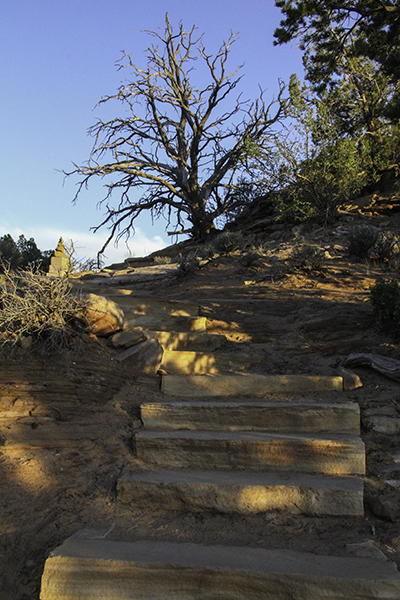
tree on Harpers Corner Trail
Up at 5:00 am to high winds and a sky that is on fire. It seems we may be the only people in the park today – or ones that like to get to places before they open. It will take us at least an hour to get to the entrance of the park some 16 miles away. I slam on the brakes when I see the first elk cross the road. He looked both ways and made sure it was safe for the three ladies following him – very polite animals. We will see about 80-100 more.
Then I see what appears to be a fox with a jacket on, but the fox’s coat is just that bright orange naturally with a smoky gray tail about as long and as thick as its body. It looks to be carrying a gray ball of breakfast or offspring. We decide to drive to the end of the road and work our way out. Our first hike will be Harpers Corner Trail, two miles round-trip, in and out. We will see the Green and Yampa Rivers and Echo Park that is 2,500 feet below.

dinosaur on display outside of the Quarry Visitor Center – by Caleb
I love the twisted trees and purple flowers. The rivers look like snakes being electrocuted as they wind their way through the hills. It’s enough of a climb to raise my body temperature and I unzip my coat. It’s not as windy here, but a bit overcast. Halfway back we pass another couple and I contemplate their arrival. We were doing 30 mph or less in a 45 zone and were more than alone yesterday. They are in a Camaro from Nevada. Where did they sleep? How fast were they driving?
I will have two donuts for breakfast and skip the coffee that I ruined by adding too much raspberry syrup. Our next hike is a short one, for us, since we won’t hike the eight mile length. I put a jacket on as the day warms up. We go far enough to find some gopher trails among purple and yellow flowers. Then to finish our visit on this side of the park, in Colorado before driving to Utah, we walk the Plug Hat Trail on top of a butte.
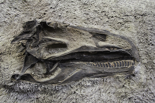
149 million old dinosaur skull
Ten o’clock finds us at the Fossil Bone Quarry with 30 minutes to explore the museum in the visitor center before the next tour. It explains how the bones were found and how some of them were shipped to other museums worldwide before it was decided to leave the rest in the mountain. We follow a pilot truck to a large enclosure where they have a wall of bones locked away to help preserve them. We are allowed to stare and ask questions for an hour before returning to the visitor center to swear me in for my paleontologist badge.
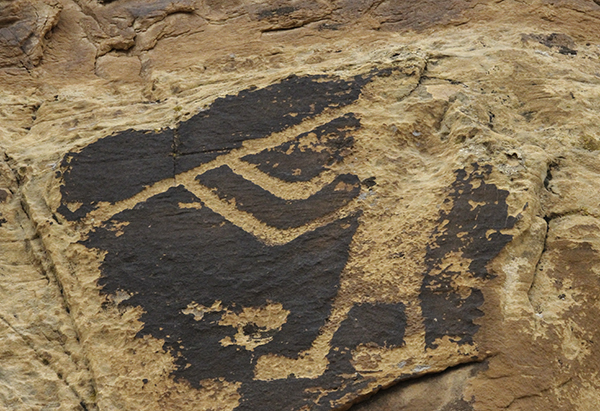
We explore the Sound of Silence Trail and then drive around the Green River campsite where it looks like the mountains have fallen over and are slowly sinking into the water – I’m sure that’s how a scientist could describe it in layman’s terms. Down near the river we get to see a water snake and a two-toned lizard. We will drive through a private ranch before reentering the park to see rocks covered in petroglyphs – new shapes we haven’t seen before and some in large sizes.
At the end of Cub Creek Road is Josie Morris’ cabin where she lived and ranched independently until she died at age 89, living in the cabin for fifty years during her many marriages, the first being when she was still a teenager. It would be a different husband though that would help establish a homestead 40 miles from the family ranch. Josie was a bit of an outlaw – accused of stealing cattle and making wine during prohibition.
We drive through the Ashley National Forest and by the Flaming Gorge Reservoir into Wyoming. We stop in Green River at Cubby’s Pizza for dinner. $10 will get us a 12-inch with pineapple, jalapenos, and tomatoes. It has been a long, cloudy day and we have a stack of pizza boxes in the back. We saw six antelope, one prairie dog, and 64 train cars. We are setting up camp across the street from the Historic Quarry Trail of Fossil Butte National Monument because the next lodging is 15 miles away and I’m tired at 9:00 pm.
Piggy was ready to jump in the tent from the back. It’s 54 degrees out. Once she was let in through the front by Caleb she was disappointed to find a lack of sleeping material because it hadn’t been set up yet. We have covered 3, 364 miles so far on this trip.. We detoured around Yosemite because of the snow, but didn’t let the bit we saw in the hills today slow us down as we are again headed north.