

It’s around 2am when I awake in Texas Springs Campground, in the middle of quiet hours, in a dark sky park. I’m grateful I acquainted myself with the location of the toilet earlier so I can stumble there quietly, and though I’m able to cover my eyes from a passing headlamp, I’m blinded by the headlights of a car that wants to be first to wherever they’re going so early. Since I’m up, I might as well take in the view again, so I grab my camera from the unlocked car…

I will try to use the metal table as a tripod, but the camera throws an error message that no change in settings will correct, so I pull out my phone to capture a glimpse into a portion of the amazing. It has been too long since I have seen so much sky and I’m just flabbergasted that people would prefer their artificial lights in solitude rather than around the fire and then under the stars of a night spent with family and friends, or heck, even strangers can be preferable.
As excited as I am thinking about my imaginary tribe in a vast field somewhere, with a forest nearby, as we watch the Earth spin I know I need to return to the confines of my tent or I’ll be tired in a few hours when the rest of the camp begins to stir. I settle back in around 3am and am enjoying the immense quiet, that even with crickets and frogs causing a commotion (not here), only nature can provide when not overwhelmed with the technology of civilization. Meanwhile, Caleb breathes next to me like his life depends on it.

I’m woken before 530am by the illegal wood collectors, who slept in the site next to ours, shaking their tent, scraping the table, slamming their doors, and stomping their dishes. This also wakes the story-telling gentleman and his friend, who not wanting to get out of his tent last night for a piss spilled the collected bottle over his pants, so he will be wearing shorts today and hoping for the high of 77*F to be reached soon. We talked a bit more and he recommends Dante’s View, as they went yesterday and say it’s worth the detour.
We are here to see Lake Manly and at sunrise are ready to make the 17.8 miles drive to Badwater Basin. Seeing the mountains reflected in the water upon approach was mesmerizing and we were thrilled to be able to see more of this special occasion. What we hadn’t realized was that all that early morning traffic was cars getting here in the dark so that they could be scattered all over the wet areas that the park sign clearly said to avoid with their tripods, galoshes, and flowing gowns causing damage that can take years to disappear. We took some photos and I told a couple to avoid crunching through more yet untrampled terrain.
This felt like the equivalent of us all taking a stalactite as a trinket and was frustratingly disappointing as we thought about what would be destroyed underneath. I understand the want to be the one who made it to this rare sight and got the best selfie, and perhaps when the water dries it will evaporate any evidence of their presence, as a ranger confirms that people are free to go in the water, just not any of the wet crunchy land that surrounds it. Sadly, there was no one there to enforce this policy as cars continued to arrive.

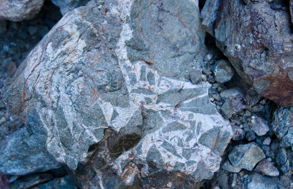
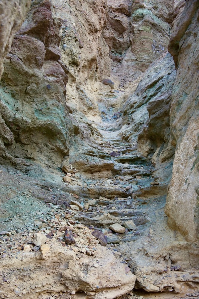
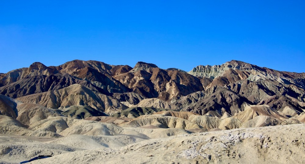
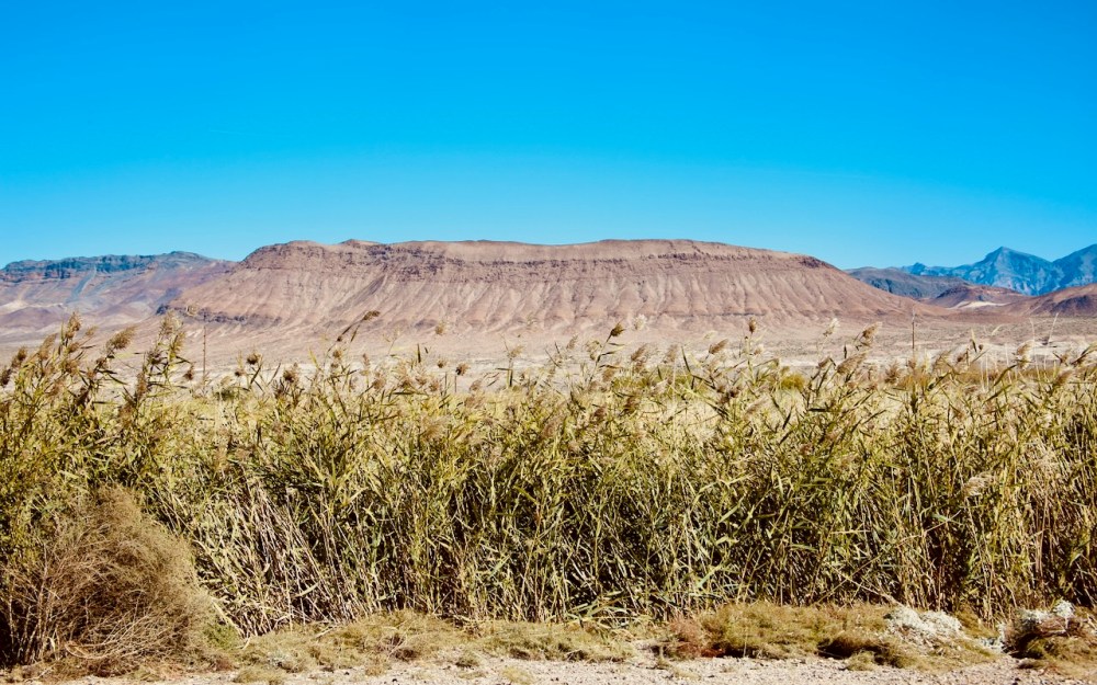
There’s a sign above us that says Sea Level and a path that disappears into the canyon, so we try our luck there only to find that it’s not far before we would need mountain climbing gear to get over the straight face of rock staring down at us. We’ll stop at Golden Canyon on our way back to the main road and hike towards Red Cathedral as a man had tried going towards Gower Gulch but was having trouble finding the path. I was more looking forward to the high rocks surrounding me and was surprised to find parts of an old paved road running through the canyon. We’ll have to return for the Zabriskie Point Loop, a 6.5-mile tour on foot of some beautiful desert, especially when the sun lights it up in winter.

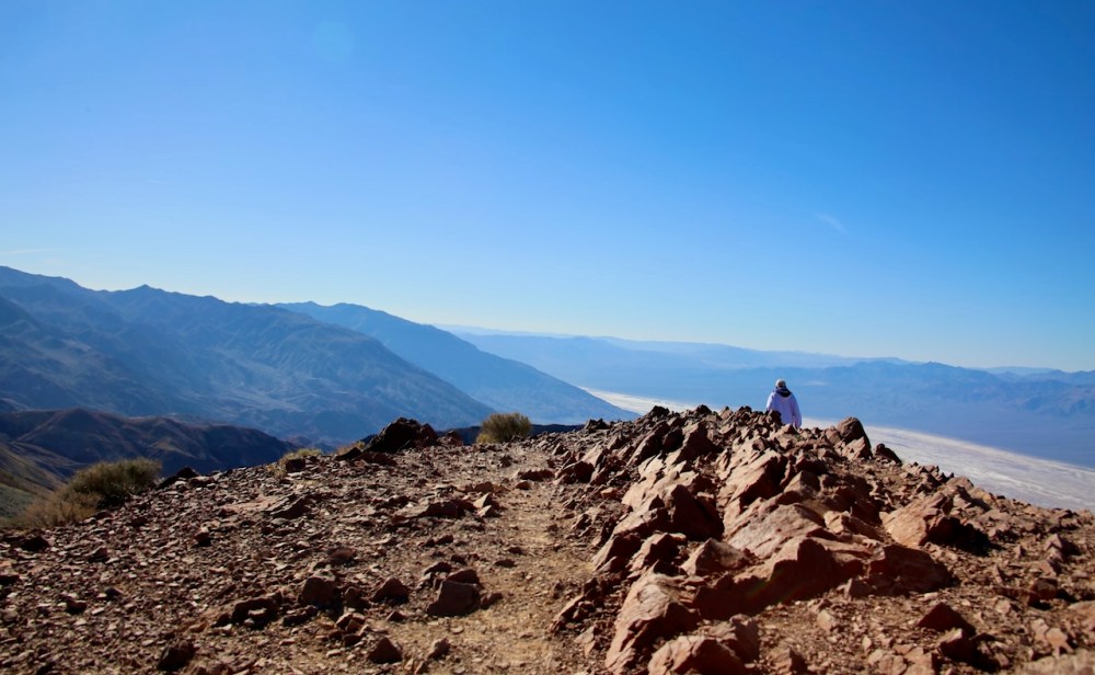
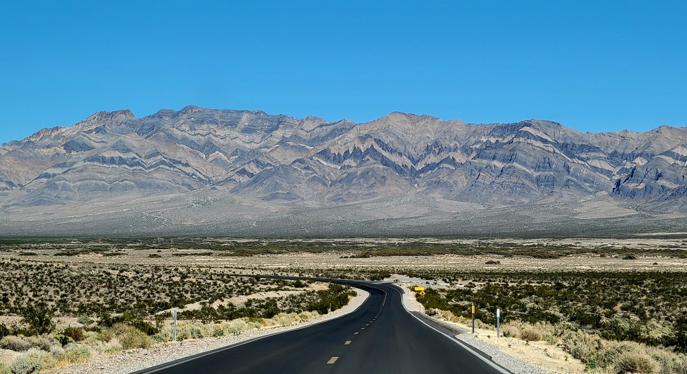
In looking to see how our route doubles back on itself, I learned how Lake Manly got its name. There was an expedition of forty-niners that got stranded on a short cut and William Manly was one of two men who returned with supplies and led the party to safety. I’ll drive us the 26 miles up to Dante’s View as I think about how the shape of the park resembles the profile view of the Moai, the heads of Easter Island, and how grateful I am that the park is open with parts of their roads washed out, which some people instead of taking the gravel path slowly just speed up to take the paved road faster.


Along our route is Twenty Mule Team Canyon, a 2.7-mile one-way dirt road detour of beauty through badlands. This area was once a background for films but has since stopped permitting that activity to preserve the park wilderness. I don’t think there was a posted speed limit but I would be ok with all roads being this slow throughout parks as it gives you more time to look around. Some people aren’t as easily impressed but others find this spot worth the stop when passing through, to take pictures of their cars and children, each time. We’ve still got at least 30 minutes before we reach Dante’s View so I won’t be circling around to drive the one-way again.


The lake looks larger from above but that’s also because it’s easier to see the other side and where it’s starting to evaporate. Standing on the spine of the Black Mountains, we are on the Basin and Range Geologic Province that stretches from Utah to California and from Idaho to Mexico. This park has a way of making you feel like a piece of dust while connecting you to the giant ball of particles flying through space at 67,000mph. We hike both directions from the parking lot to take in all the watery goodness.
Coming to the same place at different points in your life allows you a new way of seeing things. I know Caleb and I have been here at least twice as have my Dad and I. Each time the view is changed a little but our perspectives have widened with age and wisdom. It’s comforting to look back at old photos and see our human fragility against the Earth’s stability and know that whether the sun explodes or freezes, or the Earth gets overrun by zombies, aliens, or robots we were here once, twice, three times. We’ll keep coming back when we can to measure our short lives against the unfathomable time of space.
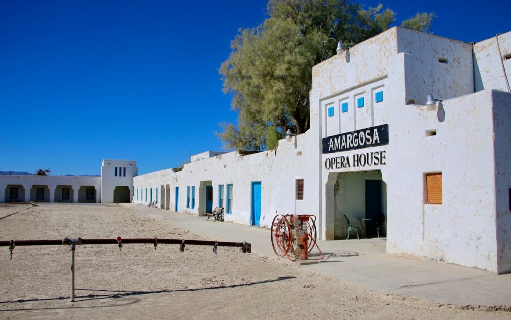
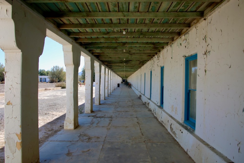
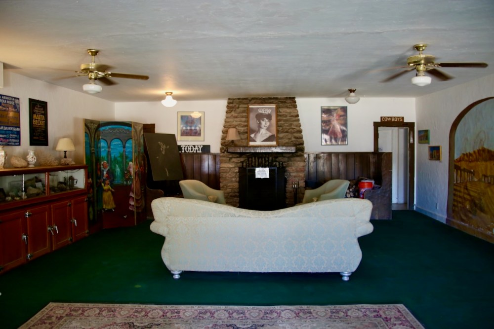
Near Death Valley Junction are toilets and a pay station to enter the park. It’s here I’ll watch a man and his two sons collect some rocks while a couple takes their kid behind a bush to pee; not sure if he couldn’t wait or didn’t want to go inside, but I thought little boys were less squeamish about such things as concerns their undies. In town, is home to the Amargosa Opera House, which was transformed in 1968 after being abandoned for twenty years. The hotel is open and we’re able to tour the lobby. It’s here that we learn that we won’t be seeing inside the historic Corkill Hall and that the hotel used to charge by shower or tub preference, more for the luxury of a combo, as each room came with twin or double beds.

Also posted on the wall are the rates for these rooms – 2 persons with a shower at the inn that faces the valley would be $14.00 or 2 persons with a bath in a sleeping cabin at the camp would be $5.00. In the brochure, “its facilities and accommodations provide the comforts which the city dweller finds he requires on a trip.” Service like this today will cost $107 for a Sunday night. The two women don’t leave the front office and don’t say anything as we have a look around at the curiosities on the shelves that surround them.
Across the street is a retired garage, that allows overnight parking, and an exhibit inaugurated in 2018 in honor of Marta Becket’s first time on stage 50 years prior on February 10. Death Valley Junction had rail service until 1940 and at its peak had a population of 300, which today sits between four and twenty. Our drive south is disrupted by a road closure on the 127, so we detour into Nevada and have to drive past the outskirts of sprawling Las Vegas to get us back on route. We drive through Mojave National Preserve and stop near the train station in Kelso to stretch our legs before continuing south on our long and very bright drive through the desert.
That detour added a hundred miles between where we were and where we were camping for the night as the posted sign recommends three hours for a return trip to walk the perimeter of Amboy Crater and back. We drive back into town where we stopped for gas and coffee that should’ve been free in 2018, but when we go inside it’s a diner-looking gift shop. Amboy was settled in 1858 as a water stop with the Southern Pacific Railroad and Route 66 was opened in 1926. Highway 40 bypassed the town in 1973, and though water is still here, the service at the motel isn’t the same.

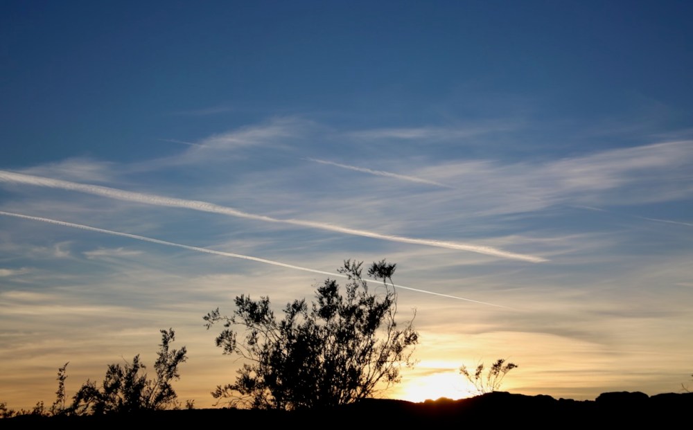
Back at the park and exploring the area, Caleb points out a tarantula, which I think is freaking awesome and has Caleb determined that we will not be walking around here after dark and tripping to our death as the arachnids come out in full force to feed upon us. Parked next to us, the only other vehicle being a camper, is Ella Rose, 51, and her husband who is retired Air Force who shot film in the cock pit. He is now interested in developing his digital photo skills in national parks and dark sky places. We talk for about an hour and a half as they are waiting for the stars to emerge.

They are staying to take some shots of the Milky Way and then will drive the two hours home to Bullhead City, with the addition of an hour for the time change; what an inspirational duo. They’ll eat their homemade packed dinners while we cook ours. They take off into the night, warmed inside and out, loaded with gear as we sit down to dinner and try to memorize the sky, as I catch the bright end of a large shooting star; capturing the feeling of being so grand but seemingly so insignificant.

